Hadrian's Wall Path
Follow the entire length of a UNESCO World Heritage Site and pass some wonderful scenery on the way
Also in Cumbria, United Kingdom • Gateshead, United Kingdom • Newcastle upon Tyne, United Kingdom
Hiking Moderate
- Distance
- 138 km
- Ascent
- 1.5 km
- Descent
- 1.5 km
- Duration
- 1 day +
- Low Point
- 1 m
- High Point
- 340 m
- Gradient
- 3˚

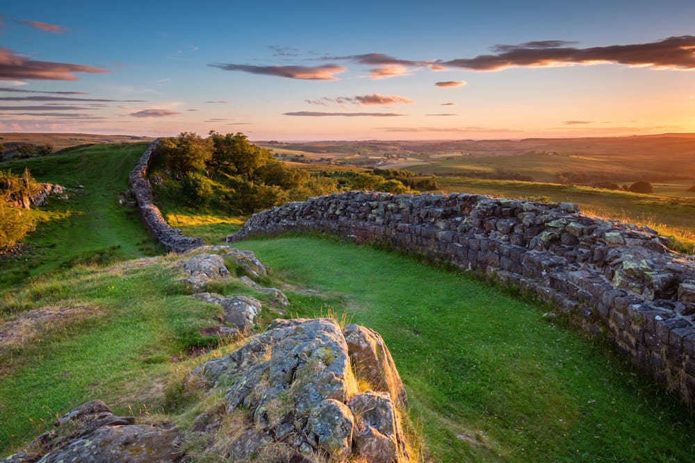
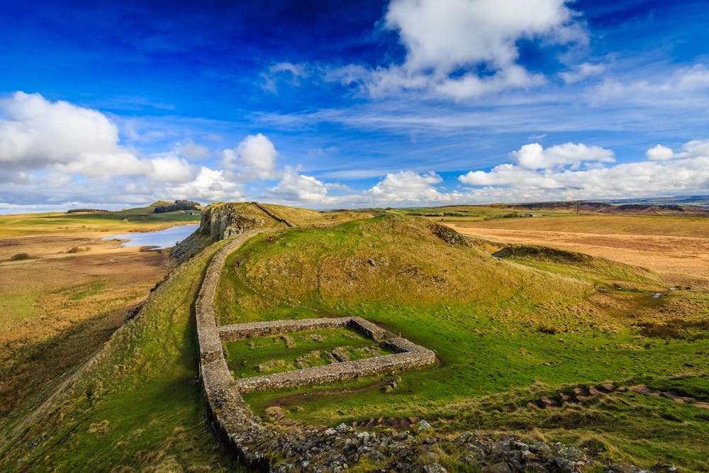
The Hadrian's Wall Path is a long-distance footpath in northern England that follows the route of Hadrian's Wall, a historic Roman wall built in the 2nd century AD. The path is approximately 84 miles (135 km) long and runs from Wallsend in Newcastle upon Tyne to Bowness-on-Solway. It offers scenic views of the surrounding countryside, including rolling hills, forests, and farmland. The path passes through several historic sites, including Roman forts and settlements, and offers opportunities for hiking, birdwatching, and other outdoor activities. Some sections of the path can be challenging due to steep inclines and uneven terrain, but it is generally considered to be a moderate hike with good signage and waymarking.

- •
- •
- •
Description
The trail passes through and close to countless towns and villages so you should be able to keep a reasonably flexible schedule and just book accommodation a day or 2 in advance rather than having a fixed itinerary. If you want to book everything ahead of time then the relatively mellow nature of the terrain on this hike make it possible in bad weather, but it can be pretty unpleasant up on the moors when the raining is falling and the wind is blowing! Having the option to adjust your schedule when the often-bad northern weather causes problems is highly recommended.
When the sun is shining there can't be many more scenic parts of England than the wilder parts of this hike, and the fact that it follows such a famous landmark only adds to the ambience. Before even reaching the wall you'll pass through the quayside area of Newcastle Upon Tyne, a part of the city which was once an industrial eyesore and is now - thanks to significant investment - one of the most attractive sections of waterfront real estate in Britain.
As you progress along the trail it gets progressively wilder all the way to the coast (except for the brief foray into Carlisle town centre) and it ends at the little seafront village of Bowness-on-Solway. Spending a day after your hike finishes exploring the local viewpoints over the Solway Firth sandbanks and mudflats is a great way to relax and re-enter the real world!
Difficulty
Moderate
Hiking along trails with some uneven terrain and small hills. Small rocks and roots may be present.
Medium Exposure

The trail contains some obstacles such as outcroppings and rock which could cause injury.
Remoteness
Away from help but easily accessed.
Best time to visit
Features
- Wildlife
- Historical
- Picturesque
- Dog friendly
- Family friendly