6 routes · Alpine Climbing · Ski Touring
The classic and most popular route to the top of North America.
Alpine Climbing Severe

The West Buttress is the way by which the vast majority of people summit Denali. Many guided parties will tackle the West Buttress each season and many climbers summit each year who have little to no experience on technical alpine terrain. However, don't let the lack of technical climbing on this route fool you into thinking it is an easy undertaking. It is not.

Being so far north, the air is very thin on Denali relative to its altitude. It is said that it feels close to climbing at 7,000m nearer to the equator. And it is extremely cold high on Denali. Frostbite and cold related injuries are very common especially early in the climbing season. Weather windows can be short and the forecasts are often unreliable.
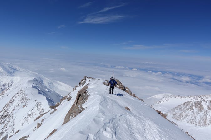
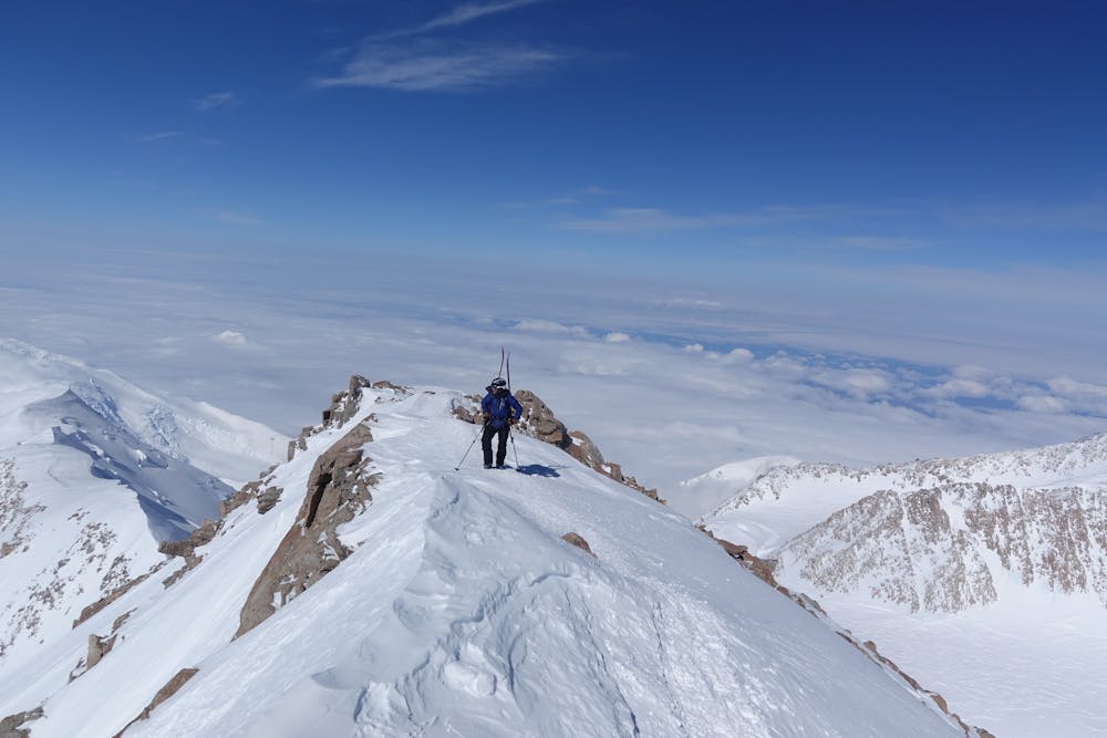
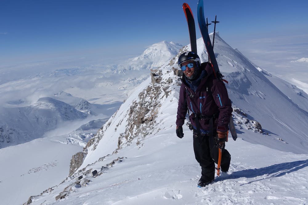
The West Buttress is a route of high quality that is varied and follows some beautiful ridge lines. The scenery and views are mind blowing if you have the capacity to take them in. For some, summiting via the West Buttress is a lifetime achievement, for others it might be a way to acclimatise for a harder route. But most agree on both the beauty and the seriousness of climbing Denali.
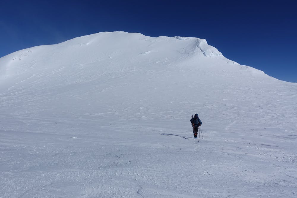
The route as drawn and described here is for 14k Camp to the summit which makes up what most people refer to as the West Buttress. Fit and acclimatised teams will be able to climb from 14k Camp to the summit in one push. Many however, will need to breakup the ascent by spending time at 17k Camp. This camp is a very high, cold and desolate place and is best avoided if possible.
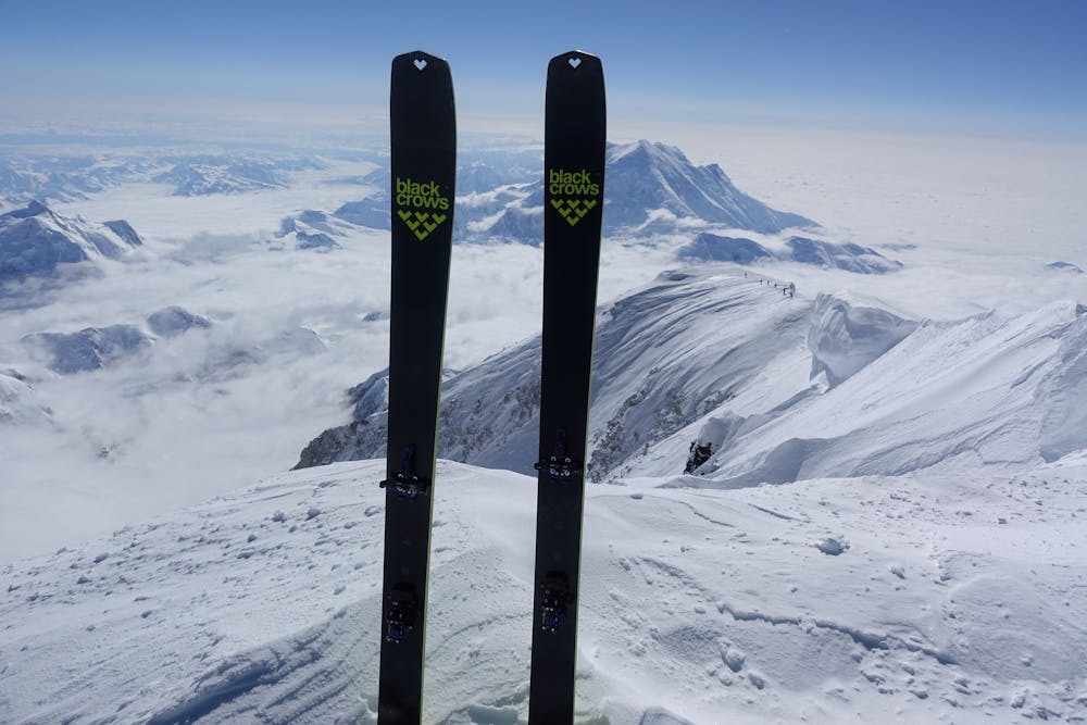
From 14k Camp, ascend the fixed ropes up the 50 degree icy face. An interesting and varied ridge line then leads to 17k Camp. After passing through this camp, follow the notorious Autobahn leftwards to Denali Pass. This traverse on exposed 40 degree ground has been the scene of several fatal accidents. There are however fixed pickets in place for protection. Continue up past the Archdeacons Tower and finally up the lung busting Pig Hill and onto the final stunning summit ridge to the brass trig point. Reverse the route in descent, or ski down if you were smart enough to carry skis up.
Severe
Steep, sustained and serious terrain on rock/ice. Routes will be long, exposed and possibly committing. D, D+

The route features some exposed and/or difficult to protect sections.

Little chance of being seen or helped in case of an accident.
6 routes · Alpine Climbing · Ski Touring

18 routes · Alpine Climbing · Hiking