486 m away
Brooks Falls
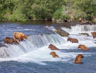
One of the best places to view grizzly bears in the world.
Easy Hiking
- Distance
- 3.8 km
- Ascent
- 36 m
- Descent
- 36 m
A mountain hike beginning in Brooks Camp campground, reaching views of the whole valley and the option to continue to the summit.
Hiking Difficult

This is the best option for a real hike from Brooks Camp. It begins at the campground and goes up the nearby mountain. Go high enough, and you’ll earn terrific views over the Brooks River and the lakes, as long as the weather is clear.
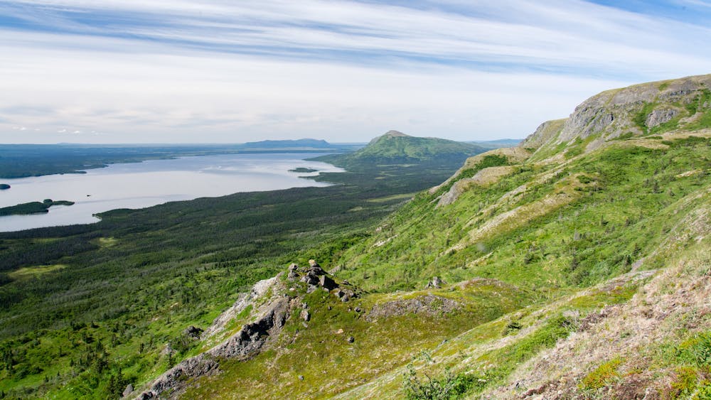
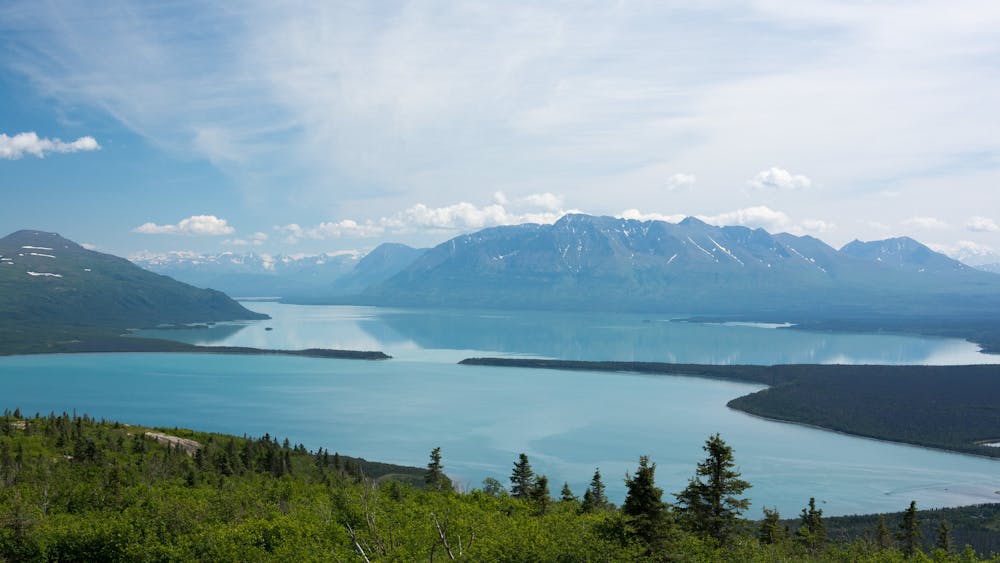
The trail leads first through a lush deciduous forest, where the understory is thick with flowers and leafy grasses. But there are also patches of beetle-killed trees, where the forest is a bit less appealing. As you climb higher, the species transition to more conifers, and eventually, the timberline is reached. Turn around for the birds-eye view over Brooks Camp. Above that elevation, the alpine tundra takes over, where plants are diminutive but greenery still carpets the slopes. A lesser-traveled but very visible path continues up the mountain, eventually reaching the top.
The track mapped here is not the farthest you can go. This turns around on a subpeak of Dumpling Mountain, beyond which point the trail fades further into the tundra. It’s unmarked but can still be traced all the way to the summit. You might continue on up if time and weather allow. From the top of the mountain, you can see off the other side toward King Salmon, and around at all the lakes and peaks of the peninsula.
Keep in mind that this entire trail is within grizzly habitat. Leaving the forest for the alpine does not leave the bears behind. Be sure to always hike with bear safety in mind, as you would in the rest of Katmai.
Sources: https://www.nps.gov/katm/planyourvisit/outdooractivities.htm https://medium.com/@exploreorg/dumpling-mountain-hike-8bd8c7b8d56e
Difficult
Hiking trails where obstacles such as rocks or roots are prevalent. Some obstacles can require care to step over or around. At times, the trail can be worn and eroded. The grade of the trail is generally quite steep, and can often lead to strenuous hiking.

The trail contains some obstacles such as outcroppings and rock which could cause injury.
Away from help but easily accessed.
486 m away
One of the best places to view grizzly bears in the world.
Easy Hiking

3 routes · Hiking

63 routes · Alpine Climbing · Hiking