1 m away
Glacier View and Exit Glacier Loop
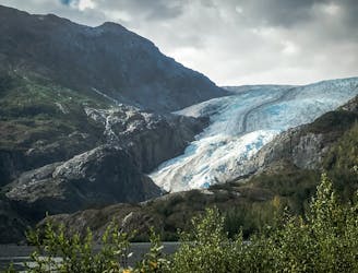
Kenai Fjords’ most accessible hike, leading to the foot of Exit Glacier and along its rocky outwash plain.
Moderate Hiking
- Distance
- 3.4 km
- Ascent
- 98 m
- Descent
- 98 m
This is the hike to do in Kenai Fjords National Park, ascending alongside a glacier to a mind-blowing view over the vast icefield above.
Hiking Difficult

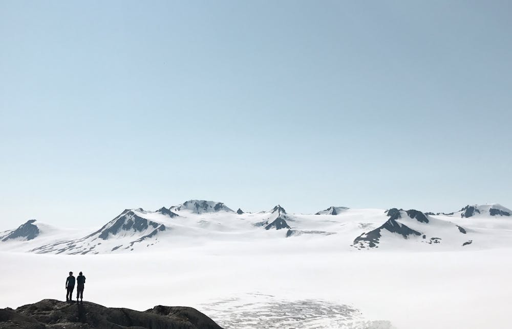
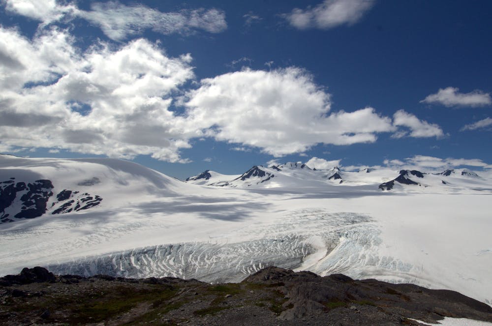
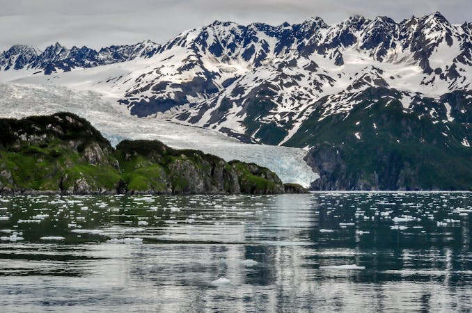
The Harding Icefield is the crowning feature of Kenai Fjords National Park. It’s a frozen expanse of 700 square miles that buries most of a mountain range and feeds the dozens of glaciers carving fjords down to the sea. But unless you get high above the coastline, you’ll never see the icefield for yourself. The best way is to hike the Harding Icefield Trail in the Exit Glacier Area.
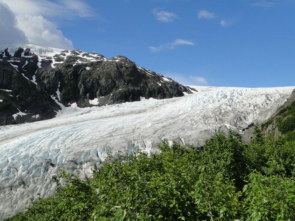
The trail climbs very steeply––nearly 1000 feet per mile––from Exit Glacier Nature Center. Hiking any amount of the trail earns expansive views over the glacier and its outwash plain, but you have to reach the top to see the icefield.
The trail begins in a lush forest of cottonwood, alder, and conifer trees, but soon climbs to unimpeded views on rock ledges. You’ll see the toe of the glacier descending to the valley floor, and the river pouring out of it and braiding across a rocky plain. The trail is clearly defined and well maintained, but works through many tiers of bedrock and scattered boulders on its way up. It’s important to remain on the path so as not to worsen erosion.
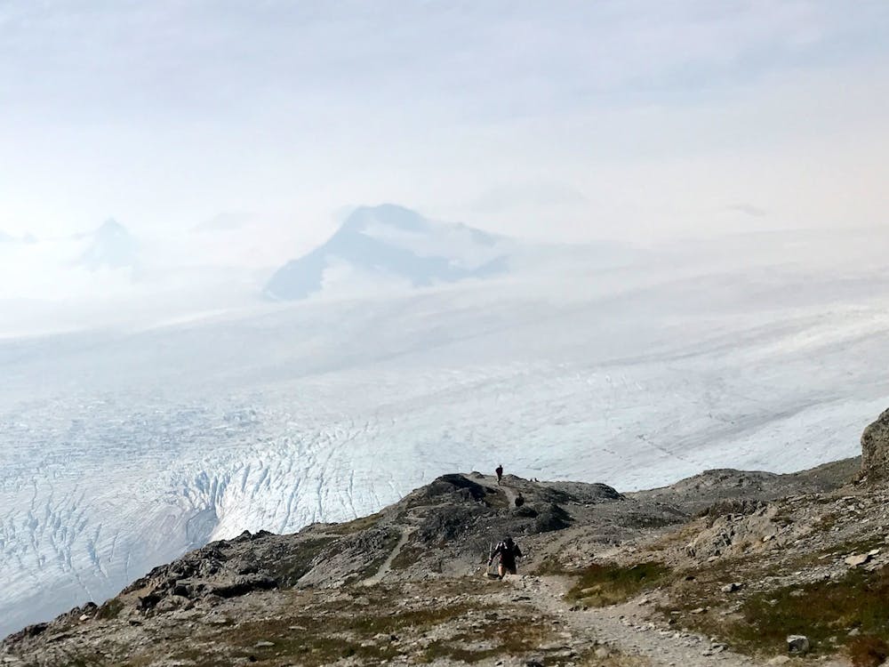
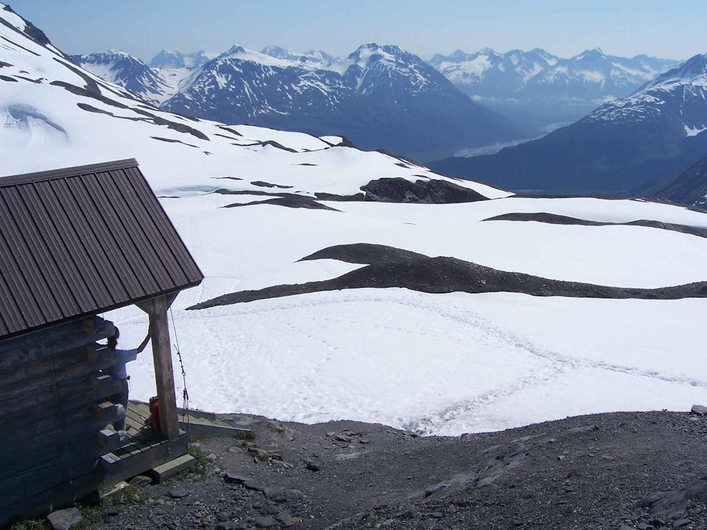
Near the top, the trail mellows to a dirt path across a grassy hillside, and the icefield comes into view. At the end, you can scramble a rocky knoll for the ultimate panorama. The ice stretches as far as one can see, punctuated by nunataks (mountain peaks) on the horizon. Continuing beyond the end of the trail and venturing onto the ice is possible, but it's hazardous because of fissures and instabilities which might be hidden under snow.
The road to Exit Glacier typically opens in early- or mid-May, but visitor services might not resume until early June. The upper part of the trail can stay snowy into July, so traction devices could be useful. Try to pick a day with clear weather so you can see the views, but always plan on conditions that could change rapidly. For those prepared and determined, completing the Harding Icefield Trail is sure to be a highlight of any trip to Kenai.
Sources: https://www.nps.gov/kefj/planyourvisit/hardingicefieldtrail.htm https://www.nps.gov/kefj/learn/nature/the-harding-icefield.htm
Difficult
Hiking trails where obstacles such as rocks or roots are prevalent. Some obstacles can require care to step over or around. At times, the trail can be worn and eroded. The grade of the trail is generally quite steep, and can often lead to strenuous hiking.

The trail contains some obstacles such as outcroppings and rock which could cause injury.
Away from help but easily accessed.
1 m away
Kenai Fjords’ most accessible hike, leading to the foot of Exit Glacier and along its rocky outwash plain.
Moderate Hiking
3 routes · Hiking · Ski Touring

63 routes · Alpine Climbing · Hiking