Lost Lake Loop
A long loop covering some of the best singletrack on the Kenai Peninsula.
Difficult Hiking
- Distance
- 52 km
- Ascent
- 2.2 km
- Descent
- 2.2 km
Hike to a stunning alpine lake in the shadow of Mt Ascension.
Hiking Difficult
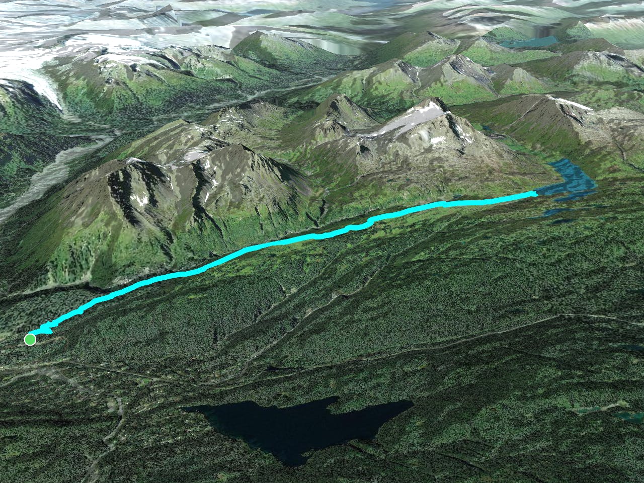
The Lost Lake Trail has long been renowned as one of Alaska's classic backcountry trails, and it's absolutely a must-hike if you're in the region! The hike begins from a trailhead outside the town of Seward by climbing through the deep Alaskan rainforest.
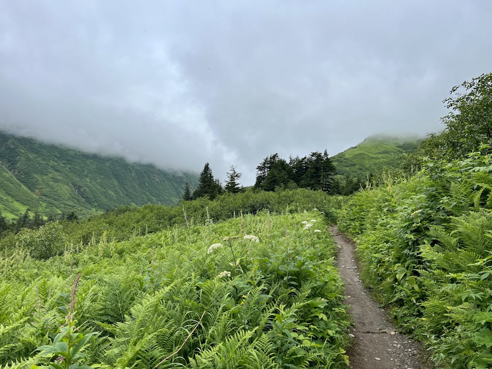
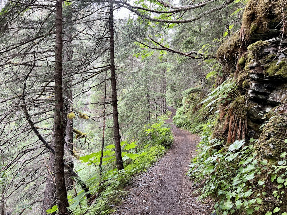
The first few switchbacks on the ascent include some large technical features that might seem intimidating, but this isn't indicative of the rest of the climb. While there are a few more big features on the way up, overall the trail tread is very manageable. The climb up the mountain ascends consistently, gaining almost 2,000 vertical feet to the high point.
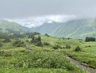
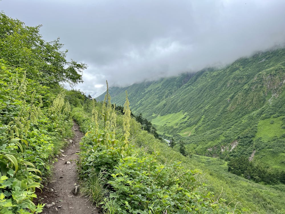
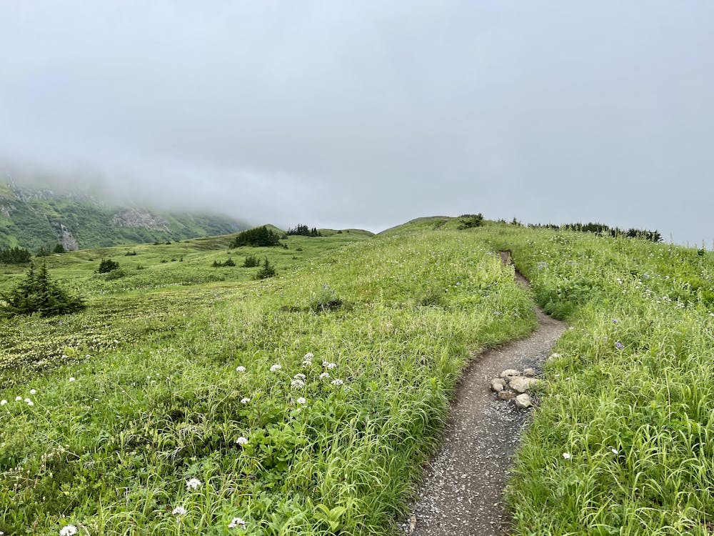
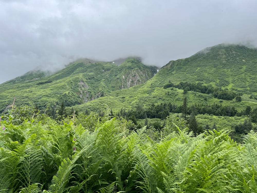
After several miles of climbing, you'll break out above treeline and, on a clear day, enjoy stupendous views of the glacier-covered mountains around you. Most notably, Mount Ascension rises to a height of 5,710 feet above sea level and towers almost directly above the trail!
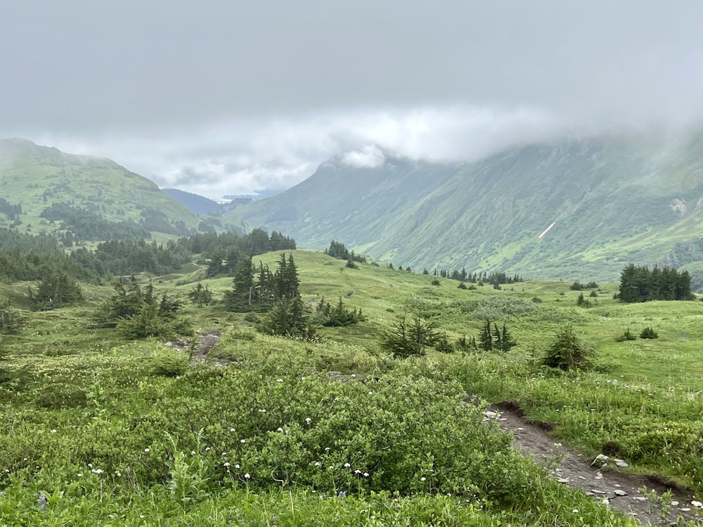
However, getting a clear day on the Kenai Peninsula is a rarity, so you need to be prepared to hike up into low-hanging clouds that obscure the view and that may very well rain on you on any given day. But that's all part of the adventure when braving the Alaskan wilderness!
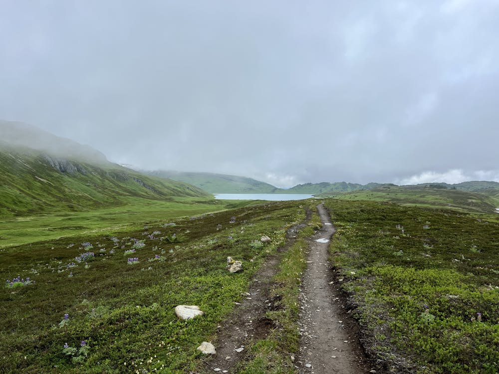
You'll hike for miles above treeline, enjoying long-range views if the clouds are high enough. But even if they aren't, the alpine tundra is often covered in colorful wildflowers in the summertime, providing their own unique micro beauty.
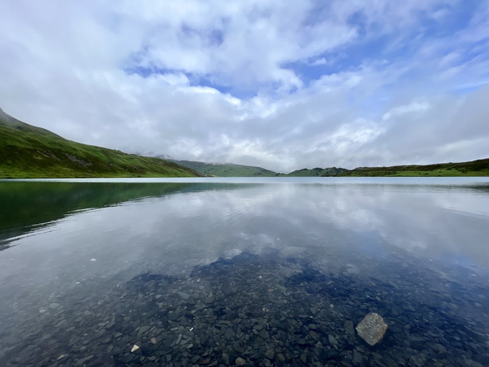
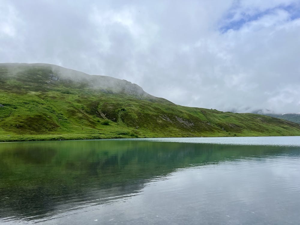
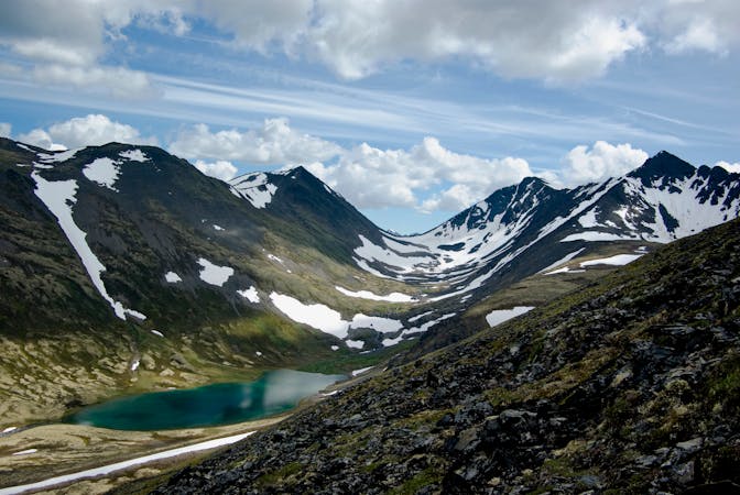
This out-and-back route tops out on a ridge and then descends almost 300 vertical feet back down to reach the shores of Lost Lake. It's well worth the effort to drop down to the lake and hike back up, as the views from the shore are stunning! Above and beyond the long-range mountain views, Lost Lake itself is surprisingly large for being tucked away so high in the mountains, and the water is crystal-clear. Enjoy some delightful solitude on its shores before turning around and hiking back up to the top of the mountain ridge.
The route mapped here is an out-and-back that returns back to the car via the same path. However, it's also possible to create a 32-mile epic backpacking loop using this trail (mapped separately).
While fit hikers can definitely hike up to the lake and back in a day, this trail is also very popular as an easy, approachable backpacking route. It's possible to backpack an out-and-back, a point-to-point route by descending the Primrose trail, or the epic loop mentioned above. On the hike up, you'll note several obvious campsites next to the trail and a signed spur trail that leads to additional campsites and a cabin.
If you choose to backpack in the area, be sure to follow Leave No Trace principles, which include camping at least 200 feet from water sources, including Lost Lake.
Difficult
Hiking trails where obstacles such as rocks or roots are prevalent. Some obstacles can require care to step over or around. At times, the trail can be worn and eroded. The grade of the trail is generally quite steep, and can often lead to strenuous hiking.

The trail contains some obstacles such as outcroppings and rock which could cause injury.

Little chance of being seen or helped in case of an accident.
A long loop covering some of the best singletrack on the Kenai Peninsula.
Difficult Hiking
3 routes · Hiking