7 routes · Hiking
A 4-5 day trek through the central Brooks Range, tracing tundra river valleys among seemingly boundless mountains.
Hiking Difficult

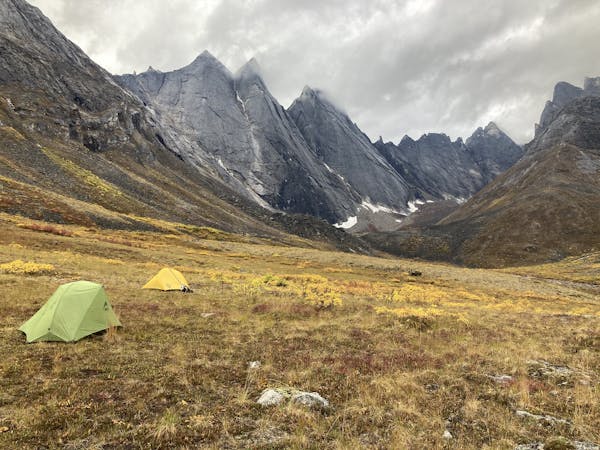
The village of Anaktuvuk Pass is a common starting or ending point for trips in Gates of the Arctic. Commercial flights are available from Fairbanks, and the village has some visitor services during the summer. The route mapped here begins in Anaktuvuk and goes to Summit Lake. This can make a standalone route with a charter flight pickup at Summit Lake, or the first half of a route going all the way to Dalton Highway. Note that this trip could just as well be done in reverse, with dropoff at Summit and a flight out of Anaktuvuk.
The track mapped here shows the general route, but does not account for the complexity of terrain, which is ever changing along the riverbeds. Therefore, expect your actual distance to be greater than what’s shown here. As with elsewhere in the Brooks Range, there is no trail. Most of the journey is along rivers, where you’ll either on the gravel bars or on grassy tundra. Mounting the highpoint at Peregrine Pass requires ascending and descending steep talus slopes, which may be streaming with water or covered with snow. Expect a certain amount of rock-hopping, bushwhacking, and tussock-balancing all along the route. Constant route finding is required to find the safest and most efficient ways forward.
Sources: https://www.nps.gov/gaar/planyourvisit/backpackingandhiking.htm https://www.alaska.org/detail/oolah-pass-packback
Difficult
Hiking trails where obstacles such as rocks or roots are prevalent. Some obstacles can require care to step over or around. At times, the trail can be worn and eroded. The grade of the trail is generally quite steep, and can often lead to strenuous hiking.

Some trail sections have exposed ledges or steep ascents/descents where falling could cause serious injury.

In the high mountains or remote conditions, all individuals must be completely autonomous in every situation.
7 routes · Hiking