7 routes · Hiking
A trek of 4-5 days from the truly remote Oolah Valley to the boundary of civilization at the Dalton Highway, through deserted river valleys of the central Brooks Range.
Hiking Difficult

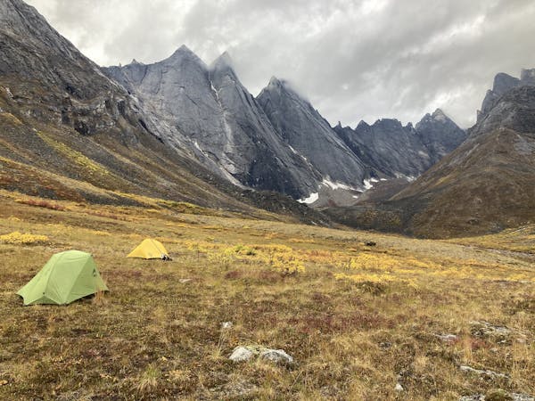
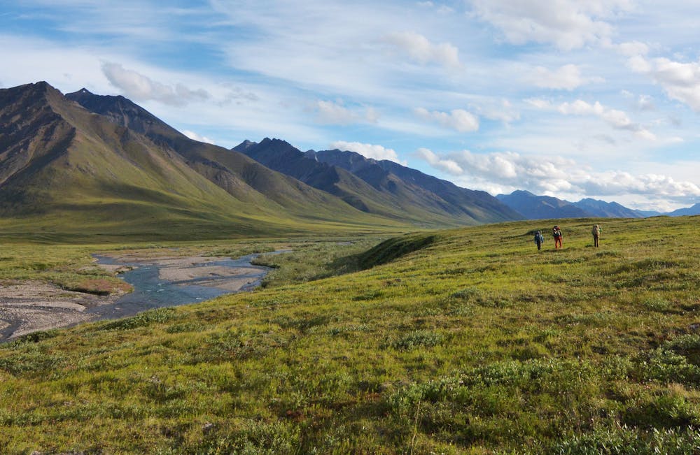
Oolah Valley is renowned as one of the most stunning places in Gates of the Arctic, but few get to experience it. Vast tundra meadows, dotted with lakes and streaming with creeks, stretch between sweeping rows of snow-streaked mountains. Side valleys penetrate the ranges, revealing glaciers and granite walls to those who venture into them. Only by floatplane or a very long hike can you reach the Oolah Valley, then a lot more walking is required to get around.
The route mapped here is from Summit Lake in the Oolah Valley to the Dalton Highway on the eastern edge of Gates of the Arctic. It makes a trek of 4-5 days, not counting side trips, or it can make half of the full traverse between Anaktuvuk Pass and Dalton Highway. If starting or ending at Summit Lake, you’ll need to charter a flight. For pickup or dropoff along Dalton Highway, you might want to arrange a shuttle. Alternatively, you could make an out and back or devise a loop with the eastern portion of this route, in order to avoid an expensive bush flight.
This track shows the general route but doesn’t account for the complexity and changing nature of the terrain, so actual mileage will be greater. Tracing rivers and creeks for most of the way, you’ll rely on your own route finding to choose between wet and rocky streambeds or brushy and muddy higher ground. Note that this track does not necessarily indicate suitable places to ford the rivers. The tundra waterways are constantly shifting, so it’s up to you to find the safe crossings.
Sources: https://www.nps.gov/gaar/planyourvisit/backpackingandhiking.htm https://www.alaska.org/detail/oolah-pass-packback
Difficult
Hiking trails where obstacles such as rocks or roots are prevalent. Some obstacles can require care to step over or around. At times, the trail can be worn and eroded. The grade of the trail is generally quite steep, and can often lead to strenuous hiking.

Some trail sections have exposed ledges or steep ascents/descents where falling could cause serious injury.

In the high mountains or remote conditions, all individuals must be completely autonomous in every situation.
7 routes · Hiking