815 m away
Valley of Ten Thousand Smokes: Ukak Falls

Hike into the Valley of Ten Thousand Smokes, to see the volcanic devastation up close and to stare into a churning river canyon.
Moderate Hiking
- Distance
- 4.1 km
- Ascent
- 181 m
- Descent
- 181 m
Journey across a lunar landscape––a valley buried by the largest eruption of the 20th century––to find the still-smoldering crater of the volcano.
Hiking Difficult

The Valley of Ten Thousand Smokes is the name of the area devastated by the 1912 volcanic eruption. The source of this destruction, a volcano called Novarupta, still smolders near the head of the valley. It’s not a glaciated peak like neighboring volcanoes, however, because the blast was so violent that it blew away any structure this mountain once had. All that’s left of Novarupta, on the surface at least, is a 200-foot dome of solidified lava in the center of a broad crater. It plugs the portal to a molten core deep beneath, evidenced by steam and odors that still vent from within. Novarupta shows no sign of imminent aggression, however, so it’s safe to hike to. Get close enough, and you can feel the heat emanating from its blackened rocks. Reaching it is not easily accomplished, however, because it requires crossing the lunar-like Valley of Ten Thousand Smokes.
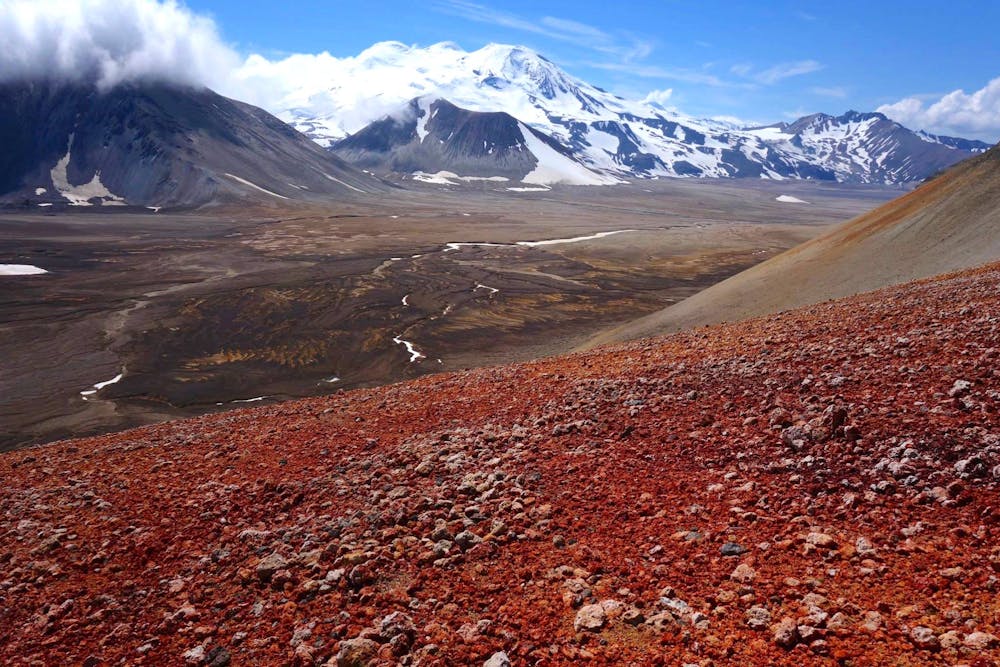
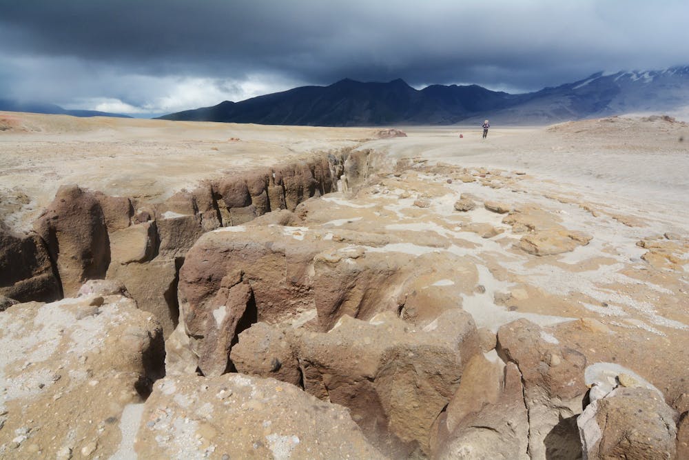
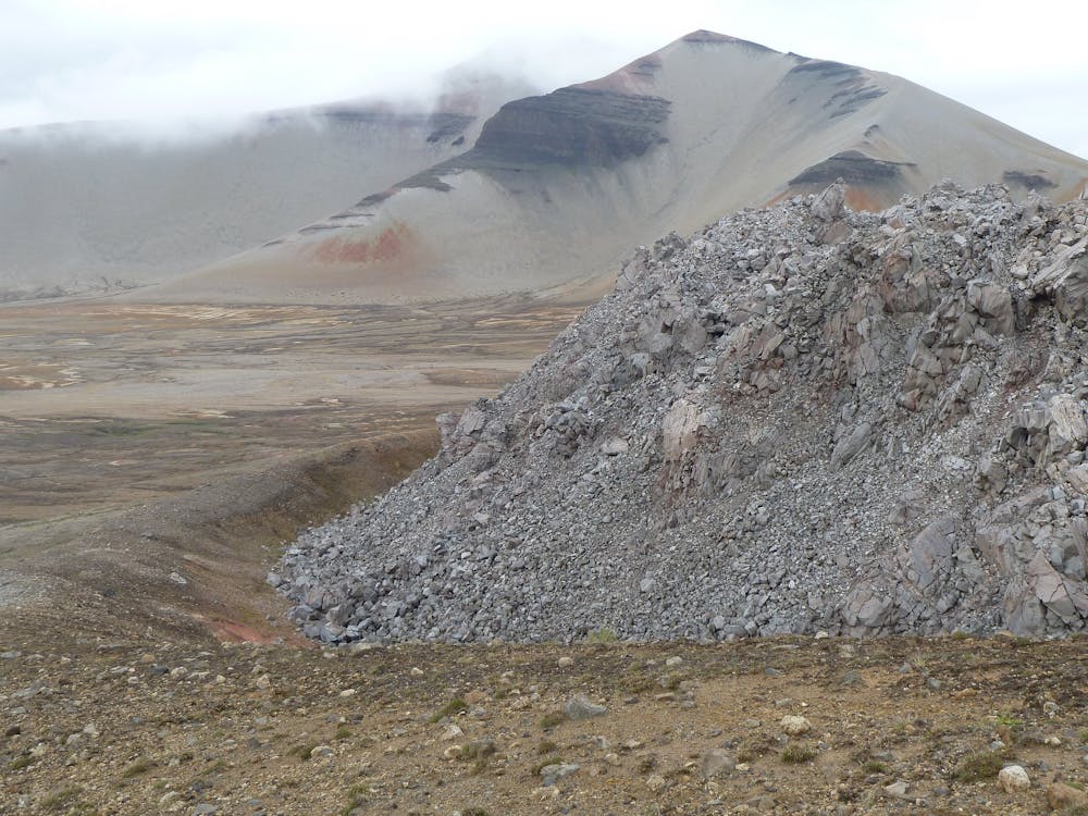
“The Valley” is today a sea of volcanic ash and pumice, which feels in most places like beach sand but even finer. It whips up readily on frequent winds, and penetrates every possible cranny of clothing and skin when it does. Crossing the Valley feels perhaps like walking the surface of the moon, except it’s also running with water in some places. Many streams weave across the surface and cut deep into the volcanic debris. Hikers must ford these silty waters, but it’s not safe or even possible everywhere. Most formidable is the River Lethe, which incises more than a hundred feet in some places. Even where the flow appears broad and calm, a deep middle channel might drop away suddenly, invisible beneath the ash-laden water.
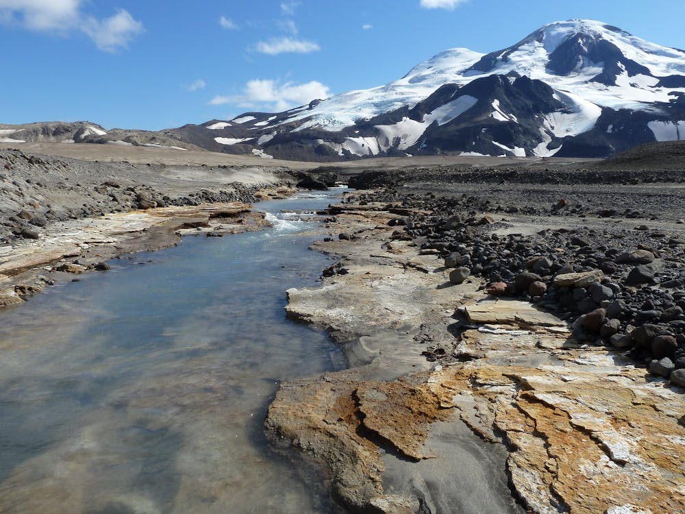
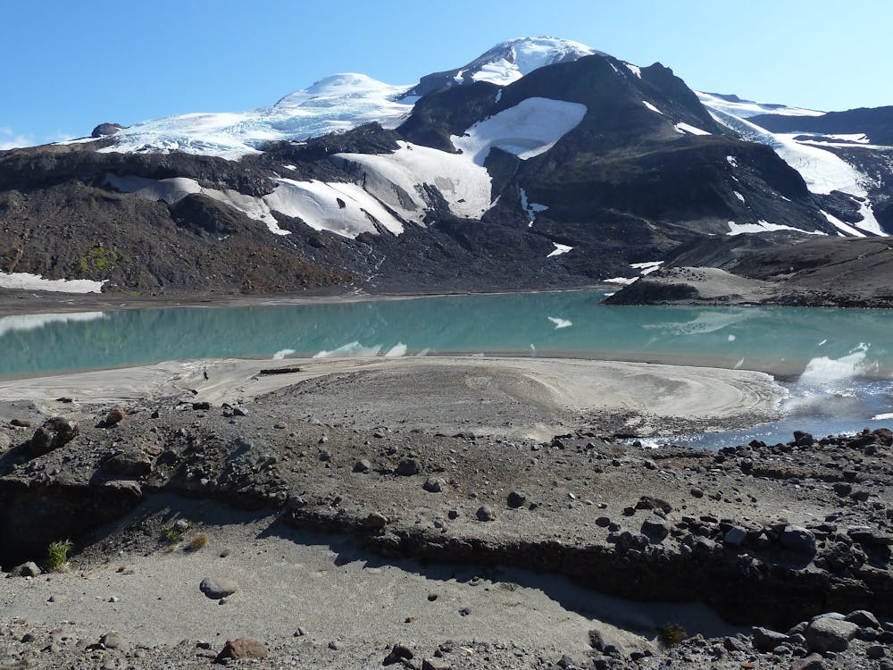
The route mapped here avoids crossing the River Lethe except at its headwaters, which are the two lakes at the foot of Mount Mageik. These lakes offer camp spots as good as they come in the Valley, with reasonable wind protection and less-silty water cascading on the nearby mountainsides. From the lakes, it’s a jaunt farther across the moonscape to Novarupta. Camping at the Novarupta crater is actually decent as well, if you don’t mind the occasional whiff of sulfur. Water can be melted from summer snowfields there, and natural windbreaks can be found.
The journey to the lakes and Novarupta begins from the Valley of Ten Thousand Smokes Road, where shuttle buses run from Brooks Camp in the summer. Ask to be dropped at the Windy Creek Trail to begin the hike as mapped here. A visible but likely overgrown path descends through vegetation to the creek, which is generally easy to cross. On the other side the trail continues out onto the barren plain, then curves to hug the foot of the Buttress Range to the west. About 6 miles from the start, at a point informally known as “6 Mile,” the trail peters out, lost to windblown ash and pumice rocks. The route proceeds in much the same manner though, out across the ashen sands and tracing the foot of the mountains. Instead of going all the way to Mageik Lakes on the first day, you could also find good camp spots among alcoves in the Buttress Range, including one near 6 Mile.
Note that the track mapped here is only a general route to Mageik Lakes and on to Novarupta. The actual route will differ based on the intricacies of the landscape. This is mapped as a one-way ending at the crater, but possibilities for further exploration abound. Other lakes, glaciers, and summits surrounding the Valley make additional objectives for longer trips. If your plan is just to reach Novarupta and then return, there are still a few options for how to get back. The pass between Baked Mountain and Broken Mountain is another common way to reach Novarupta, so it makes a good route of return. It’s shorter than going back by way of the lakes, but requires finding a place to cross the formidable River Lethe in the middle of the Valley. After fording the river, you’d simply forge a route toward 6 Mile and thus rejoin the trail back to the road.
Note that the Baked Mountain huts, once a popular overnight shelter, are no longer viable according to the park service. This makes the Baked Mountain approach/de-proach to Novarupta less appealing due to the lack of a sheltered place to camp.
Sources: https://www.nps.gov/katm/planyourvisit/exploring-the-valley-of-ten-thousand-smokes.htm https://medium.com/@exploreorg/to-novarupta-exploring-the-valley-of-ten-thousand-smokes-76fe335d5ced http://stevenmileyphotography.com/blog/katmai-national-park-august-2017 https://caltopo.com/m/CQJE
Difficult
Hiking trails where obstacles such as rocks or roots are prevalent. Some obstacles can require care to step over or around. At times, the trail can be worn and eroded. The grade of the trail is generally quite steep, and can often lead to strenuous hiking.

Some trail sections have exposed ledges or steep ascents/descents where falling could cause serious injury.

In the high mountains or remote conditions, all individuals must be completely autonomous in every situation.
815 m away
Hike into the Valley of Ten Thousand Smokes, to see the volcanic devastation up close and to stare into a churning river canyon.
Moderate Hiking

3 routes · Hiking