Picketpost Mountain
A technical scramble to the top of a spectacular mountain!
Alpine Climbing Moderate
- Distance
- 6.7 km
- Ascent
- 606 m
- Descent
- 606 m
- Low Point
- 725 m
- High Point
- 1.3 km
- Gradient
- 23˚

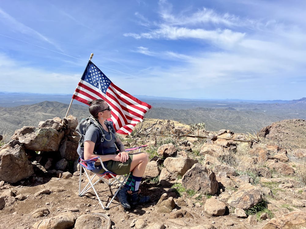
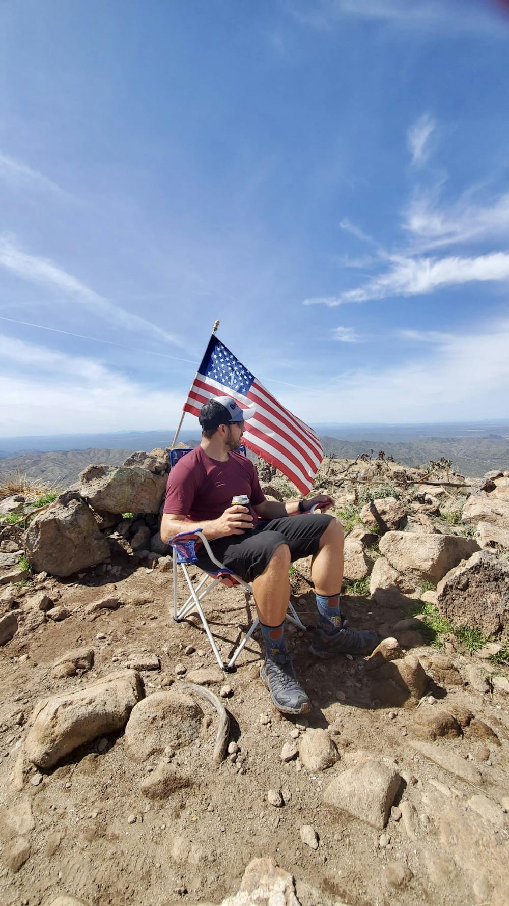
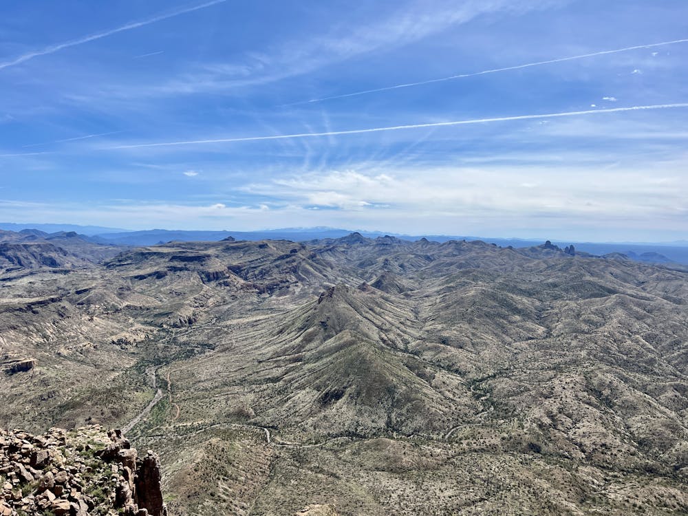
Picketpost Mountain is a stunning freestanding mountain that rises 2,000 feet above the town of Superior below. The landscape around Picketpost is dramatic, and from the top, you'll enjoy stunning views of the famed Superstition Mountains to the north, the Catalinas to the south, nearby Apache Leap Ridge, and other minor mountain ranges. Despite being surrounded by other mountains, Picketpost itself is not part of a mountain range and rises as a striking flat-top monolith. Thus, the climb to the top of Picketpost is a popular Phoenix-area climb.
- •
- •
- •
- •
- •
- •
- •
- •
- •
- •
- •
- •
Description
Despite the well-developed trailhead and the popularity of the climb to the summit, navigating the trail to get there can be confusing at first. Immediately after departing from the trailhead, forks in the trail, including junctions with the Arizona Trail, can lead hikers astray. Despite newly-added trail signs, locals have had to modify them by scribbling directions to reach Picketpost. Consequently, it appears that the trail to the top might be a social route that isn't sanctioned, despite being extremely popular. It's hard to tell precisely, so be sure to download this route for offline navigation.
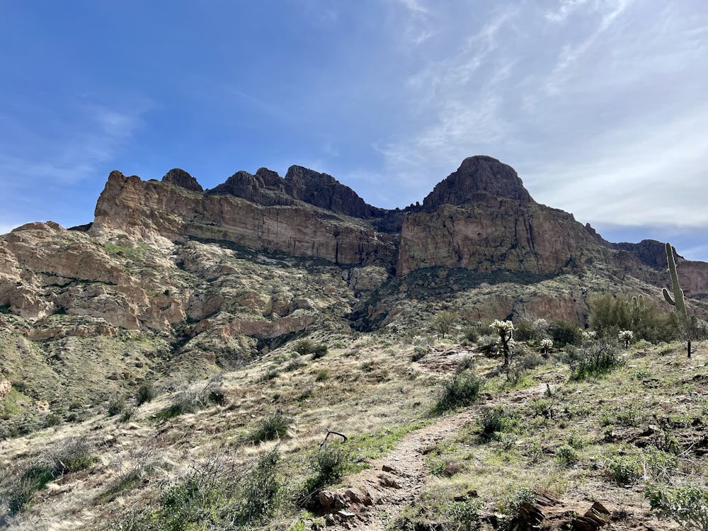
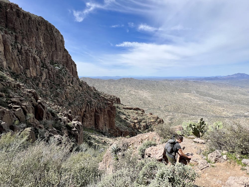
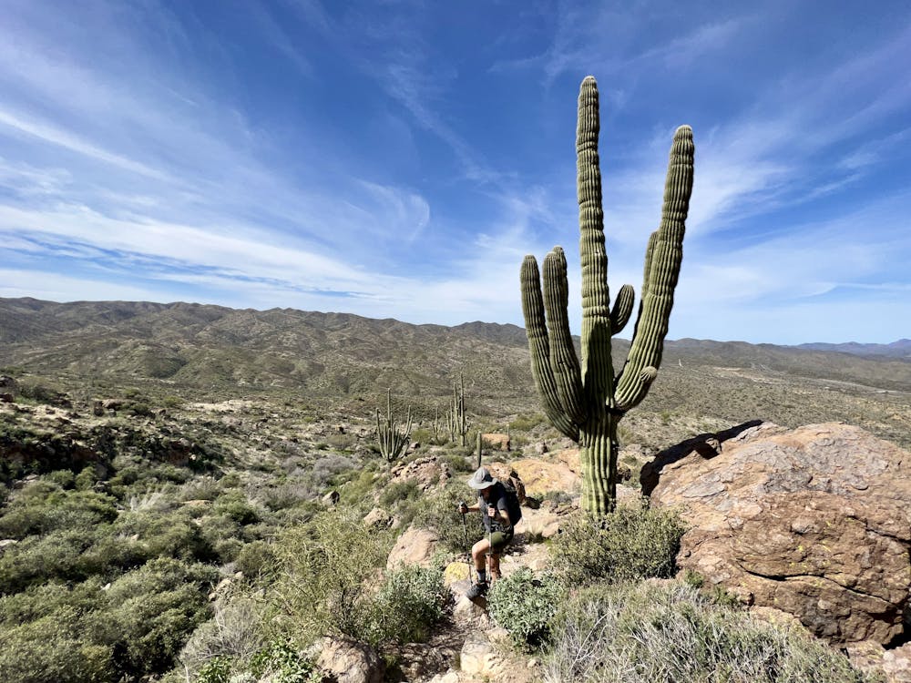
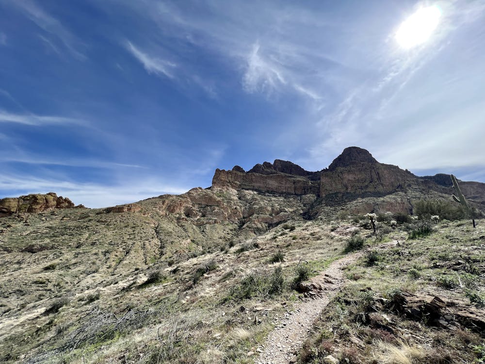
The initial climb toward the mountain is steep and rough, ascending a series of narrow switchbacks and eventually some substantial rock gardens. As you look at the formidable cliff face ahead, you might think that the route has to go around the back side to ascend... but you'd be wrong. Do you see the obvious cleft in the front of the mountain? That's your route to the summit.
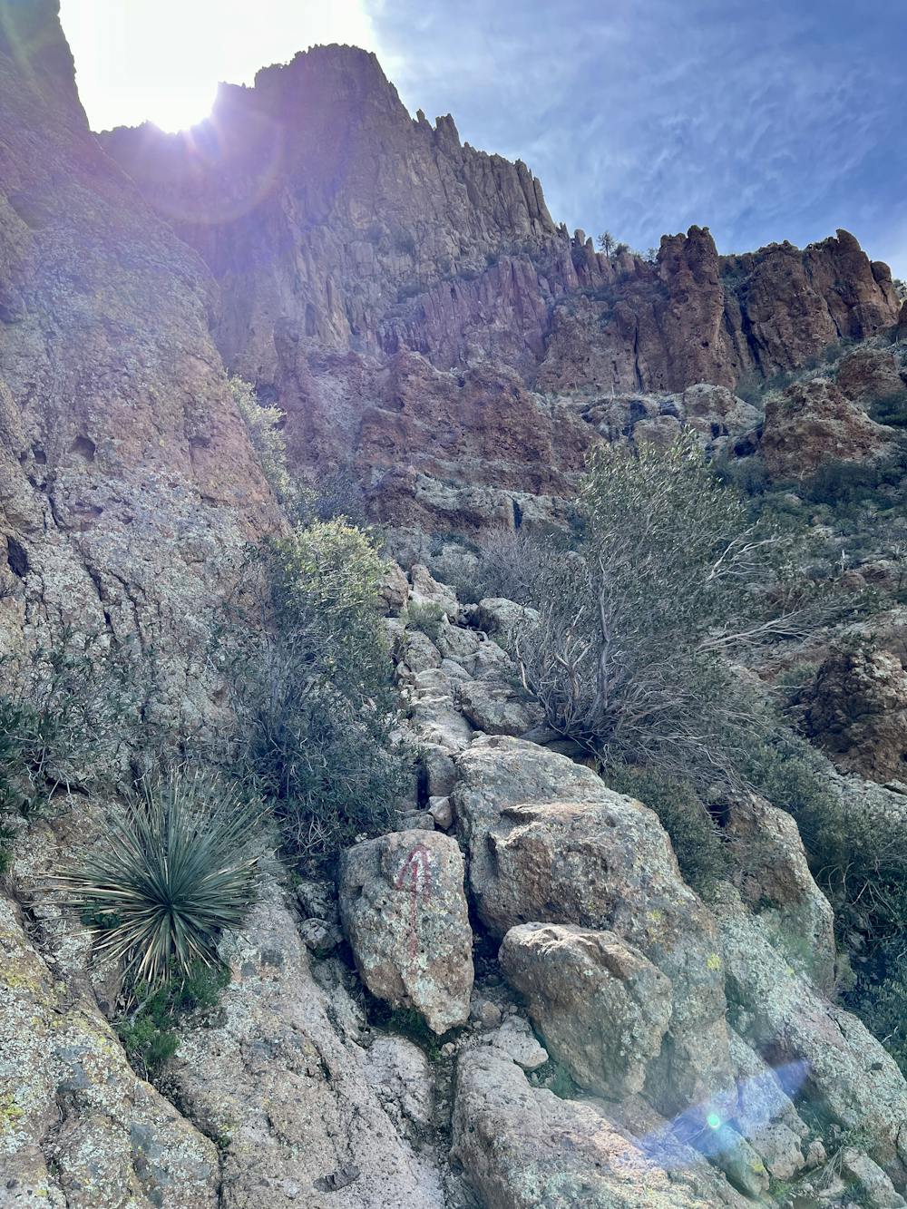
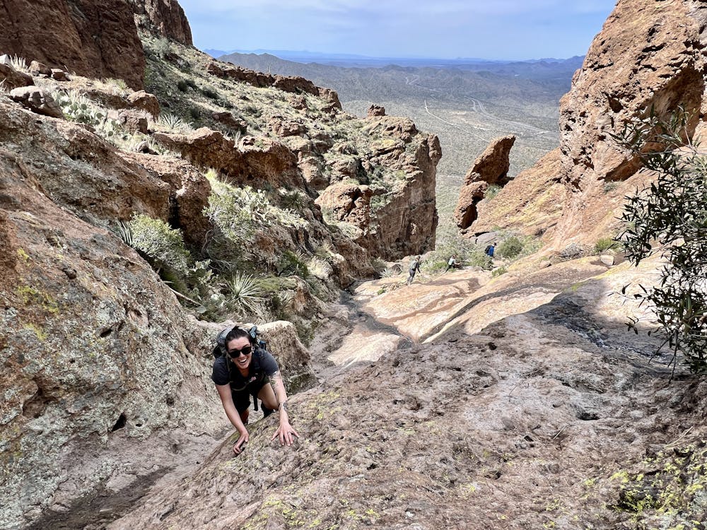
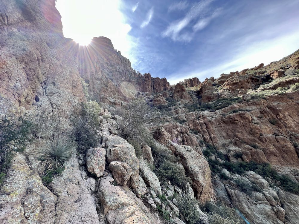
Once you realize that the central gorge is your path to the summit, you'll also realize just how technical this climb will get. Soon, you'll find yourself scrambling up a few moderate rock slabs with both hands and feet. The ascent switches back and forth between scrambling and hiking as you approach the gut of the canyon leading up the mountain.
As you near the valley, the route switches to almost entirely rock scrambling for the crux of the climb. You'll have to scramble exposed lines along cliff faces before scrambling up a rock gorge with a stream flowing through it (especially prevalent in winter and spring). Route finding can be difficult through this section. When in doubt, you can look for paint dots to show the way, but in places, these dots are difficult or impossible to spot, and sometimes they don't lead to the best route. When scrambling next to the most extensive waterfall section, it's best to stick to the climber's right for the best handholds.
This rocky scramble is steep, technical, and very exposed in places. Many hikers turn around where the scrambling starts, and others only make it a short ways further before turning around. Even though Picketpost is renowned as a popular local climb, there's a definite emphasis on the climbing here! This rocky ascent earns a FATMAP "Extreme" difficulty rating, or a "Moderate" mountaineering difficulty, despite the lack of glaciers or alpine terrain.
If you do persist, eventually, the trail will level off again as you reach the top of the mesa. As you do, you'll realize that the mountain's high point was out of sight from below, so you'll have to climb a bit more to reach the summit on the far side of the mountain.
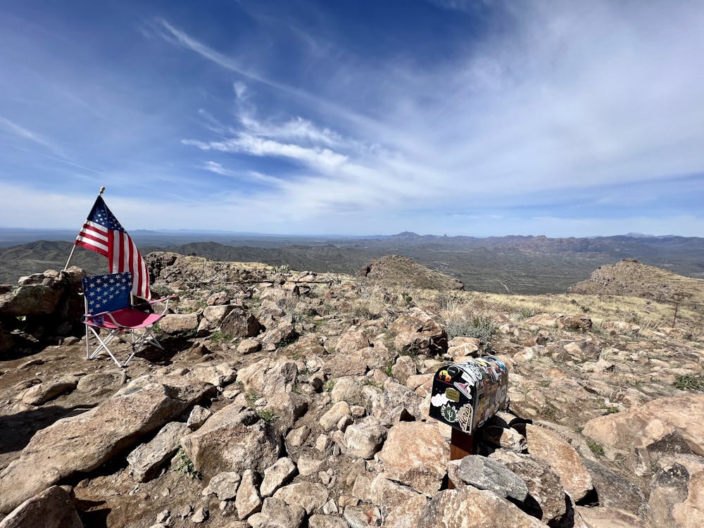
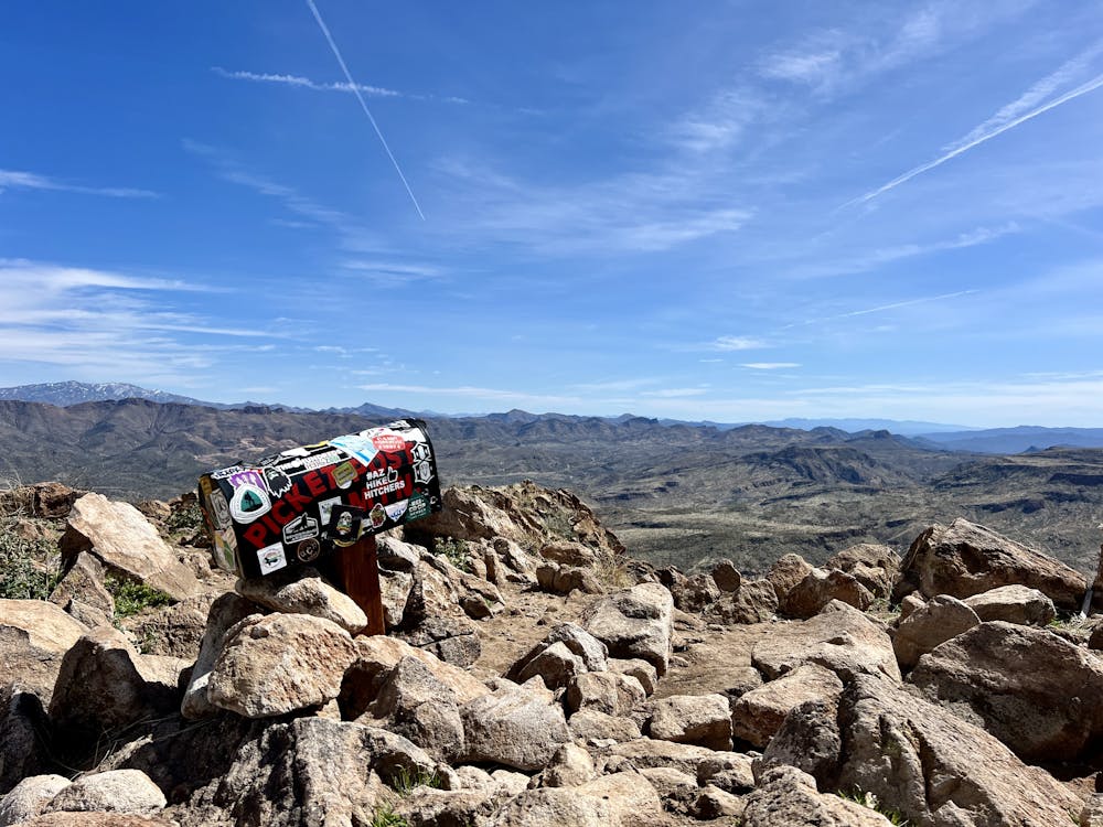
When you reach the top, you'll be greeted by a sticker-covered mailbox and possibly even a bench or a lawn chair. Many climbers choose to haul up encouraging notes to leave in the mailbox for the next hiker. Even if you didn't bring one with you, take a few minutes to read some of the notes in the box and enjoy this unique social experiment found on top of a rugged, remote mountain!
Once done enjoying the unique summit of Picketpost Mountain, retrace your steps to descend. Remember that downclimbing technical rock faces is always more difficult than ascending. If you have any doubts while climbing, it's best to turn around before getting cliffed out or stranded on the descent.
Difficulty
Moderate
May involve slightly more complex glacier hikes, easy but possibly long rock ridges and steep snow up to 45 degrees. Equivalent to PD, PD+
High Exposure

Much of the route is difficult to protect and a fall could be disastrous at certain points.
Remoteness
Little chance of being seen or helped in case of an accident.