Horton Creek Trail
A beautiful hike leading to a gushing spring from the side of the Mogollan Rim
Hiking Moderate
- Distance
- 14 km
- Ascent
- 753 m
- Descent
- 753 m
- Duration
- 4-5 hrs
- Low Point
- 1.7 km
- High Point
- 2.4 km
- Gradient
- 19˚

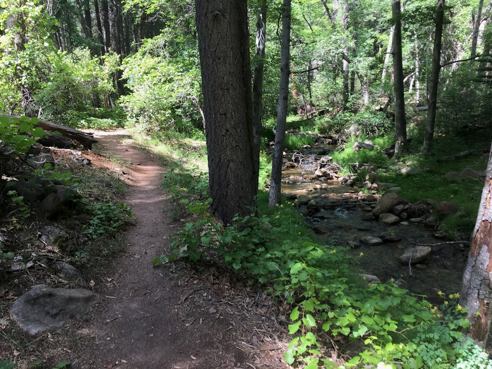
A beautiful and refreshing hike awaits you at the Horton Creek Trail in the Payson area. Following Horton Creek from its confluence with Tonto Creek to its source at Horton Spring, this 8.9-mile out-and-back trail takes you through a lush forest of pine, oak, and maple trees.
- •
- •
Description
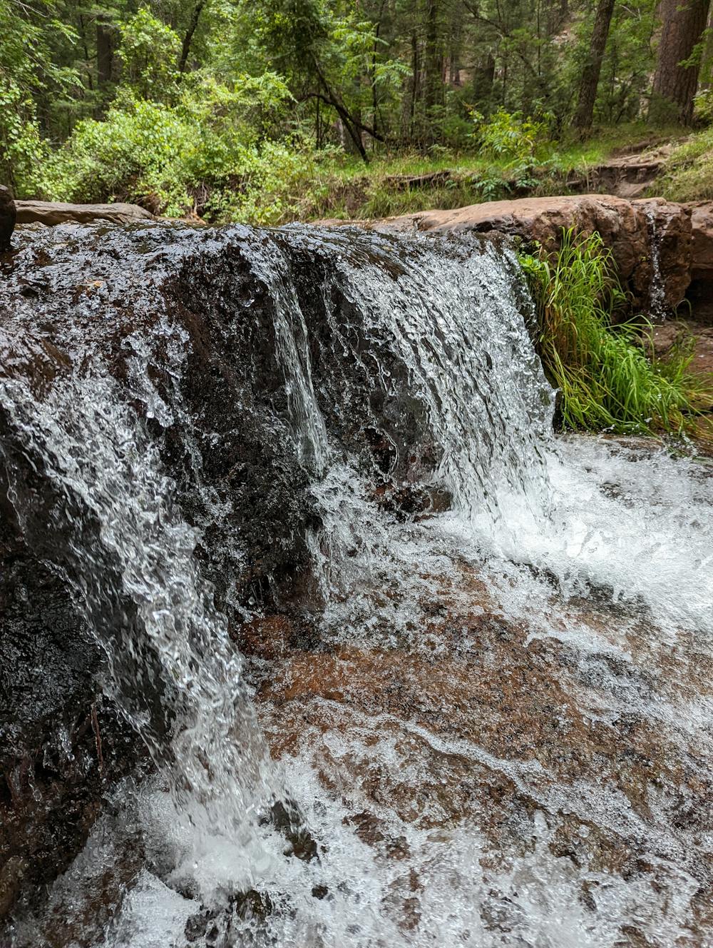
Starting from the Upper Tonto Creek Campground, the trail heads north along the creek, which is a constant companion throughout the hike. With a gentle uphill grade for most of the way, the trail is well-marked and easy to follow. You will enjoy listening to the creek as it flows over rocks and cascades down small waterfalls.
About 4 miles from the trailhead, you will reach Horton Spring, where water gushes out of the side of the Mogollon Rim, creating Horton Creek. This is a great place to rest and refill your water bottles. You can also explore the area around the spring, where some old cabins and a historic irrigation ditch can be found.
The hike can be done year-round, but it is especially beautiful in the fall when the leaves change color. It is also a great hike for camping and backpacking, as there are several campsites along the trail and near the spring.
The Horton Creek Trail offers a cool escape from the heat and a chance to experience Arizona's natural beauty and history.
Sources: Payson, AZ's Horton Creek Hiking Trail is fresh spring bliss. https://www.azutopia.com/easy-hikes/horton-creek-trail/. Horton Creek Trail #285, AZ | HikeArizona. https://www.hikearizona.com/decoder.php?ZTN=62. Tips for Hiking Horton Creek Trail in Arizona | Simply Wander. https://justsimplywander.com/horton-creek-trail/. Horton Creek Trail. https://www.fs.usda.gov/recarea/tonto/recreation/hiking/recarea/?recid=35613&actid=50. Conversation with Bing Chat
Difficulty
Moderate
Hiking along trails with some uneven terrain and small hills. Small rocks and roots may be present.
Medium Exposure

The trail contains some obstacles such as outcroppings and rock which could cause injury.
Remoteness
Away from help but easily accessed.
Best time to visit
Features
- Picturesque
- Water features