10 routes · Hiking
A short hike into a volcanic cinder cone full of unique red rock formations.
Hiking Easy

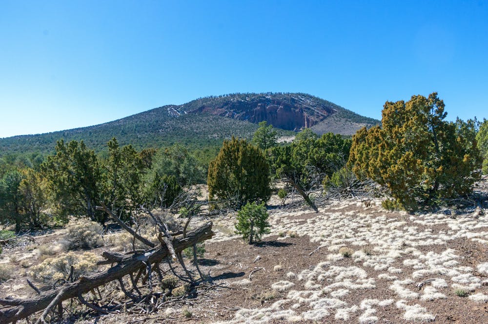
Red Mountain is one of the best short hikes near Flagstaff and one everyone in the family can enjoy. The trail begins by gently meandering through a hard-packed wash, then snakes its way through a series of unique hoodoos and along a sheer cliff face. Ponderosa pine, juniper, and pinyon line most of the trail, and during the spring and summer, "the path is dotted with a variety of blooms - yellow, orange, pink and red against the red cinders of the green pinyons." Wildlife, particularly birds, can be seen along the canyon walls, and its lower elevation means this hike can be enjoyed year-round.
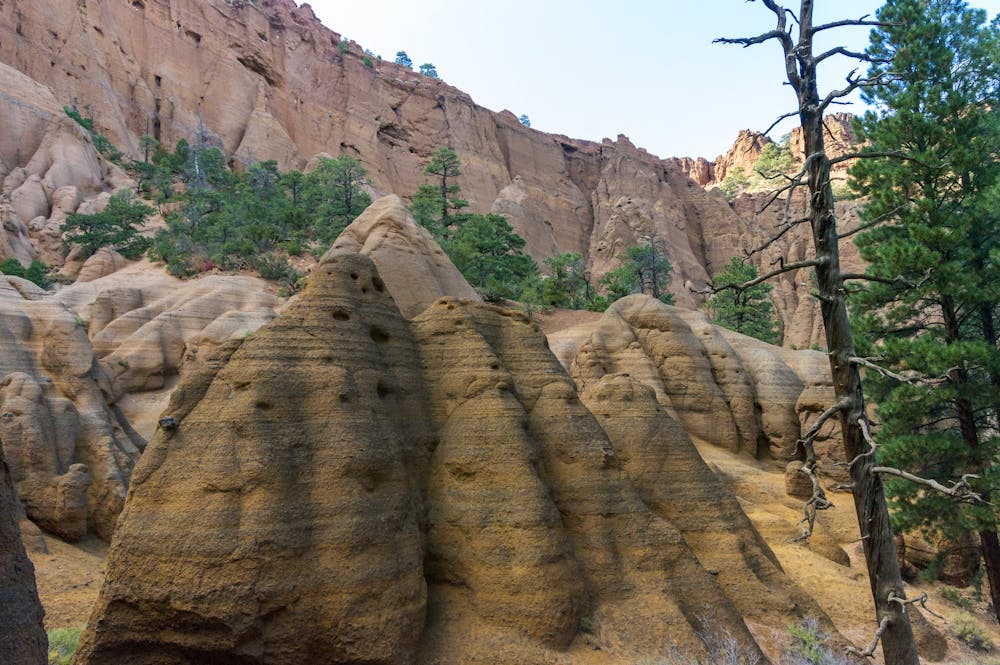
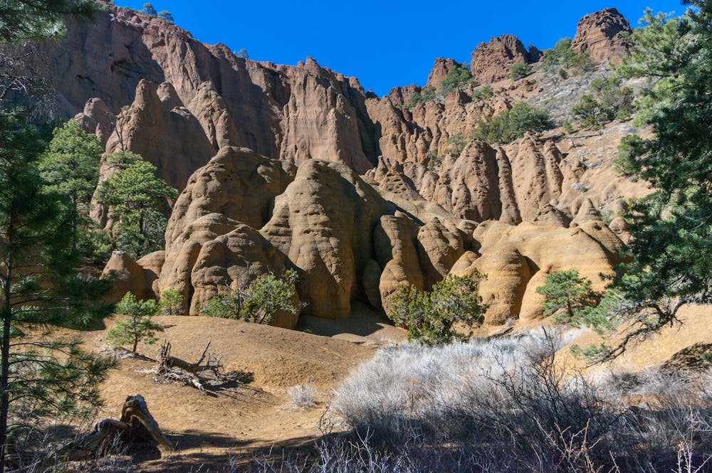
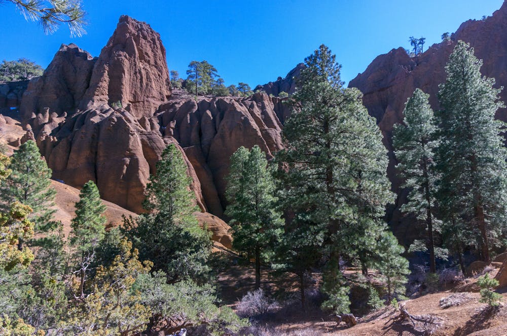
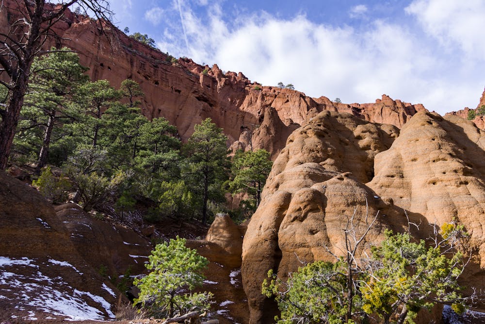
Estimates by the USGS and Northern Arizona University date Red Mountain at nearly 740,000 years old. The vertical pillars, known as hoodoos, line the central cone of the volcanic cinder cone, "and many dark mineral crystals erode out of its walls," the Forest Service notes.
Once you arrive at the black lava formations, you'll have the option to ascend a ladder into the inner area or scramble up the side of the cone and back down into the formation. Should you be hiking with dogs, the scramble around the ladder is generally a better option. Just be mindful of your footing since it is a bit more exposed.
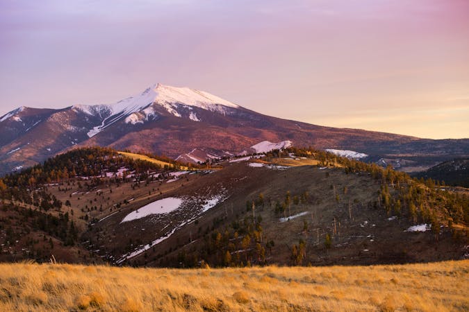
The trailhead for Red Mountain is located about 25 miles north and west of Flagstaff. Nearly all of the drive is on paved highways, though the last 1/4-mile to the trailhead is on a well-maintained dirt road. There is no water at the parking lot or along the trail, so plan ahead and carry at least 1 liter per person on a warm day, the Forest Service suggests. The hike from the trailhead to the base of the mountain averages about 30 minutes, but it's easy to lose track of time admiring the unique formations and cliff faces once you're standing beneath them.
Sources: https://hikearizona.com/decoder.php?ZTN=101 https://www.fs.usda.gov/recarea/coconino/recarea/?recid=55160
Easy
Walking along a well-kept trail that’s mostly flat. No obstacles are present.

The trail contains some obstacles such as outcroppings and rock which could cause injury.
Away from help but easily accessed.
10 routes · Hiking