
23 routes · Mountain Biking · Hiking
The last two passages of the Arizona Trail are combined into one grand finale on today’s ride.
Mountain Biking Difficult

One of Arizona’s least visited natural wonders lies hidden on the Kaibab Plateau north of Grand Canyon National Park. Along the Arizona Trail between Grand Canyon and the Utah state line you’ll discover outstanding singletrack, phenomenal views, and beautiful forests and meadows that seldom see human visitors. This area is only accessible between May and November as winter can bury the entire plateau in snow for over half the year.
This was the first segment of Arizona Trail to be designated in the 1980s and remains one of the most significant portions of trail in the state. After four days of riding you’ll understand why. While the first two days include rolling terrain at high elevation, the last two are mostly downhill. The highpoint of this ride on Day 1 is above 9,150 ft. and the lowpoint on day 4 is at 5,000 feet. Riders of all ability levels will appreciate this AZT Expedition, including beginners who don’t mind sucking a little wind at altitude.
Day Four
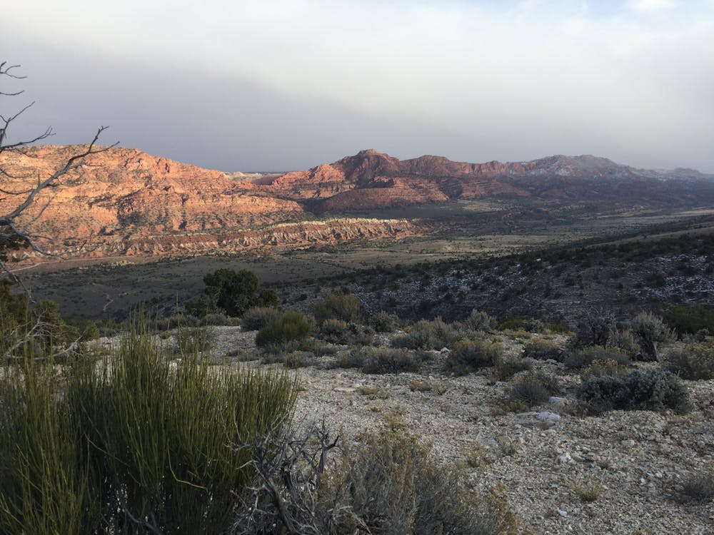
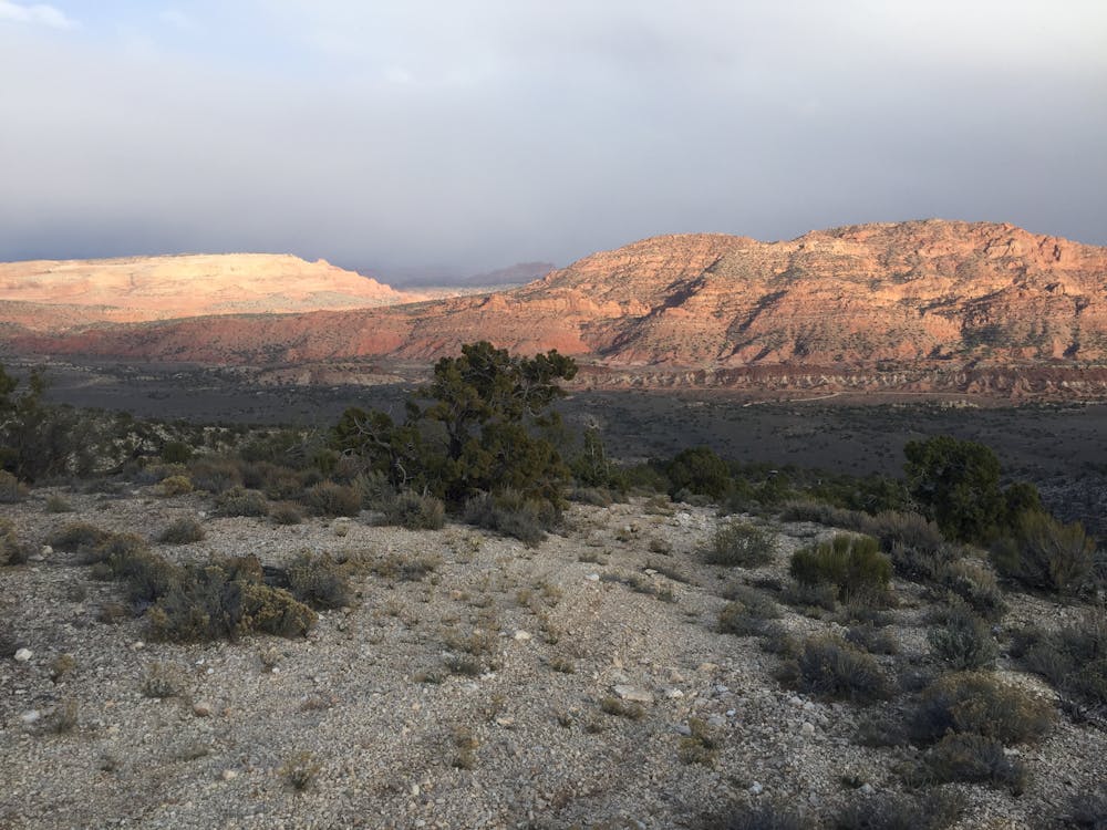
The last two passages of the Arizona Trail are combined into one grand finale on today’s ride. Starting at 7,500 feet and ending at 5,000, just let gravity have its way with you and enjoy the ride. These 28 miles will disappear all too quickly under your wheels as you speed through the forest like a Jedi. After a few hours the terrain changes almost instantly as you leave the forest and enter a sea of sagebrush. The sweet pungent smell announces your arrival into a whole new zone. From here, the soil changes from grey-brown to red – hinting at the sandstone paradise that lies to the north. After crossing Winter Road, the Arizona Trail continues down down down on a segment of trail that you’ll want to ride over and over again. After cresting one small rise you’ll catch your first glimpse of Coyote Buttes, Buckskin Gulch and the sandstone domes of southern Utah. We have yet to meet anyone that doesn’t gasp from the beauty. You’ll spend more time on your brakes than your pedals as you coast into the State Line Campground at the border of Arizona and Utah – the northern terminus of the Arizona National Scenic Trail. Ride length is about 28 miles.
For more information and to book a tour, visit: http://aztexpeditions.com/portfolio/grand-canyon-to-utah.html
Difficult
Mostly stable trail tread with some variability featuring larger and more unavoidable obstacles that may include, but not be limited to: bigger stones, roots, steps, and narrow curves. Compared to lower intermediate, technical difficulty is more advanced and grades of slopes are steeper. Ideal for upper intermediate riders.

The trail contains some obstacles such as outcroppings and rock which could cause injury.

In the high mountains or remote conditions, all individuals must be completely autonomous in every situation.
23 routes · Mountain Biking · Hiking