4.8 km away
Fantasy Island

A classic cross country ride on the southern edge of Tucson, filled with kitschy trail art.
Moderate Mountain Biking
- Distance
- 19 km
- Ascent
- 169 m
- Descent
- 169 m
A flowy, almost completely flat beginner-friendly singletrack ride.
Mountain Biking Easy

The Bunny Loop occupies the southern end of the Fantasy Island Trail System. While part of the original Bunny Trail has been destroyed by a new housing development, a new reroute has since re-connected Bunny with the Cactus Cup Loop to the north. However, the route shown here is a simple beginner loop on the southern end of the trail system.
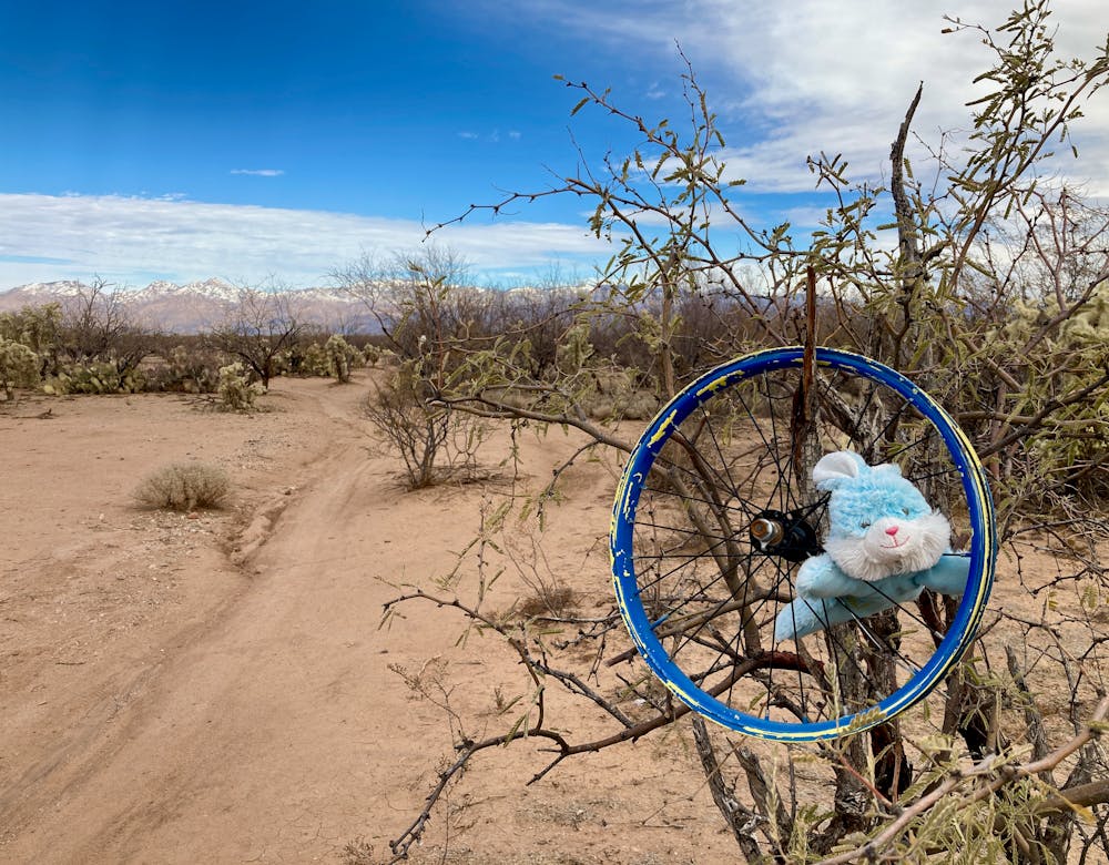
Near the trailhead southern trailhead, there are several short loops, splits, and options that could allow you to lengthen or shorten your ride. For the easiest navigation, keep turning right initially to follow the loop as mapped. However, once you reach the new housing development, you'll have to take a couple of left turns to complete this loop. Thankfully, there is one rare trail sign at a critical junction at that end of the loop to point you in the right direction.
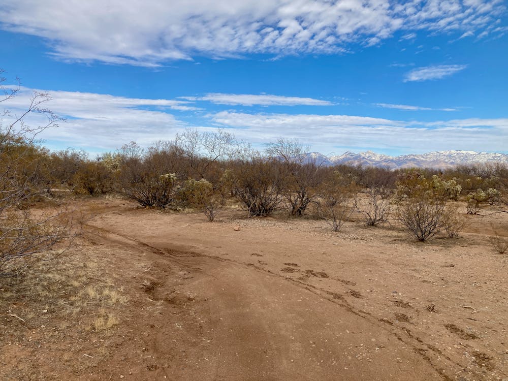
The singletrack is fast, smooth, and flowy, swooping between cacti and up and down small drainages. While the trail swings side-to-side, carving delightful S-turns in the desert floor that provide a delightful kinesthetic mountain bike experience, the trail itself is about as flat as one can possibly get.
For newbie mountain bikers who might not have great fitness yet, the Bunny Loop is a perfect introduction. Totally smooth singletrack paired with an utter lack of climbing makes for a fantastic way to get into the sport without the significant challenges found on most mountain bike trails.
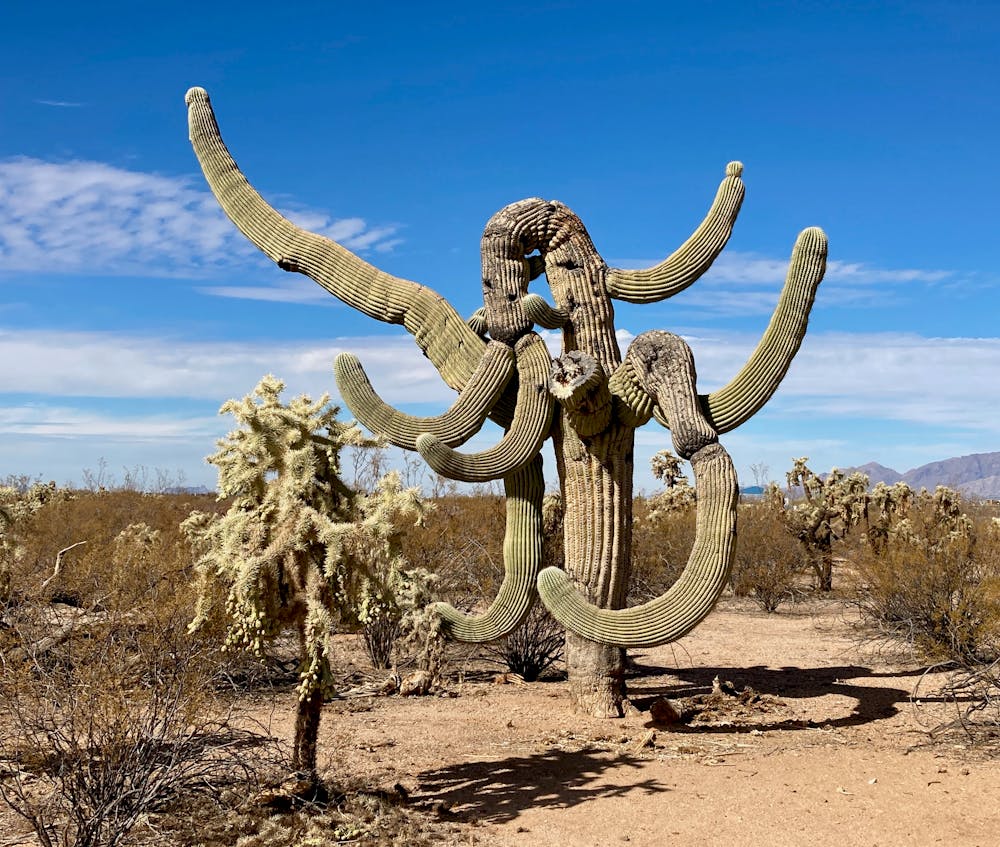
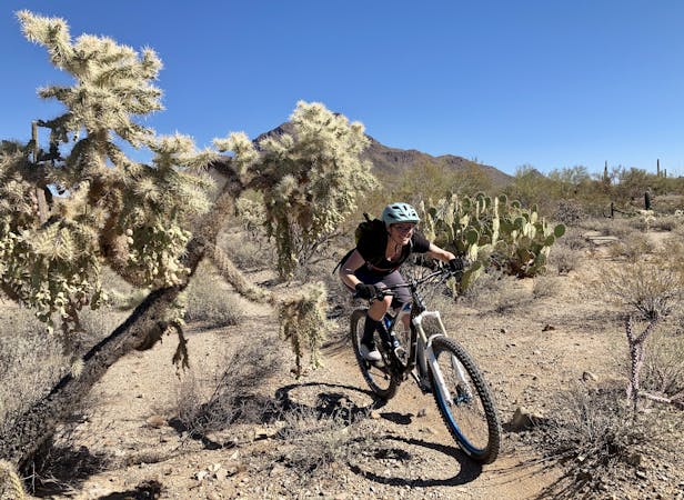
The only potential challenge on this trail is the towering cacti that grow close to the track. Be sure to avoid these beautiful organisms, because if you tap one with your shoulder, you can be sure they won't seem nearly so beautiful anymore! Also, pieces of cacti often fall into the trail tread, so be sure to bring your tubeless mountain bike tires.
Easy
Mostly smooth and non-technical singletrack with unavoidable obstacles 2in/5cm tall or less. Avoidable obstacles may be present. Ideal for beginner riders.

The path is on completely flat land and potential injury is limited to falling over.
Close to help in case of emergency.
4.8 km away
A classic cross country ride on the southern edge of Tucson, filled with kitschy trail art.
Moderate Mountain Biking
4.8 km away

A classic cross country ride on the southern edge of Tucson, filled with kitschy trail art.
Moderate Mountain Biking
9.7 km away
The Arizona Trail Race route, running from Saguaro National Park past Mount Lemmon and culminating at Oracle State Park.
Difficult Mountain Biking

23 routes · Mountain Biking · Hiking

37 routes · Mountain Biking

5 routes · Mountain Biking

10 routes · Mountain Biking
5 routes · Mountain Biking

32 routes · Mountain Biking · Hiking · Road Biking