8 routes · Mountain Biking · Road Biking
Superb singletrack along the rim of the Grand Canyon.
Mountain Biking Moderate

Though most of the Grand Canyon is closed to mountain biking, this unique trail is maintained with bikes in mind. It is, in fact, the only place to ride singletrack along the rim of the Grand Canyon. Tucked in a remote corner of Kaibab National Forest, outside of the crowded national park, Rainbow Rim is visited by few people other than mountain bikers. If coming to Grand Canyon’s North Rim with your bike, Rainbow Rim is the place to go.
The trail is mapped here as a one-way from south to north, but it’s good in either direction, and you can ride any distance out and back if you don’t have a vehicle shuttle. The trail is all singletrack, with a good blend of non-technical climbing and smooth downhill. The variety of terrain and scenery make it perfect for a relaxed-pace, all-day ride.
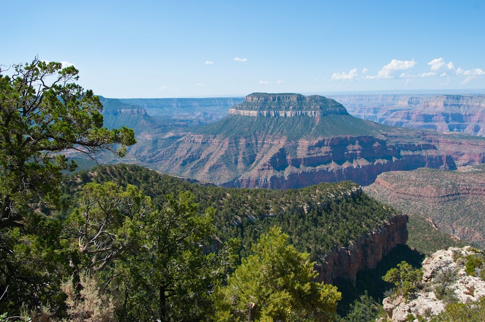
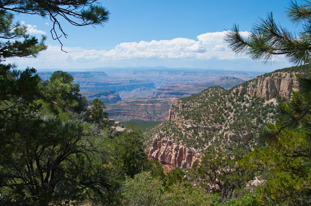
Though famous for being on the edge of the Grand Canyon, the majority of the trail is concealed in the forest. Most of the canyon views are at five “points” of land that protrude into the gorge. At these points, the trail passes dramatically, but not dangerously, close to the rim. The grandest views are had by dismounting and walking to an airy outcrop on the edge.
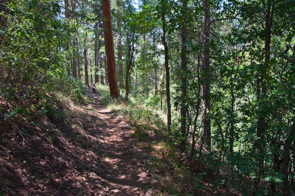
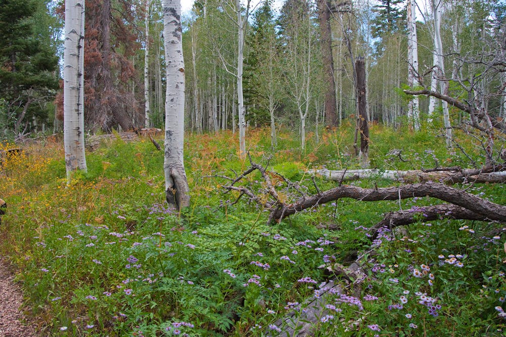
Canyon vistas are indeed the highlights, but the forest sections are far from disinteresting. The stretches between overlooks wind through sunny pine forest and dip through shady glens with aspen glades and flower-filled meadows.
Though the Rainbow Rim Trail is popular among mountain bikers, getting there is not easy, and you should expect a backcountry experience when you arrive. It requires miles of travel on rough dirt roads, with no services nearby and limited cell service. To make the most of your time, you should plan to camp at least one night. Vehicle camping is allowed for free at multiple access points along the trail. The best camp spots are at either end of the trail or at Locust Point, which is approximately the midpoint. Be sure to respect any road closures and fire restrictions that may be posted, and respect the environment by minimizing impact where you camp.
Sources: https://www.arizonahighways.com/explore/hiking/rainbow-rim-trail https://www.fs.usda.gov/recarea/kaibab/recreation/hiking/recarea/?recid=32207&actid=50
Moderate
Mostly stable trail tread with some variability, with unavoidable obstacles 8in/20cm tall or less. Other obstacles such as rock gullies and steep sections may exist. Ideal for lower intermediate riders.

The trail contains some obstacles such as outcroppings and rock which could cause injury.

Little chance of being seen or helped in case of an accident.
8 routes · Mountain Biking · Road Biking