110 m away
Bright Angel Point Loop
A versatile running loop on the North Rim of the Grand Canyon
Moderate Trail Running
- Distance
- 7.2 km
- Ascent
- 174 m
- Descent
- 174 m
A beautiful trail run on the North Rim with commanding views from Uncle Jim Point.
Trail Running Moderate

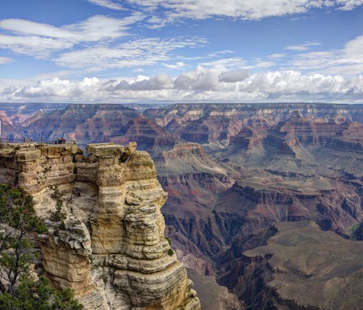
Named after an early 20th-century game warden, the Uncle Jim Trail is a moderately challenging trail run on the North Rim with stunning views from its namesake point. At the overlook, visitors are awarded sweeping views of Bright Angel and Roaring Springs Canyons, plus a direct line of sight to Bright Angel Point. Across the Colorado River, views of the South Rim and even the distant San Francisco Peaks near Flagstaff are possible.
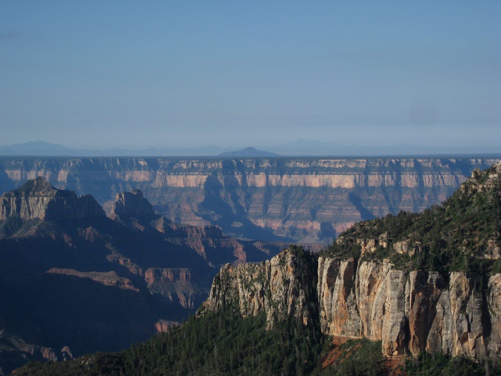
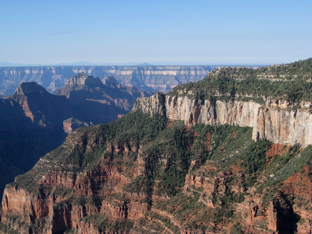
This run is more difficult than the Bright Angel Point Loop, but far less challenging than the North Kaibab Trail as it heads into Roaring Springs Canyon. Though awe-inspiring by anyone's standards, the rugged path descends rapidly into the canyon and is infrequently chosen by day hikers or runners (other than those completing a Rim to Rim to Rim traverse).
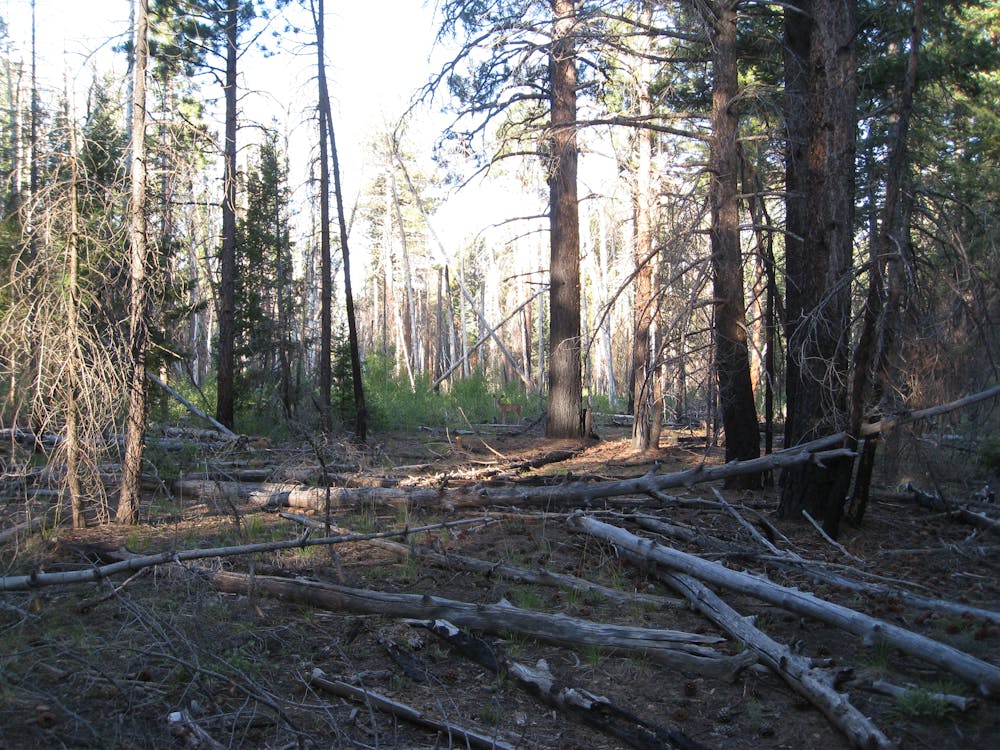
During James T. Owen's (Uncle Jim's) era "wildlife managers believed that predators were “bad” and needed to be removed to benefit “good” game species." Fortunately, that belief was ultimately seen as flawed, but not before the "deer herd exploded and destroyed much of the vegetation on the Kaibab Plateau," according to grandcanyontrust.org. Thankfully, those theories have now been superseded by modern-day research of healthy ecosystems and the importance of natural predators.
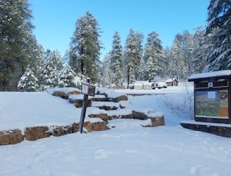
For those visiting for the day, park at the North Kaibab Trailhead. The trail begins in the eastern edge of the parking lot near the mule stables. If you are staying at the campground, consider taking the Bridle or Transept Trails to the start instead since parking fills up quickly during peak season. Countless connector trails pass through the campground making access extremely easy.
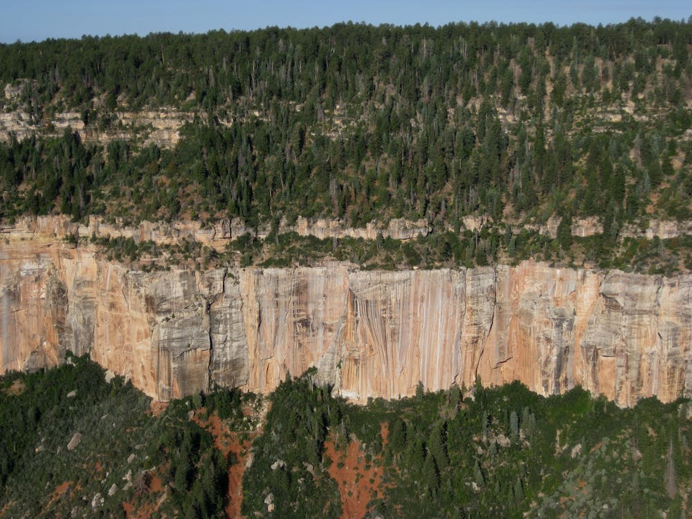
The loop begins by heading east on the Ken Patrick Trail for the first mile, then turns right at the junction with the Uncle Jim Trail. .3-miles later, you'll reach the start of the loop. Most runners and hikers stay right to complete the loop counter-clockwise. In addition to its numerous views, the loop showcases a mixture of healthy "Douglas fir, Engelmann spruce, ponderosa pine, and occasional groups of aspen," according to grandcanyontrust.org, though you may also notice remnants of recent burns.
While the Visitor Center is seasonally open from May 15th to October 15th, the road to the South Kaibab Trailhead remains open through November 31st. Be extremely mindful of road conditions and upcoming weather patterns as the date approaches. There are numerous stories of vehicles stuck in snow remaining there throughout the winter. Recovering them can become extremely challenging during heavy winter storms.
Sources: https://www.grandcanyontrust.org/hikes/uncle-jim-trail https://www.nps.gov/grca/planyourvisit/hours.htm
Moderate

The trail contains some obstacles such as outcroppings and rock which could cause injury.
Away from help but easily accessed.
110 m away
A versatile running loop on the North Rim of the Grand Canyon
Moderate Trail Running
11 routes · Trail Running