3.8 km away
Split Rock Loop
Scenic stroll among the boulders, tucked out of the way near the busy Skull Rock area.
Moderate Hiking
- Distance
- 3.1 km
- Ascent
- 68 m
- Descent
- 68 m
Quick hike to a natural arch and popular photography spot.
Hiking Easy

Hidden in a jumble of rocks behind a campground sits an impressive natural arch, made from an oblong boulder with a span of about 30 feet beneath it. A visit to Arch Rock used to be an exclusive treat for those staying in White Tank Campground, but the spot’s popularity compelled the park to establish a hiking trail that’s accessible to more people. Now, you can park outside the campground, in the appropriately sized lot at Twin Tanks trailhead, and hike a moderate distance to see the arch.
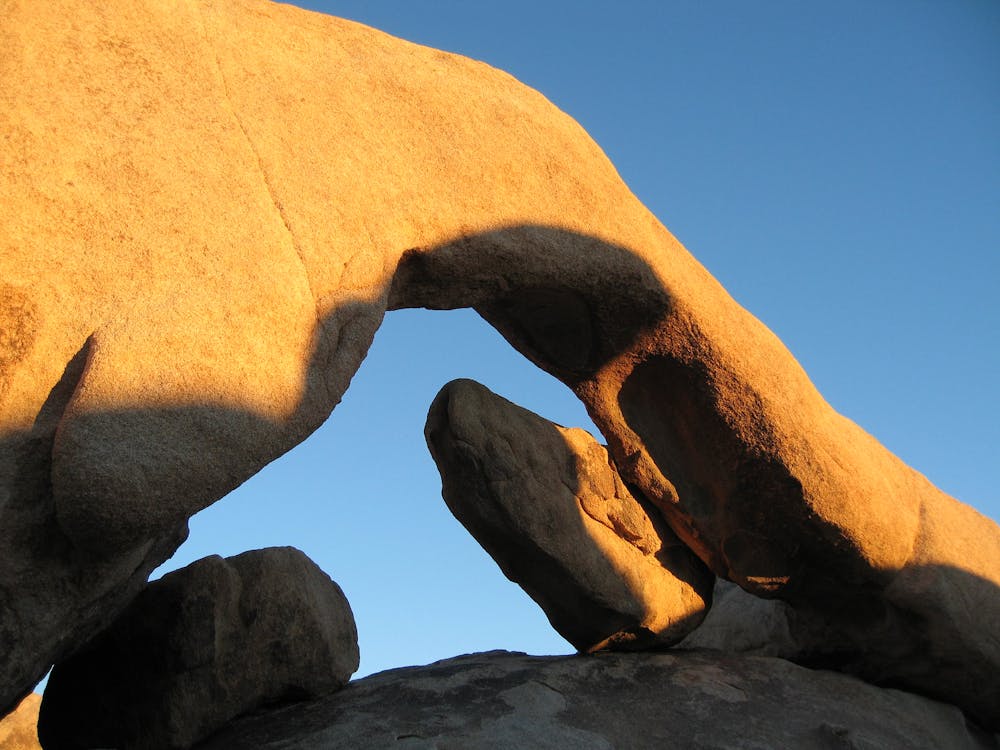
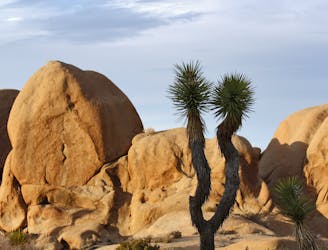
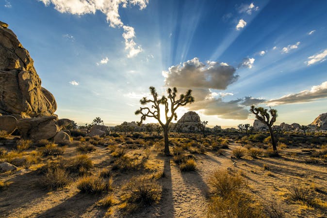
The hike goes across open desert, dotted with creosote and yuccas. The trail crosses the road once and continues toward the campground, then joins a loop trail that leads into the boulder garden. Once at the arch, you can walk right up to it and underneath it. With some rock climbing skills, you can even get on top of it. The arch and the maze of rocks around it are like a natural playground for rock scrambling, photography, and simply admiring the geology of Joshua Tree’s granite.
Sources: https://www.thewholeworldisaplayground.com/arch-rock-joshua-tree-national-park https://www.hikespeak.com/trails/arch-rock-joshua-tree/
Easy
Walking along a well-kept trail that’s mostly flat. No obstacles are present.

The trail contains some obstacles such as outcroppings and rock which could cause injury.

Close to help in case of emergency.
3.8 km away
Scenic stroll among the boulders, tucked out of the way near the busy Skull Rock area.
Moderate Hiking
9 routes · Hiking