244 m away
Coastal Trail
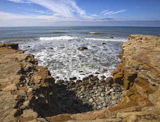
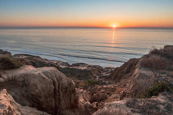
A beautiful path among wave-battered sea cliffs and tide pools overlooking the Pacific.
Easy Hiking
- Distance
- 1.6 km
- Ascent
- 43 m
- Descent
- 43 m
Explore the nature, wildlife, and history of Point Loma, with views over downtown San Diego.
Hiking Easy

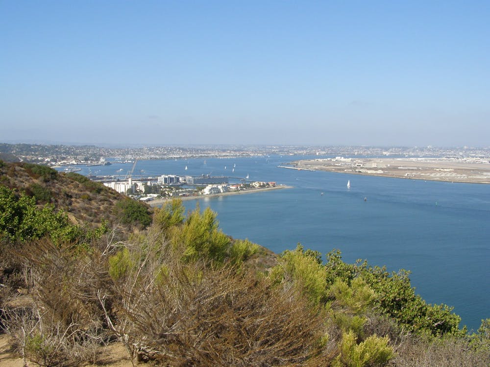
Point Loma is the south-stretching peninsula east of San Diego Bay. It’s drenched in scenery and steeped in history, both of which are preserved in Cabrillo National Monument. Named for the Spanish explorer who first sailed America’s west coast and located near the spot he first landed on its shore, the national monument honors him and protects a vestige of the natural environment he encountered here nearly 500 years ago.
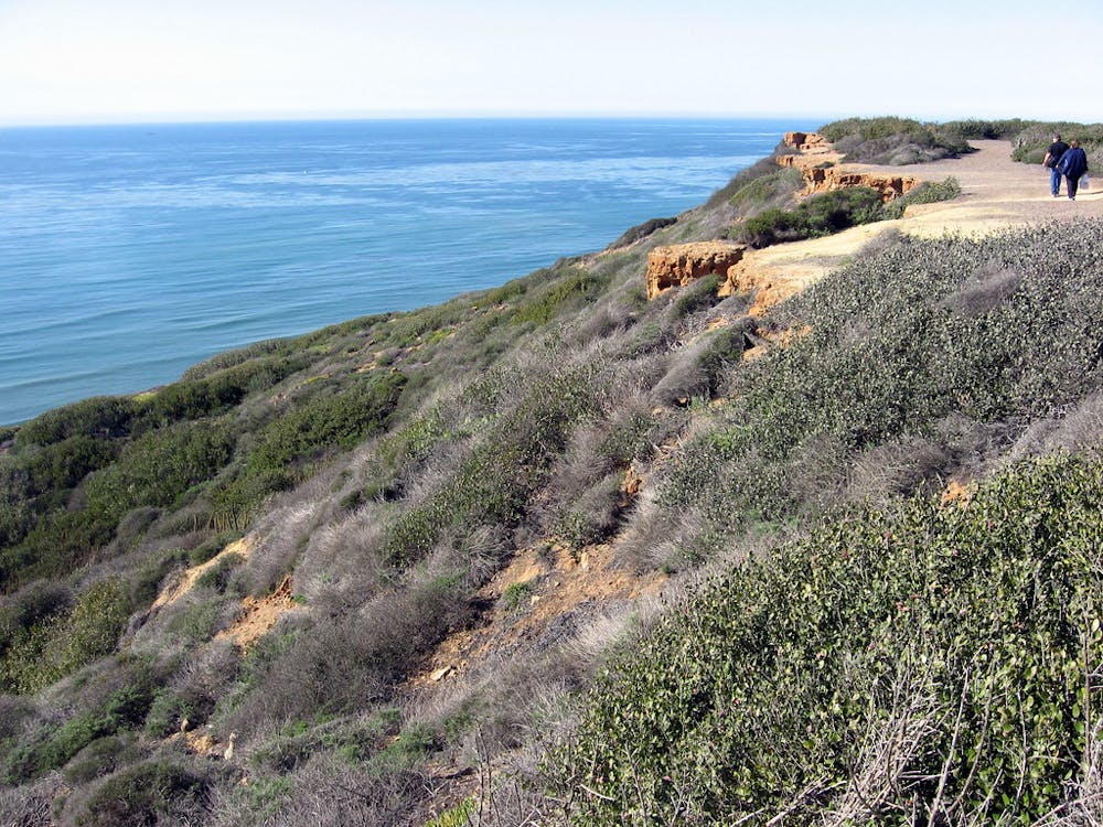
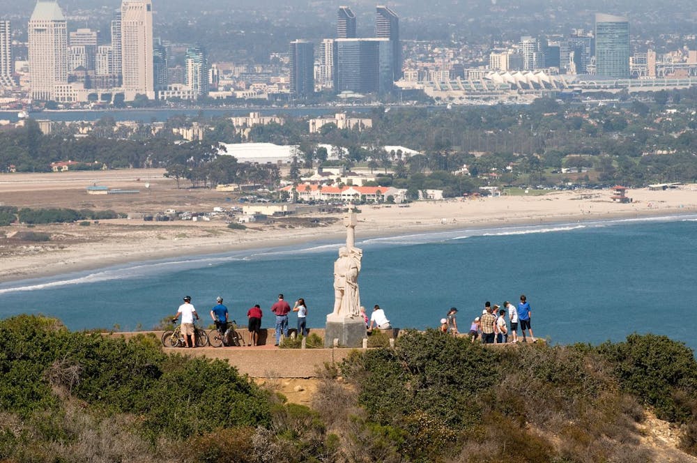

In more recent history, the peninsula has seen the construction of a lighthouse, military fortifications, a power plant, and a statue of Cabrillo. All of these can still be seen here, but so can the rare and fragile ecosystem that survives. It’s a vegetation type known as coastal sage, which is a mix of low-desert cacti and high-desert sagebrush and yucca, plus seaside wildflowers, grasses, and drought-tolerant trees. It’s home to seabirds, quail, hummingbirds, ground squirrels, rabbits, foxes, and many other animals. In the water, you may see seals, sea lions, dolphins, or even whales during the winter migration season.
Bayside Trail is a good tour of this environment and adds great views of San Diego to the natural scenery. There are two ways to start the hike from the parking lots—a paved path and a dirt path, both of which go to the Point Loma Lighthouse then Bayside Trailhead. The pavement grants nice views over the bay, but an even more scenic, steeper, dirt path leads past the Military History Exhibit and up a hill with a view over the ocean. The latter is the route mapped here, but both are efficient ways to reach the lighthouse and continue on Bayside Trail.
The trail starts as a paved road heading downhill below the lighthouse. A signed turn then follows a gravel path that descends more, crossing naturally vegetated slopes above the bay. Along the way are many signs explaining the species, landmarks, and history you encounter. A dead end is the trail’s turnaround point, where you’ll start the hike back uphill. Take advantage of numerous benches to catch your breath and take your time returning.
Easy
Walking along a well-kept trail that’s mostly flat. No obstacles are present.

The path is on completely flat land and potential injury is limited to falling over.
Close to help in case of emergency.
244 m away
A beautiful path among wave-battered sea cliffs and tide pools overlooking the Pacific.
Easy Hiking
17 routes · Hiking