Lake Del Valle
A long and spectacular trip around a gorgeous lake
Hiking Difficult
- Distance
- 30 km
- Ascent
- 1.2 km
- Descent
- 1.2 km
- Duration
- 1 day +
- Low Point
- 168 m
- High Point
- 687 m
- Gradient
- 15˚

Close (but not quite close enough for a day trip) to San Francisco, Del Valle Regional Park is a beautiful spot and this long hike makes the best of it for those who have the fitness and determination to complete it.
Description
In the early 20th century, water storage became a critical issue for the growing population of the San Francisco Bay Area. The Alameda County Water District was formed in 1914 to address water supply challenges. Del Valle Reservoir, the centerpiece of the park, was constructed between 1963 and 1968 as part of the water district's efforts to create a reliable water source.
Following the completion of the reservoir, the East Bay Regional Park District acquired the land surrounding the reservoir and established Del Valle Regional Park in 1969. The park was named after the Del Valle family, who were early Spanish settlers in the Livermore Valley.
Over the years, the park has undergone development and improvement to provide recreational opportunities to visitors. Facilities such as picnic areas, campgrounds, hiking trails, and a marina were added to enhance the visitor experience while preserving the natural beauty of the park.
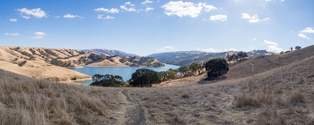
The scenery is incredibly varied around the lake, and it's surrounded by rolling hills, oak woodlands, and open meadows. As you hike along the trails, you'll have the chance to enjoy stunning views of the lake, nearby mountains, and the surrounding countryside.
Del Valle Regional Park is home to a variety of wildlife species and provides excellent opportunities for birdwatching and wildlife observation. Keep an eye out for deer, rabbits, squirrels, and a variety of bird species during your hike. The park also has picnic areas where you can relax and enjoy the natural surroundings.
One thing to note is that it's a good idea before visiting to check the park's official website or contact them directly to get the most up-to-date information on trail conditions, park regulations, and any permits or fees required.
Difficulty
Difficult
Hiking trails where obstacles such as rocks or roots are prevalent. Some obstacles can require care to step over or around. At times, the trail can be worn and eroded. The grade of the trail is generally quite steep, and can often lead to strenuous hiking.
Medium Exposure

The trail contains some obstacles such as outcroppings and rock which could cause injury.
Remoteness

Little chance of being seen or helped in case of an accident.
Best time to visit
Features
- Wildlife
- Picturesque
- Dog friendly
- Wild flowers
- Water features