9 routes · Hiking
Nicely varied loop with an oasis, a historic mine, and an optional scramble on the rocky peak.
Hiking Moderate

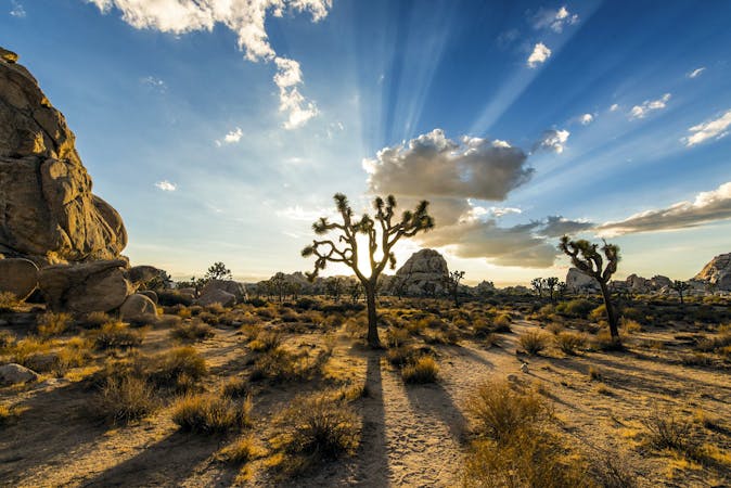
This moderately challenging loop combines a lot of the best of Joshua Tree National Park––a palm oasis, desert vistas, granite jumbles, and a gold mine. The best view is atop the peak, but not everyone may wish to scramble up it, and that’s ok because views from the base are still quite rewarding.
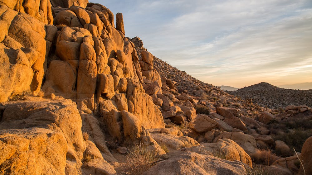
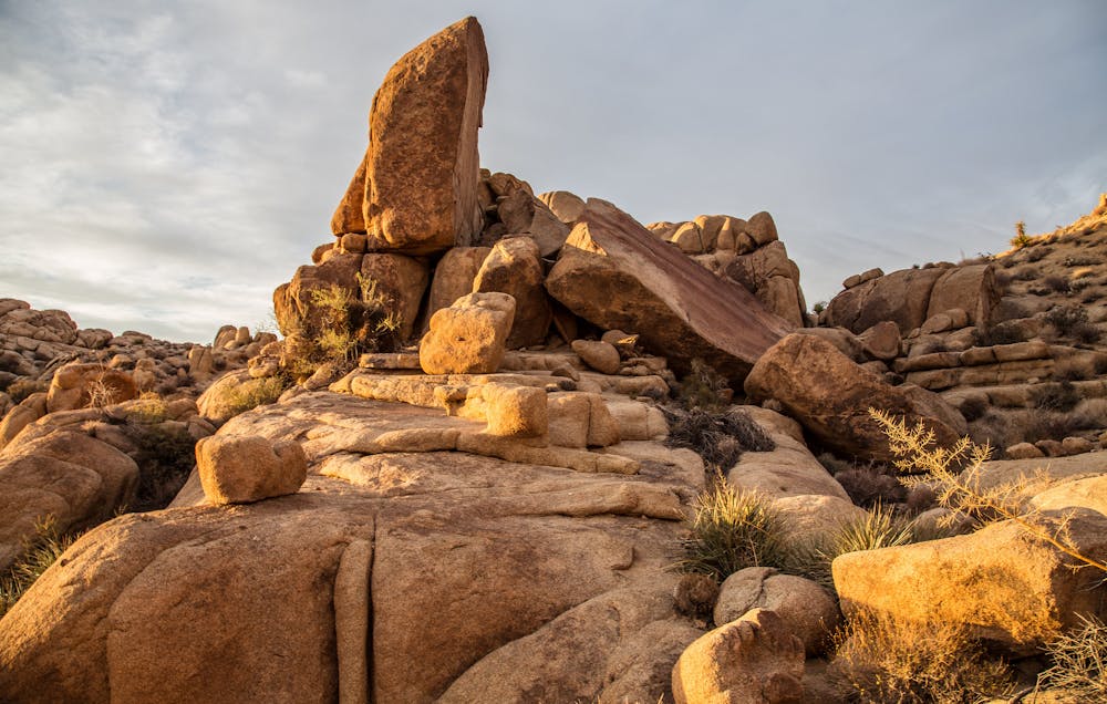
Mastodon Peak is not a peak not in the sense of a mountain, but more like a stone pinnacle. It’s not a massive formation, but it is taller than anything else nearby. Like most of the rock formations in Joshua Tree, it’s made of gold-tinged boulders that appear to be stacked on top of each other.
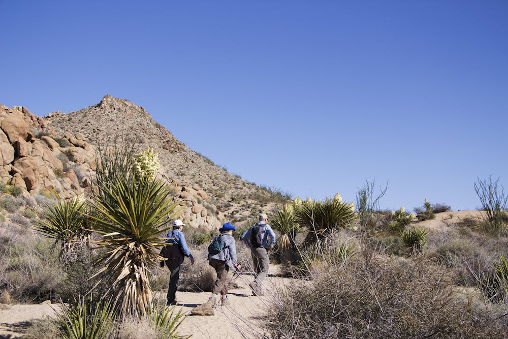
The hike begins from Cottonwood Spring Trailhead. The spring is close, within the palm grove next to the parking area. You may not see flowing water, but the vegetation is evidence of ample moisture in the ground. After passing through the palms, the hike becomes open desert with no shade, only scattered shrubs and yucca. The sandy trail goes over a series of small hills, which are rocky in places but not too difficult. Piles of boulders crown the nearby hillsides, and soon the trail turns to climb into the imposing rocks.
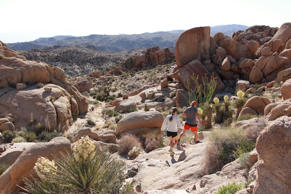
A steeper section involves stepping up rock slabs and stone stairs, but it’s short, and then you’ll be at the base of Mastodon Peak. To climb it, continue up into the boulders and around the backside of the formation, where a natural ramp and ledges form a route to the top. The summit is very much worth the effort, with 360-degree views and excellent photo opportunities.
Continuing the loop, the trail drops back down and comes to a historic gold mine, which is very well preserved. There’s a wooden hut built over a shaft, and inside is some of the machinery used to separate ore. From there, the trail follows a wide, sandy wash walled in by low cliffs. The wash soon meets a canyon, and it tumbles away through the rocks, but the trail stays on higher ground a bit longer, passing more boulder jumbles before curving downhill. It joins another wash and follows this one to meet the road and then the trailhead.
Moderate
Hiking along trails with some uneven terrain and small hills. Small rocks and roots may be present.

Some trail sections have exposed ledges or steep ascents/descents where falling could cause serious injury.

Close to help in case of emergency.
9 routes · Hiking