5 m away
Broken Hill Beach Loop
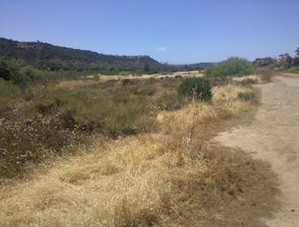
Quieter trail, and the long way to reach the beach in Torrey Pines Reserve.
Moderate Hiking
- Distance
- 4 km
- Ascent
- 115 m
- Descent
- 115 m
Connects some of the best overlooks and the beach in Torrey Pines Reserve.
Hiking Moderate

This loop is perhaps the best tour of Torrey Pines’ natural scenery. It combines two of the reserve’s best overlooks plus the hike-in sandy beach, all among an intact coastal forest of chaparral and the endangered Torrey pine tree. The trailhead is at a parking area near the visitor center. Park here (fee required) or walk in along the park road for free.

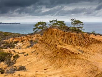
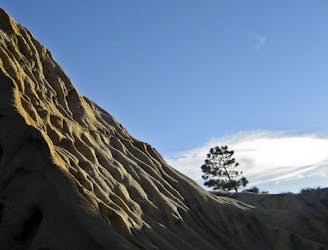
Right away the trail leads through diverse vegetation, including some of the Torrey pine trees. Early in the hike, you can see a platform of reddish rock rising over the greenery some distance away. This is Red Butte, and the trail leads to it. A steep section of trail reaches the top of the butte, where you can see up close how water and wind have carved these wrinkled hills called "badlands." Enjoy the view atop Red Butte, then descend the hill leading to the ocean.
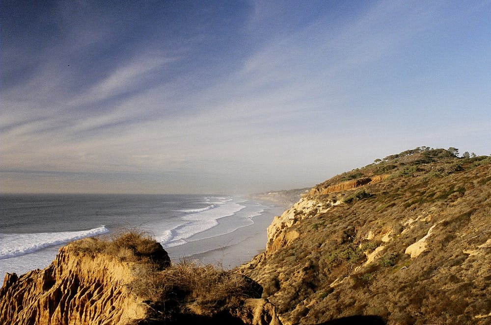
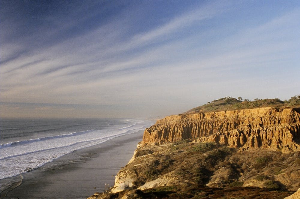
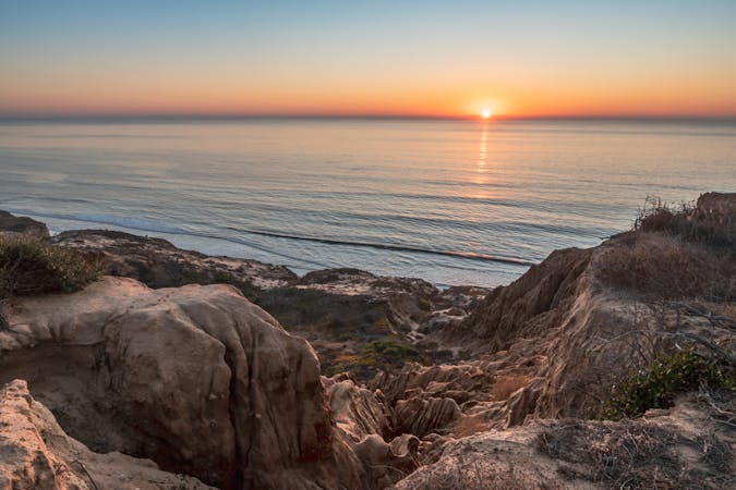
Next comes Razor Point, with an even better view. Vegetation thins as you near the wind-whipped precipice, and you can look down on countless runnels in the cracked cliffs that drop 100 feet to the breaking waves. At the tip of the point, a knife-edge ridge of bare soil extends outward toward the sea. In order to protect this and other fragile formations as well as plant life, it’s very important to stay inside the fence and on marked trails.
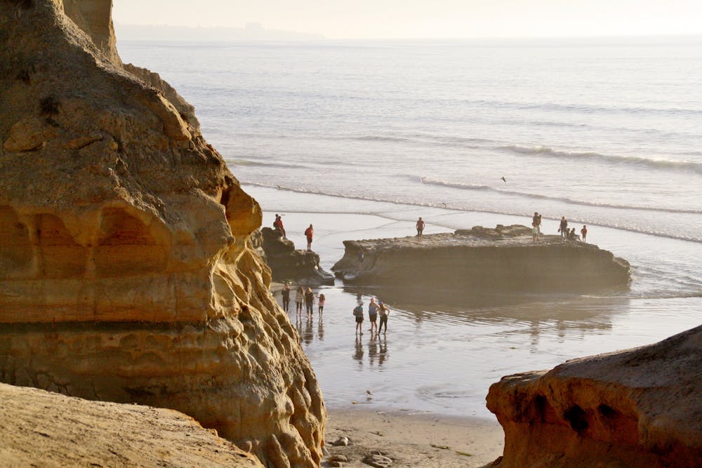
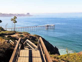
Continue along the main trail and soon you’ll reach the spur trail to Yucca Point, a worthwhile side trip. Yucca Point looks down on more sea cliffs and the secluded beach tucked among them, which is a short but steep descent away. Backtrack to the main trail and follow it to join Beach Trail. A twisting downclimb on stairs in a tight canyon puts you on the beach, where you can admire the badland formations from below and dip your feet in the ocean.
Beach Trail is the most direct route back to the parking lot and completes the loop. There is, of course, the option to return the way you came, however, or to explore different side trails on the way back. You can also make a longer loop with Broken Hill Trail and see a different part of the reserve.
Note that Torrey Pines State Reserve has special rules to protect the fragile ecosystem. Leaving marked trails is not allowed. Pets are not allowed in the reserve. Food and drink (except water) are not allowed on reserve trails.
Sources: https://www.parks.ca.gov/?pageid=657 https://torreypine.org/ https://en.wikipedia.org/wiki/TorreyPinesStateNaturalReserve https://torreypine.org/wp-content/uploads/maps/mapa.pdf
Moderate
Hiking along trails with some uneven terrain and small hills. Small rocks and roots may be present.

The trail contains some obstacles such as outcroppings and rock which could cause injury.

Close to help in case of emergency.
5 m away
Quieter trail, and the long way to reach the beach in Torrey Pines Reserve.
Moderate Hiking
405 m away
Short loop with ocean views and fine specimens of the endangered Torrey pine tree.
Easy Hiking
4.6 km away
Oasis of water and nature with many trails in the metro area.
Moderate Hiking
8.6 km away
A beautiful walk along a fantastic San Diego beach.
Easy Hiking
17 routes · Hiking