5 routes · Hiking
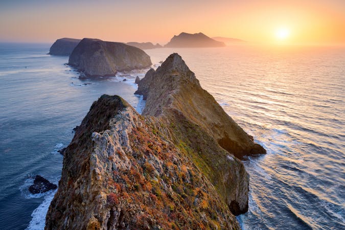
Day 1 of a backpacking trip on the wild shores of Santa Rosa in Channel Islands National Park.
Hiking Moderate

This route is just one suggestion for a backcountry trek on Santa Rosa Island. It leads from the pier to the vicinity of remote beaches at Ford Point, on the southeast side of the island. The way is mostly along old ranch roads, so it’s not difficult hiking except for all the hills. Along the way, you’ll have expansive views over rolling grassland, steep canyons, and blue horizon, as well as wildflowers if you go in early spring. You might spot wildlife like bald eagles or the island fox, and you might share your beach camp with lounging seals. During a stay on Santa Rosa you can expect to deal with heat and wind, but perhaps also fog and rain, and you must carry lots of water because sources are few.
In addition to preparing for conditions, backcountry camping on Santa Rosa requires significant logistics. You will need to arrange a backcountry permit from Recreation.gov and also book transport through Island Packers, which is the park’s licensed concessionaire. Alternatively, you could arrive on Santa Rosa by private vessel, but a backcountry permit is still needed for on-shore camping. Outside of the one established campground, camping on Santa Rosa Island is restricted to the beaches, and to certain times of year. The southeast shores of the island, where Ford Point is located, are open August 15 to December 31, and otherwise closed for wildlife.
The drop-off point for Island Packers boats is the pier at Bechers Bay. From there the hike begins. You’ll soon pass the Santa Rosa Campground, where you’ll want to stop and fill up water. Continue on the road signed as Wreck Road to climb into the hills. The only other reliable source is Clapp Spring, located more than halfway across the island, at the spur trail on the track mapped here. At the spring, there is a concrete tank and a spigot, but water must be treated before drinking. You’ll need to fill up there on all the water you might need for camping, unless you’ve been assured by a ranger that a seasonal source is available elsewhere.
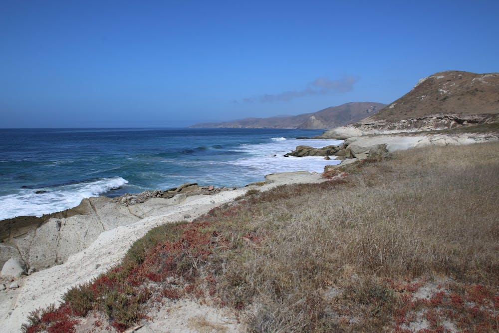
From Clapp Spring, continue down the roads to Ford Point. The point itself does not have a good beach, but from there, you can scout the nearby beaches and determine where to camp. Elephant seals are usually abundant, so it can be difficult to find a spot that’s out of their way. Be sure to give all wildlife a good safe distance.
The route mapped here is simply a one-way to Ford Point, giving an idea of what your first day will be like. You’ll want to complete this with enough daylight to select a camp spot, then rest up for the return journey or for further exploring along the coast. Hiking right along the shoreline is difficult because of cliffs and tidal cut-offs, but you can walk the ridges and roads higher above. Augustine Canyon is one area worth exploring to the east, and La Jolla Vieja Beach is another to the west.
Sources: https://www.nps.gov/chis/planyourvisit/hiking-santa-rosa-island.htm https://www.nps.gov/chis/planyourvisit/backcountry-beach-camping-on-santa-rosa-island.htm https://www.seekadventure.net/d/150-channel-islands-national-park-santa-rosa-island-backcountry-beach-camping
Moderate
Hiking along trails with some uneven terrain and small hills. Small rocks and roots may be present.

The trail contains some obstacles such as outcroppings and rock which could cause injury.

Little chance of being seen or helped in case of an accident.
5 routes · Hiking