3.3 km away
Paradise Royale Loop
One of the only bike-legal trails in the King Range.
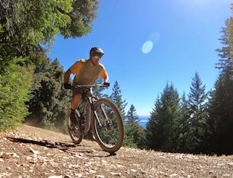
Difficult Mountain Biking
- Distance
- 18 km
- Ascent
- 715 m
- Descent
- 715 m
Easy loop before the Pacific Rim.
Mountain Biking Easy

This is a popular mountain biking route which is generally considered to be easy. It's an unknown remoteness, it features unknown exposure and is typically done in an unknown time of year. From a low point of 509 m to the maximum altitude of 555 m, the route covers 1.9 km, 111 vertical metres of ascent and 112 vertical metres of descent.
Easy loop near the Pacific Rim trailhead.
Easy
Mostly smooth and non-technical singletrack with unavoidable obstacles 2in/5cm tall or less. Avoidable obstacles may be present. Ideal for beginner riders.
3.3 km away
One of the only bike-legal trails in the King Range.
Difficult Mountain Biking