5 routes · Mountain Biking
Flowy intermediate-friendly shuttle run.
Mountain Biking Moderate

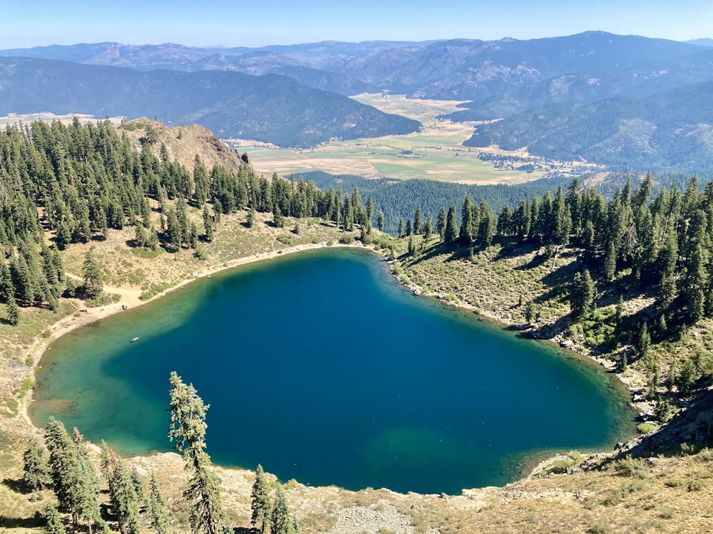
If the other shuttle runs in the Lost Sierra are too tough and technical for you, get behind the wheel and drive an hour or so north to Mt. Hough. In sharp contrast to Mills Peak just down the road, Mt Hough is fast and smooth and completely intermediate-friendly!
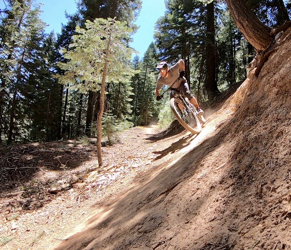
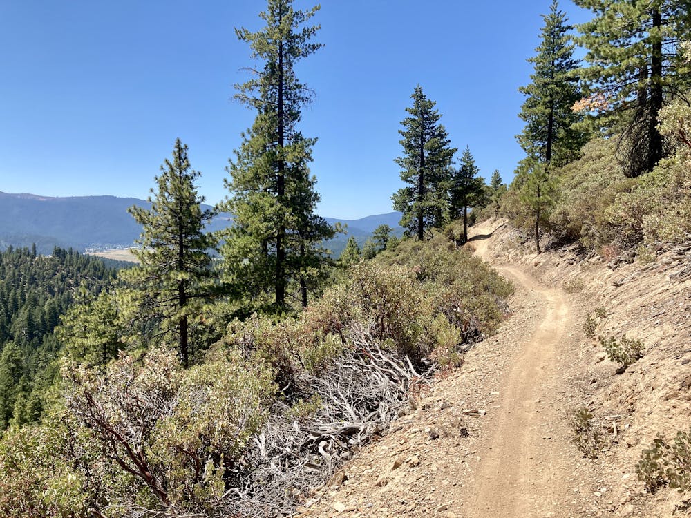
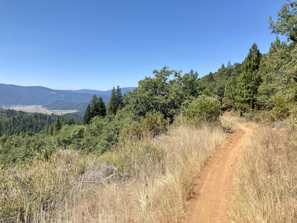
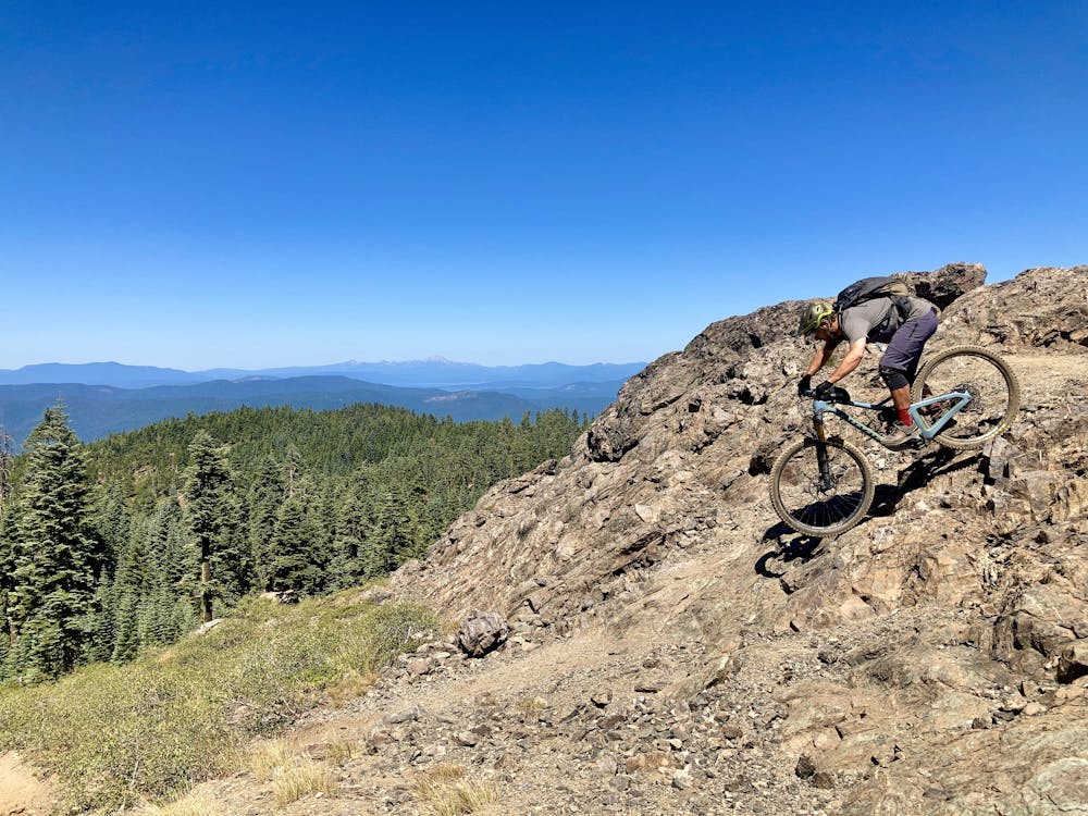
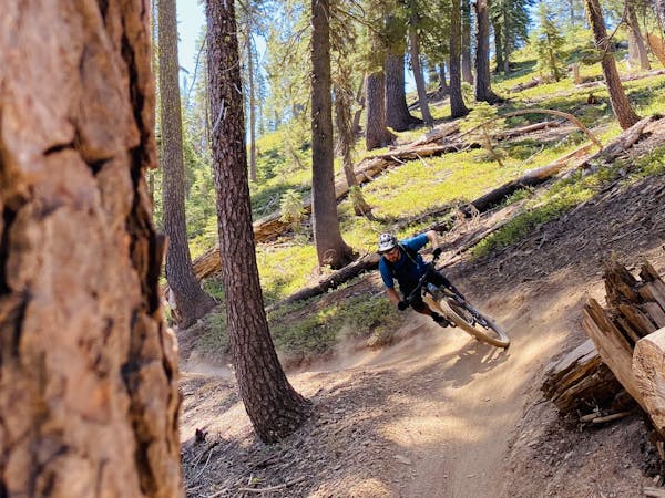
Aside from one optional tech feature at the very top of the mountain, the entirety of Mt. Hough is a smooth, flowy descent. The trail does have distinct sections with different flavors, however. The first few sections are fast and wide-open with a natural singletrack feel, then in the middle of the trail, you’ll drop into a well-built flow trail segment with berms, tabletop jumps, and more.
Even though you’ll rip down 4,200 feet of vert, you do still have to climb about 400 feet. These climbs come roughly in the middle, and after so much high speed descending, the switch to pedaling feels a bit strange and leaves you wondering if they couldn’t have just routed the trail somewhere else. But looking at the topography indicates that you just have to make it over a few small hills to get to the next downhill—then it’s back to high-speed flow!
While the singletrack on Mt. Hough is generally buff and non-technical, if you let off the brakes you can achieve blistering speeds in some sections! Some portions of the trail are shockingly steep and straight, allowing you hit mach chicken as you blaze down the mountain. Blasting down singletrack at these speeds will keep even the most advanced riders entertained! However, be aware that sometimes the high-speed downhills will throw you suddenly into tight and twisty trail through tight stands of trees, so ride heads up!
Moderate
Mostly stable trail tread with some variability, with unavoidable obstacles 8in/20cm tall or less. Other obstacles such as rock gullies and steep sections may exist. Ideal for lower intermediate riders.

The trail contains some obstacles such as outcroppings and rock which could cause injury.

Little chance of being seen or helped in case of an accident.
5 routes · Mountain Biking