7 routes · Hiking · Road Biking · Trail Running
Fast and mostly flat dirt path with some of San Francisco's most classic coastal views.
Trail Running Moderate
This route includes some of the best coastal scenery in San Francisco, as well as some of its more interesting historic sites. The length and location make it perfect for a morning or evening workout when visiting the city, or for locals who want to quickly revisit classic San Francisco sights.
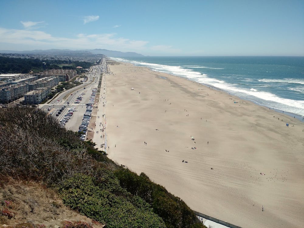
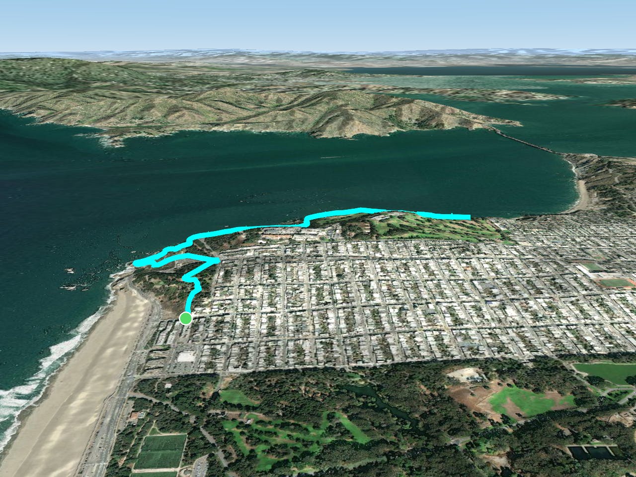
The route mostly follows the California Coastal Trail on dirt paths. As mapped, it begins with a heart-pumping climb up the Sutro Stairs from Balboa Avenue. Park on Balboa or at the beach. If you want to skip the stairs, simply start from a different spot closer to Lands End. Street parking can be found in the nearby neighborhoods.
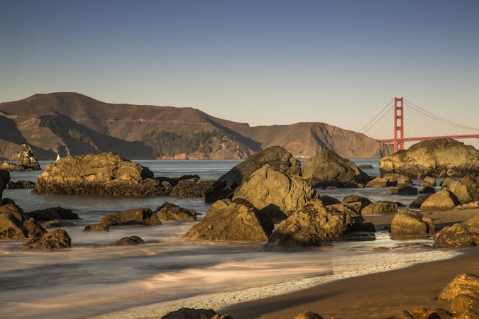
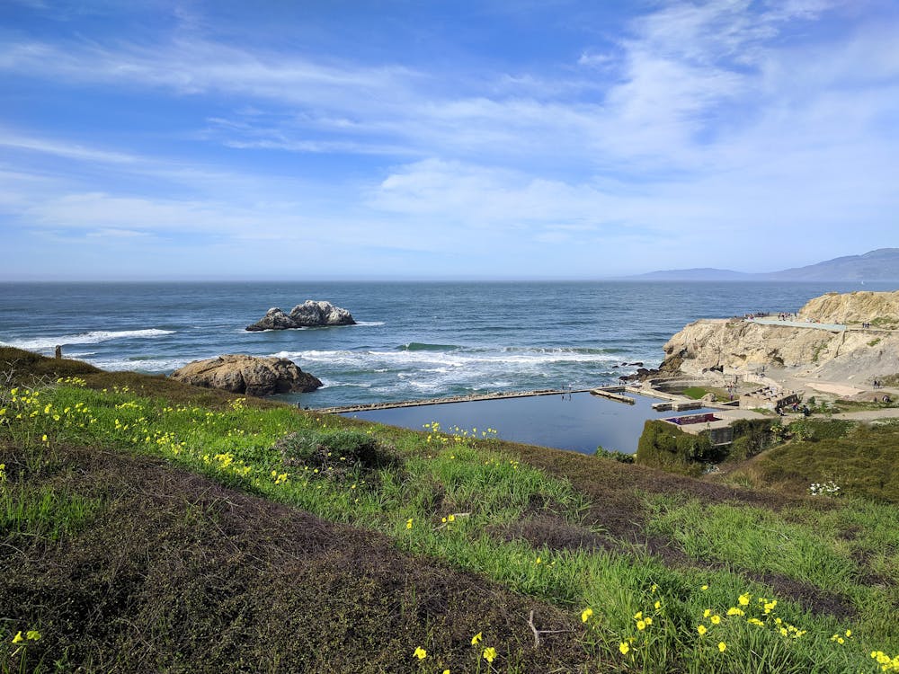
Sutro Heights is a leafy park that is quieter than Lands End. Once you cross Point Lobos Avenue, you’ll likely share the trails with a lot more people. The views from Lands End are the reason for its popularity. Sea cliffs and stacks protrude from white waves on dark water, making quite the dramatic scene on a foggy San Francisco day. On the shore below are the Sutro Baths, a ruined public pool complex from the early 20th century. The overlook here is worth a pause, before taking on the next set of stairs. These are shorter and not as steep as the previous ones, however.
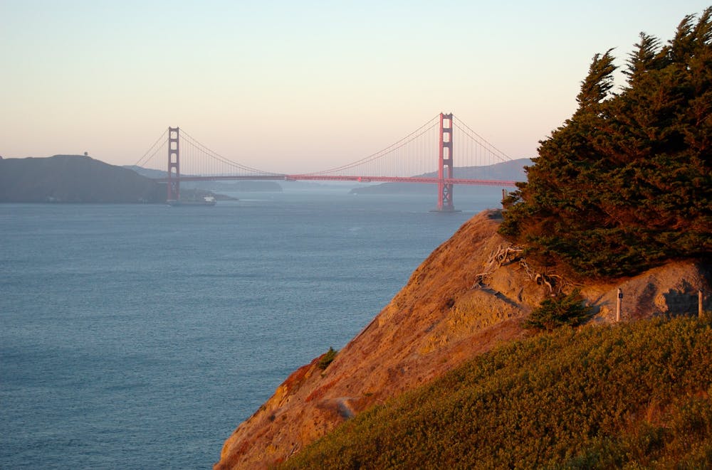
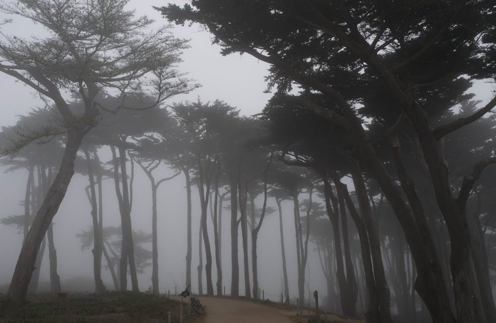
Next, continue along the wide and mostly flat path that meanders along Lands End. You’ll find clifftop ocean views, shady groves of Monterey cypress, and a few historical monuments. Then there’s the Golden Gate Bridge, of course, which you can see from several points along the trail. The mapped route is an out and back, turning around at a particularly good overlook near the Sea Cliff neighborhood. You can alternatively make a loop or other variations with connecting trails or city streets.
Sources: https://www.nps.gov/goga/planyourvisit/landsend.htm
Moderate

The path is on completely flat land and potential injury is limited to falling over.
Close to help in case of emergency.
7 routes · Hiking · Road Biking · Trail Running
5 routes · Trail Running