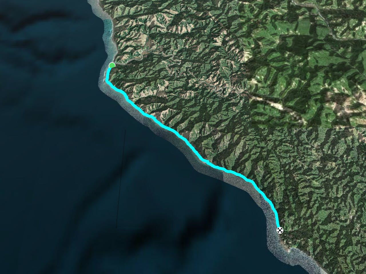
Lost Coast Trail
A rare coastal wilderness route along the most isolated section of the California coastline.
Trail Running Difficult
- Distance
- 41 km
- Ascent
- 405 m
- Descent
- 381 m
- Duration
- 5-6 hrs
- Low Point
- 0 m
- High Point
- 38 m
- Gradient
- 4˚
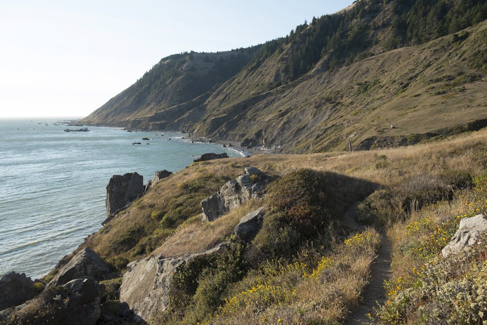
The Lost Coast Trail is a truly epic adventure that should be on any avid backpacker's shortlist. This route offers "one of the few coastal wilderness hiking experiences in the United States," according to the BLM. "Hikers will be treated to exceptional wildlife viewing opportunities such as sea lions, elephant seals, river otters, eagles, bobcats, deer, and more. Tidepools, teaming with life, line the coast. In spring, spectacular arrays of wildflowers cover the hillsides and bluffs," they continue.
- •
- •
- •
- •
Description
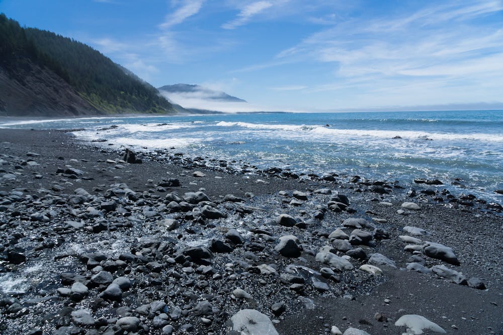
To understand what's so special about this route, you need to understand a little about what the greater Lost Coast region is. This area, which includes the formidable King Range, is so steep and rugged that it was too costly for engineers to build a coastal highway. As a result, it is "the most undeveloped and remote portion of the California coast," according to Wikipedia. While there are a few small communities on the coast here, accessing these towns by road is an arduous endeavor, leaving them almost completely isolated from the rest of California.
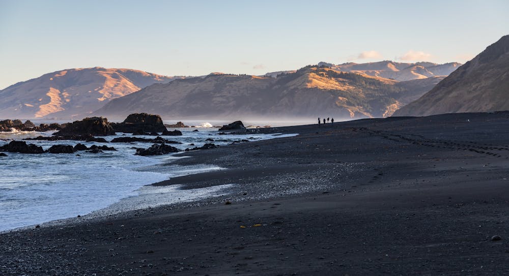
While the stats for this 25-mile route don't look that intimidating on paper, be warned that the hiking (or running, if you choose to move at a higher rate of speed) is arduous and can be very slow. Most of this route is beach walking on soft sand and loose pebbles, which will slow your pace and make for a much more difficult hike. When you do leave the beach, it's only to skirt around inlets or extremely rough sections of shoreline, and these jaunts inevitably lead you steeply up a hillside before depositing you back on the beach. They do nothing to help you increase your hiking speed and, indeed, will even slow you down more.
Most backpackers budget at least three days to complete this backcountry route. Since most of the route passes through the King Range Wilderness, you'll need to obtain a permit in advance to camp in the wilderness. Also, note that there is no camping at the Black Sands Beach Trailhead.
This unique route hides many other challenges that you need to consider. I'll quote directly from the BLM to avoid missing anything important:
"Stream crossings may be impassable during/after heavy winter rains (no bridges). The area near Punta Gorda; from Sea Lion Gulch to Randall Creek; and from Miller Flat to Gitchell Creek, may be impassable during high tide. Carry a tide table and hike these stretches during an outgoing tide of three feet or less to avoid being trapped. Always be aware of the ocean. Large sets of waves can occur at any time, sweeping unsuspecting hikers into the ocean. Large waves and/or high winds will amplify the effects of tides, causing areas normally passable at a particular tide to become impassable."
Also, many other sources note that rattlesnakes are prevalent along this route. Exercise extreme caution, especially around driftwood and other spots where snakes might be hiding or have made a den. While some backpackers might be tempted to sleep outside on the beach during periods of warm weather, some sources are adamant about setting up a tent every night with a zippered door for rattlesnake safety. Your mileage may vary, but in such a remote area, you do not want to risk a bite.
Sources: BLM.gov KRCRTV.com LostCoastOutpost.com Wikipedia.org
Difficulty
Difficult
Low Exposure

The path is on completely flat land and potential injury is limited to falling over.
Remoteness

In the high mountains or remote conditions, all individuals must be completely autonomous in every situation.