1 m away
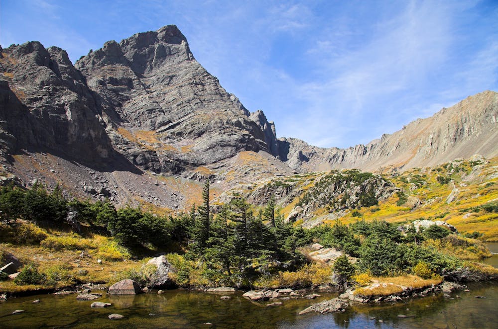
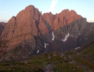
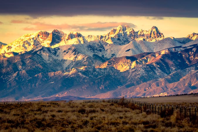
Crestone Peak
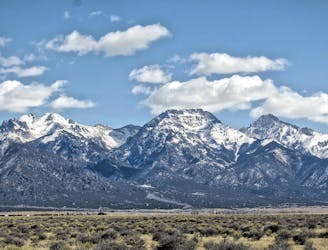
Climb one of the most beautiful and most challenging of Colorado's 14ers
Moderate Alpine Climbing
- Distance
- 17 km
- Ascent
- 1.8 km
- Descent
- 1.8 km
One of the most aesthetic and challenging Colorado 14ers.
Alpine Climbing Moderate

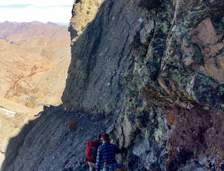
While Crestone Needle and Crestone Peak are renowned as two of the most beautiful, most formidable, and most technical 14ers in Colorado, if you stick to the standard routes, you can tackle each peak individually with a Class 3 climb. "Among the last of the fourteeners to be scaled. . .this remote and rugged mountain was once thought impossible to climb," writes Matt Lemke on SummitPost.org.
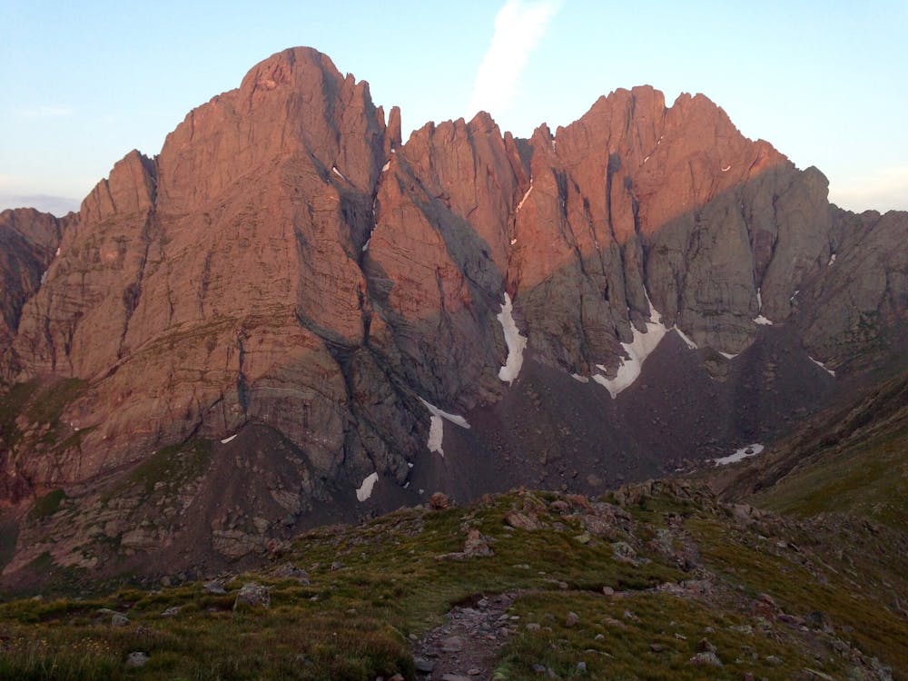
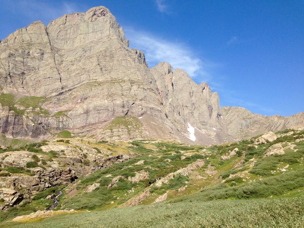
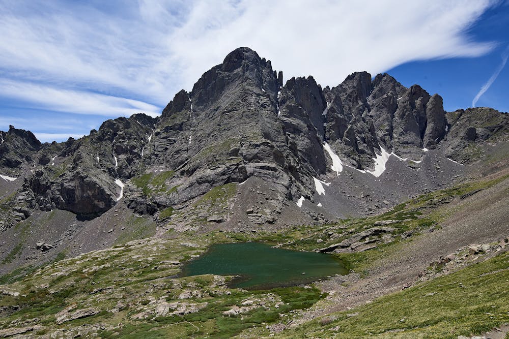

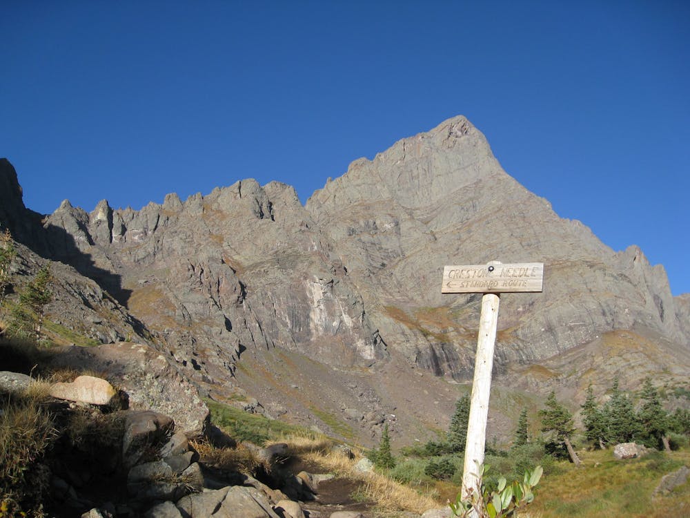
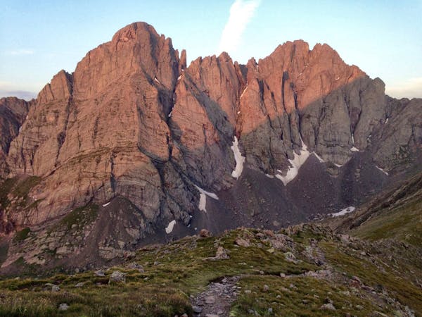
To begin the standard route up the south face, begin by following the gated 4x4 road to the approach trail. After hopping on the singletrack trail, you'll gain a low pass and face your main ascent.
The main objective is to "traverse into a large gully, climb a few hundred feet, cross west over a rib, and ascend a second gully to the summit ridge," according to 14ers.com. If you follow this crossover route, you'll be able to stick to solely Class 3 terrain. Following this route requires very careful route-finding, provided by either astute awareness of the mountains around you, climbing with someone who's completed the route before, or following careful turn-by-turn directions, linked above on 14ers.com. The route mapped here in FATMAP should be very, very close to the intended route, but be sure to remain situationally aware while on the mountain.
One route variation climbs straight up the east gully to the summit, instead of switching over to the west gully. While it's a more direct climb than the crossover route, this variation is more difficult and more technical, resulting in Class 4 scrambling. This would effectively bump the FATMAP rating up from "moderate" to "difficult."
Sources: https://www.summitpost.org/crestone-peak/150435 https://www.summitpost.org/crestone-needle/150434 https://www.14ers.com/route.php?route=cnee1&peak=The+Crestones+and+Humboldt+Peak
Moderate
May involve slightly more complex glacier hikes, easy but possibly long rock ridges and steep snow up to 45 degrees. Equivalent to PD, PD+

The majority of the route is "no fall" terrain.
In the high mountains or remote conditions, all individuals must be completely autonomous in every situation.
1 m away
Climb one of the most beautiful and most challenging of Colorado's 14ers
Moderate Alpine Climbing
1 m away
The highly-technical 5th Class traverse route/combo of Crestone Peak and Crestone Needle.
Severe Alpine Climbing
6.3 km away
Standard route up the Challenger Point and Kit Carson 14ers outside of Crestone, CO.
Moderate Alpine Climbing
10 routes · Alpine Climbing · Hiking

46 routes · Alpine Climbing · Hiking
4 routes · Alpine Climbing