Quandary Peak
Salida
Rugged ridgeline hike to the top of one of Colorado's more accessible 14ers.
Alpine Climbing Easy
- Distance
- 11 km
- Ascent
- 1 km
- Descent
- 1 km
- Low Point
- 3.3 km
- High Point
- 4.3 km
- Gradient
- 20˚

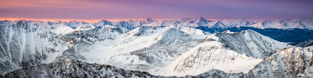
Quandary Peak (14,271 ft), just south of Breckenridge, is one of the more accessible 14ers in Colorado. It’s proximity to a road and relatively straightforward hike make it so, but the journey to the summit is not easy. It requires an elevation gain of nearly 3,500 feet in only 3 miles over rugged terrain, and exposure to potentially extreme weather. The challenge is worthwhile to stand on Quandary’s proud summit, and it makes a good introduction to the rigors of peakbagging Colorado’s 14ers. This route can be done at any time of year, but may require specialized gear like crampons and axes in winter.
- •
- •
- •
Description
Begin from the signed trailhead just off FR 851 in White Mountain National Forest. The first mile or so is along an old jeep road through the forest, switchbacking ever higher toward the treeline. The trail is well marked and generally easy to follow. Leaving the trees behind, views open up in all directions and you’ll be staring up Quandary’s barren East Ridge and the trail that climbs it.
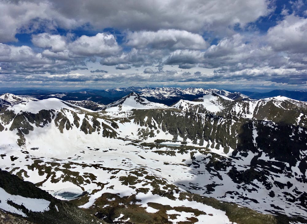
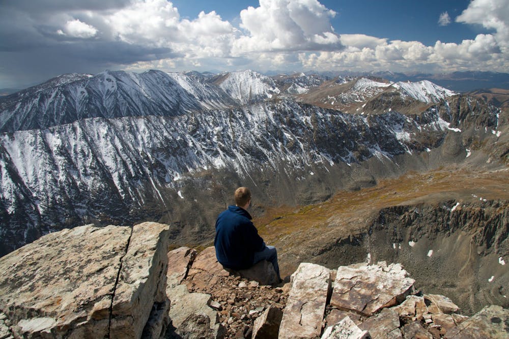
Follow this path, which is fairly obvious most of the way, and marked with cairns in some places. Trend generally upward, sometimes dipping to one side of the ridge and sometimes staying on top, following the path of least resistance. After about 2.3 miles it steepens significantly and you may have to use your hands to negotiate boulders, loose talus, or snow. Along the way keep an eye out for the famous local residents, mountain goats, which are quite common up here. At just over three miles from the start comes the summit, and huge views over surrounding mountains and ranges. Enjoy your time on top, then descend the way you came. As with other mountains in Colorado, hiking Quandary Peak makes you vulnerable to monsoon storms and lightning. These build almost every afternoon in summer, so start the hike early in order to get back below treeline by noon.
Sources: https://www.outdoorproject.com/adventures/colorado/hikes/quandary-peak-hike-east-ridge https://www.fs.usda.gov/recarea/whiteriver/recreation/bicycling/recarea/?recid=40645&actid=91
Difficulty
Easy
The ascent involves simple glacier hiking and/or short, straightforward rock scrambles. Equivalent to Alpine F, F+
High Exposure

Much of the route is difficult to protect and a fall could be disastrous at certain points.
Remoteness
Little chance of being seen or helped in case of an accident.