3.2 km away
Red Cone and Webster Pass
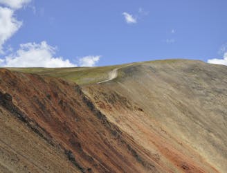
If you're looking for a challenge, this route offers an ultra-technical high alpine pass with extreme exposure.
Difficult Driving ATV
- Distance
- 65 km
- Ascent
- 3.2 km
- Descent
- 3.2 km
A popular OHV-centric trail system that's very accessible from Breckenridge.
Driving ATV Difficult

The Golden Horseshoe Trail System is an OHV-centric trail network that serves as a key hub for all motorized offroad recreation in the area. Most of the trails in this network are 4x4 road width and are technical open to jeeps and other motor vehicles as well.
The 4x4 trails in this network are rated anywhere from difficult to double black diamond/very difficult. While it’s of course much easier to navigate around the challenging areas on an ATV or side-by-side, aggressive riders can choose to challenge themselves on these gnarly roads.
If you want to add on more distance, consider heading up to Red Cone and Webster Pass (mapped separately). If you begin from this trailhead just outside of Breckenridge, you can quickly escape the tourist traps and ride through the High Rockies of Colorado for days on end!
This is a very popular trail system, so ride heads up and expect other trail users.
Difficult

The trail contains some obstacles such as outcroppings and rock which could cause injury.
Away from help but easily accessed.
3.2 km away
If you're looking for a challenge, this route offers an ultra-technical high alpine pass with extreme exposure.
Difficult Driving ATV