731 m away
Sawmill Trees

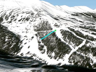
Trees off the Sawmill Cat track
Moderate Freeride Skiing
- Distance
- 150 m
- Ascent
- 0 m
- Descent
- 59 m
Secret Jib Park made entirely out of logs
Freeride Skiing Moderate

This is a popular freeride skiing route which is generally considered to be moderate. It's not remote, it features unknown exposure and is typically done in an unknown time of year. From a low point of 3.1 km to the maximum altitude of 3.1 km, the route covers 456 m, 0 vertical metres of ascent and 80 vertical metres of descent.
This is something that you will never see on a trail map for Breckenridge. For the park rider in mind, find this on the map off the groomers on Peak 9. Follow each feature through the little gully and exit out at the bottom. Have fun and good luck.
Moderate
Slopes become slightly steeper at around 25-30 degrees.

Close to help in case of emergency.
731 m away
Trees off the Sawmill Cat track
Moderate Freeride Skiing
807 m away

Unmarked Tree Run off Briar Rose
Moderate Freeride Skiing
808 m away

The steepest, tightest tree run in Breckenridge
Severe Freeride Skiing
1 km away

Traverse out along a creek
Easy Freeride Skiing
1.1 km away

Short, but fun tree shot down into the cattrack
Difficult Freeride Skiing
1.2 km away

Another way to ski the burn
Difficult Freeride Skiing
1.3 km away

An option off Tiger Run
Difficult Freeride Skiing
1.4 km away

Tight tree stash
Difficult Freeride Skiing
1.4 km away

Secret Tree Stash!
Difficult Freeride Skiing
1.5 km away
Secret Tree Stash in Southern Cross Trees.
Difficult Freeride Skiing