100 m away
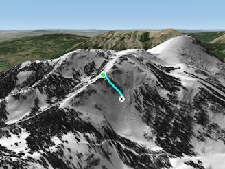
Ghost Rider

Ghost Rider
Difficult Freeride Skiing
- Distance
- 253 m
- Ascent
- 0 m
- Descent
- 95 m
Deep on the skier's right boundary of Teo 2 you'll find Whatever after taking the Teo 2 traverse all the way out.
Freeride Skiing Moderate

This is a popular freeride skiing route which is generally considered to be moderate. It's very remote, it features unknown exposure and is typically done in an unknown time of year. From a low point of 3.5 km to the maximum altitude of 3.5 km, the route covers 165 m, 0 vertical metres of ascent and 42 vertical metres of descent.
If you take the Teo 2 traverse as far as possible you'll end up in Whatever, a semi-flat pitch under rocks along the Teo 2 Traverse. You can find some fun rocks to hop off and traverse around to get on to Ghost Rider and ski to Down and Out to the Teocalli Exit to Paradise.
Moderate
Slopes become slightly steeper at around 25-30 degrees.

Little chance of being seen or helped in case of an accident.
100 m away
Ghost Rider
Difficult Freeride Skiing
175 m away

Marley's Glade
Difficult Freeride Skiing
308 m away

Down and Out is the bottom of Teo 2 as the terrain benches out and you head back up the Teocalli Exit to Paradise.
Moderate Freeride Skiing
325 m away

Outta Sight Outta Mind has some serious pillows and spines through trees from the top of Teo 2.
Severe Freeride Skiing
382 m away

Land of Many Names is a pillow land with all types of 5-25 foot cliffs to bounce between.
Difficult Freeride Skiing
429 m away

Schnoid's are some tight, mellower trees found after Outta Sight Outta Mind on the skier's left hand side of Teo 2.
Moderate Freeride Skiing
609 m away

The Morning Glory Reacharound is a way to get back to Headwall after skiing the top pitch of Morning Glory.
Moderate Freeride Skiing
684 m away
A billy goat line through the middle of the main rock section of headwall.
Severe Freeride Skiing
694 m away

Rabbit Ears is a high, steep pitch into Headwall with many rocks off of the Headwall Ridge Traverse.
Severe Freeride Skiing
759 m away

Headwall East
Difficult Freeride Skiing
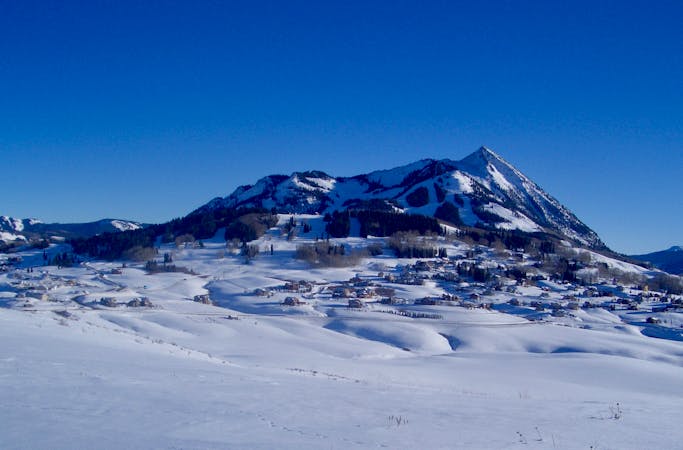
80 routes · Freeride Skiing