Waterton Canyon
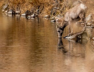
Easy hike or jog beside a swift river in a forested gorge with plentiful wildlife.
Easy Hiking
- Distance
- 20 km
- Ascent
- 219 m
- Descent
- 219 m
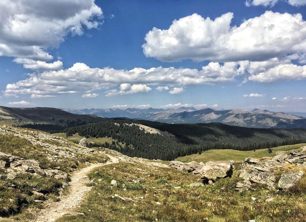
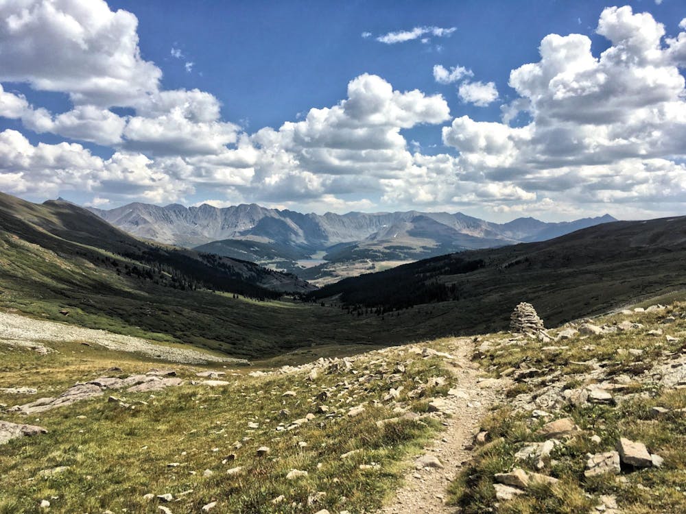
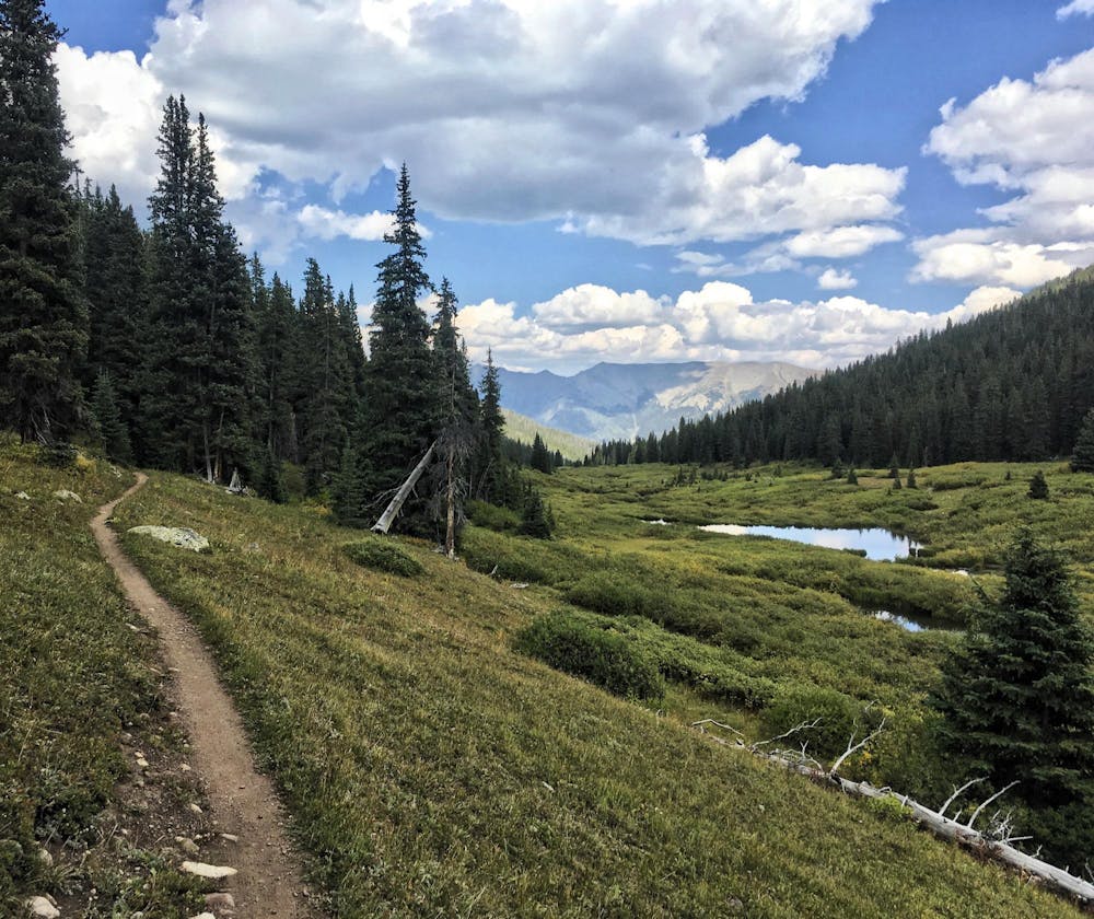
486 miles (782 kilometres) of trekking through some of the finest and wildest scenery in the United States.
Hiking Difficult

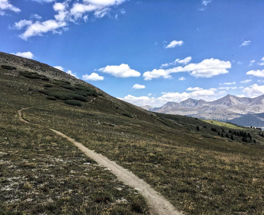
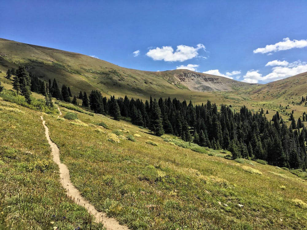
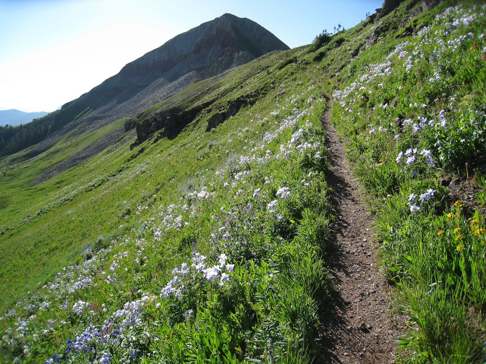
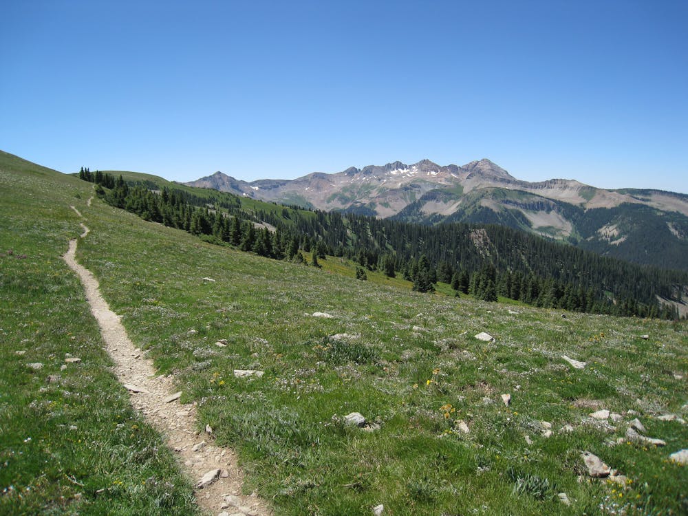
Starting from the mouth of Waterton Canyon (35 miles southwest of downtown Denver) and going through to Durango on the southern border of Colorado, this long and high elevation trail is an unforgettable adventure. Its highest point is 13,271 feet (4,045 m) above sea level, and most of the trail is above 10,000 feet (3,000 metres) but despite this, the trail often drops into forests and valleys, giving you a break from inhospitable high mountain terrain. The trail is for non-motorised transport only and passes through eight mountain ranges, six National Forests, and six wilderness areas; it is wonderfully peaceful. Its lowest point is in Denver at 5,500 feet (1,700 metres) and it reaches 13,271 feet (4,045 metres) in the San Juan Mountains. In between is everything from quiet forests and valleys to high mountain passes and old Indian settlements. The trail dips in and out of civilisation so it is logistically easy to manage but it does frequently require long sections of wild camping; the second half of trail is especially wild as it passes through and around the peaks of the San Juan Mountains. Whether you do it in a "oner" or break it up, you will climb and descend 89,000 feet (27100 metres) on this trail and see some of the finest parts of North America.
Difficult
Hiking trails where obstacles such as rocks or roots are prevalent. Some obstacles can require care to step over or around. At times, the trail can be worn and eroded. The grade of the trail is generally quite steep, and can often lead to strenuous hiking.
Easy hike or jog beside a swift river in a forested gorge with plentiful wildlife.
Easy Hiking
7.7 km away
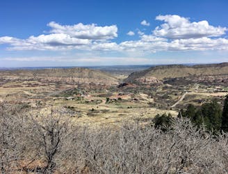
Scenic jaunt to a Denver area summit, mostly on hiker-only trails.
Moderate Hiking
9.8 km away

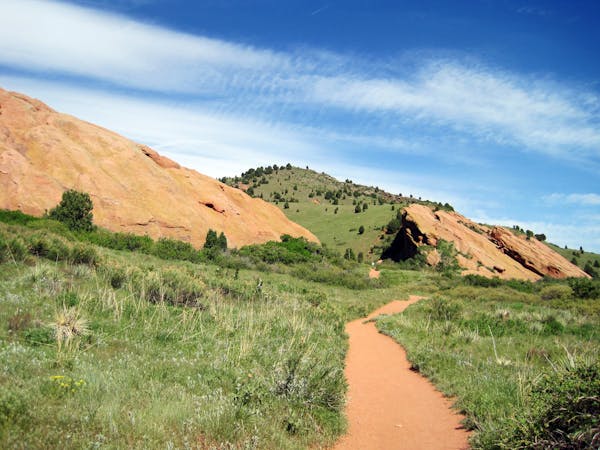
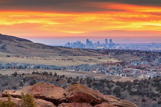
Relaxed stroll among enchanting rock formations in rolling meadows.
Easy Hiking
6 routes · Hiking
8 routes · Mountain Biking · Hiking
25 routes · Hiking