934 m away
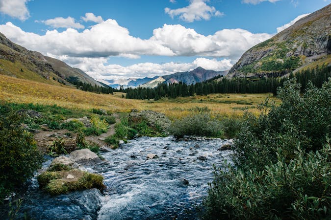
Mosca Pass Trail
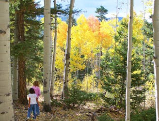
Quiet hike through montane forest and meadows, along a trickling creek.
Moderate Hiking
- Distance
- 10 km
- Ascent
- 450 m
- Descent
- 450 m
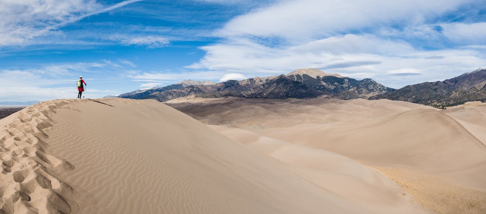
An epic trek to the summit of two of North America's tallest sand dunes in Great Sand Dunes National Park
Hiking Moderate

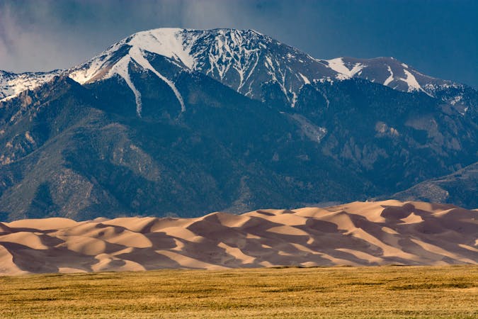
Great Sand Dunes National Park and Preserve is famous for having the tallest dunes in North America, in a dunefield spanning 30 square miles. There are no trails in the dunefield-proper, meaning that hikers can go anywhere they desire. The wind erases the tracks every night.
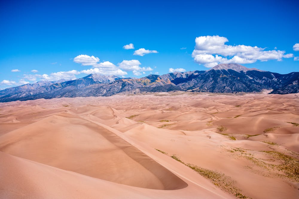
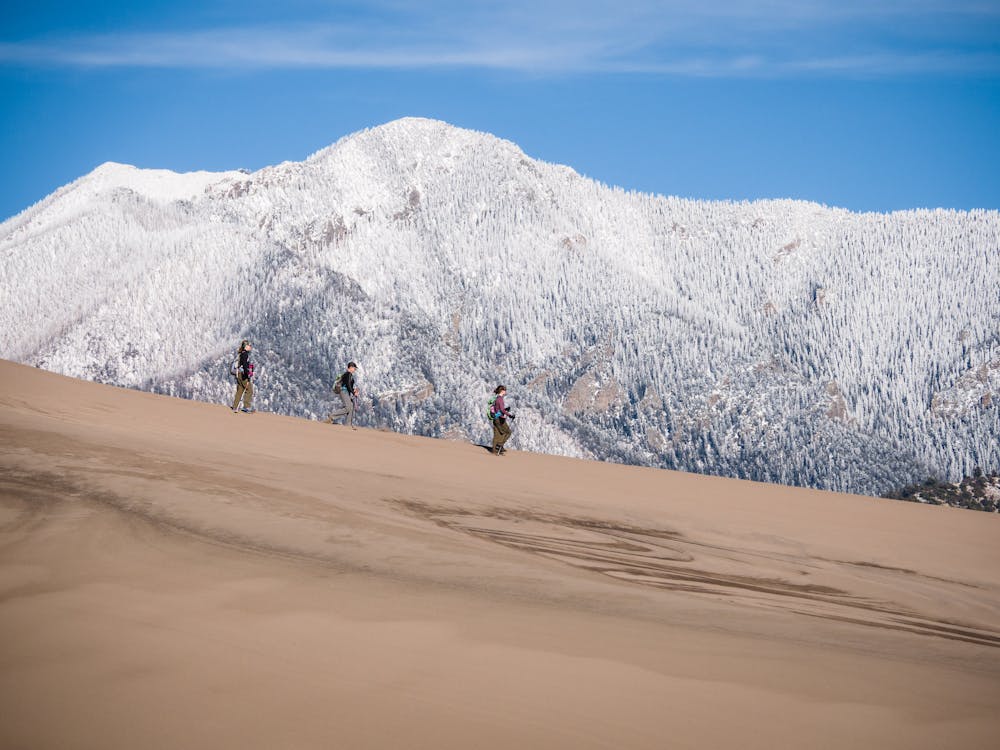
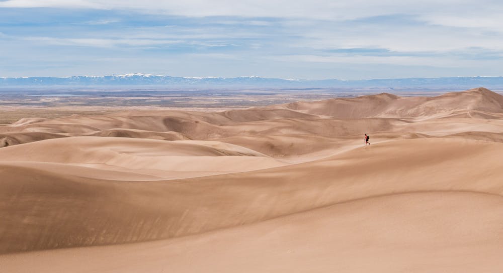
That same wind can make travel in the dunes quite a challenge; expect to find sand everywhere, including your ears, for days afterward. The best season to explore the dunes is fall or spring, when the sand does not reach typical summer temps of 150 degrees F.
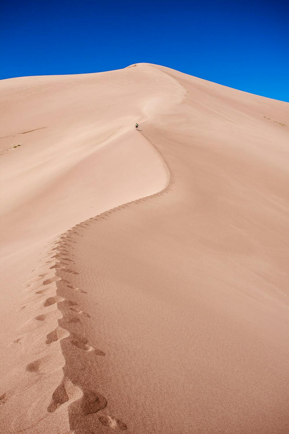
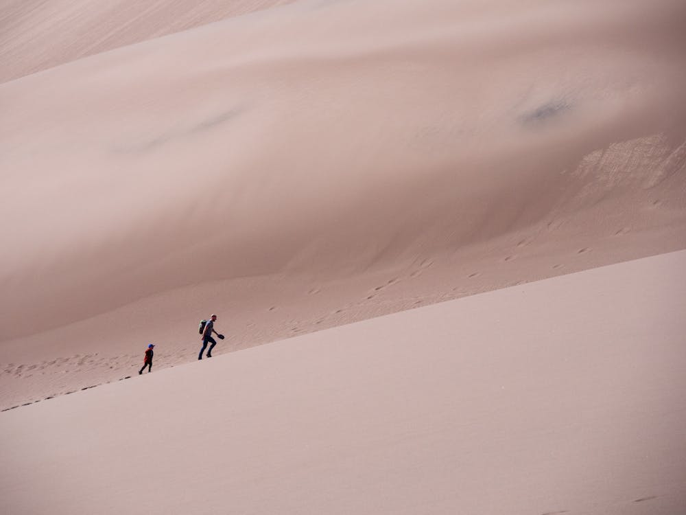
For any dunes hike, it is vital to take plenty of water. The relentless sun, wind, and lack of water sources make this a necessity. Sunglasses, closed toe shoes, and a hat should be worn. Another piece of invaluable equipment is trekking poles equipped with snow baskets, which make the steep climbs much easier.
The most popular dune-destination is High Dune, which, in itself, is a 3-mile roundtrip hike. It is on the first ridge, seen from the Castle Creek Picnic Area, and can be reached by most people with little route finding required. Leave the parking lot, wade through the shallow-flowing Medano Creek and across a broad flat expanse of sand, then pick a route up the dunes to the summit of High Dune. This is a choose-your-own-adventure hike, so get creative and have fun!
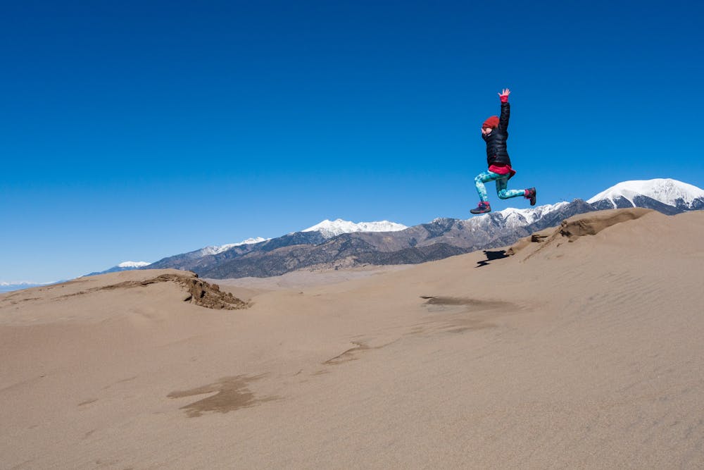
From the 8,691' summit, gaze at Mt. Herard, then turn to view the San Luis Valley, then pick out all the tiny little ant-sized people swarming on the dunes down below. Finally, find Star Dune way off in the distance and decide whether to continue on to ascend Star Dune. Once leaving the popular High Dune, the trek to Star Dune will be long, hot, and solitary. The total mileage for the High and Star Dune route is over 8 miles and will take at least 5 hours!
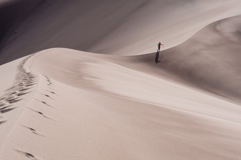
Star Dune is so-named because it IS a "star dune," which means that it has 3 or more slipfaces, or sides, and resembles a star when viewed from above. If continuing on, pick a route and start the many ups and downs of traversing the dunefield.
Once to the base of Star Dune, you are faced with ascending 750 feet up the very steep face of Star Dune. It is so steep that every footstep sets off a mini-avalanche on each side of the ridge. At the 8,617' summit of the tallest dune in North America, survey the expansive scene, then pick a route and run, slide, or skid down the sand, finding the shortest route back to the parking lot.
This is a big hike in big territory and it will be hot and exhausting. It will also be an adventure you'll never forget!
Moderate
Hiking along trails with some uneven terrain and small hills. Small rocks and roots may be present.

The path is on completely flat land and potential injury is limited to falling over.

Little chance of being seen or helped in case of an accident.
934 m away
Quiet hike through montane forest and meadows, along a trickling creek.
Moderate Hiking
1.5 km away

A short hike in the foothills, with a different perspective on the dunes.
Moderate Hiking
5 routes · Alpine Climbing · Hiking
7 routes · Alpine Climbing · Hiking

63 routes · Alpine Climbing · Hiking