North Cone
Winter Park
Winter Park Ski Area
Hike to the highest point of Winter Park Ski Resort.
Hiking Difficult
- Distance
- 12 km
- Ascent
- 490 m
- Descent
- 490 m
- Duration
- 3-4 hrs
- Low Point
- 3.2 km
- High Point
- 3.7 km
- Gradient
- 10˚

North Cone rises to 12,060 feet above sea level and marks the highest point in Winter Park Ski Resort. Since Winter Park operates via a lease with the US Forest Service, there's no reason you can't choose to hike to the top of North Cone for a spectacular mid-summer adventure!
- •
- •
- •
- •
Description
The route shown here begins from the top of the Winter Park Gondola, which does require a lift ticket to access. From the top of the Gondola, it will still take you 7.6 miles round-trip and 1,600 feet of climbing and descending to reach the summit—still a worthy hike.
The hike begins by following the Lower Roof of the Rockies trail before connecting to Upper Roof of the Rockies. While these trails are open to mountain bikes, there's generally very little bike traffic, as most of the bikers stick to the downhill MTB trails. But as you're looking for the beginning of the trail, make sure you only hike on the trails noted here—hiking on downhill mountain bike trails is not allowed.
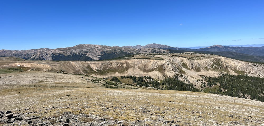
As you wind through the forest, you'll be able to admire the towering timber and the lush undergrowth in the mid elevations of the mountains. The hike steepens when it reaches Upper Roof of the Rockies, but is still quite manageable.
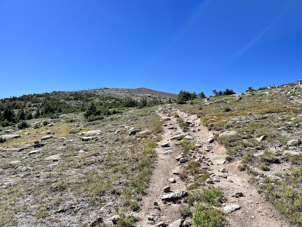
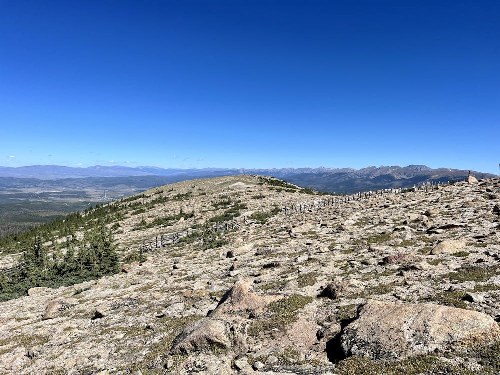
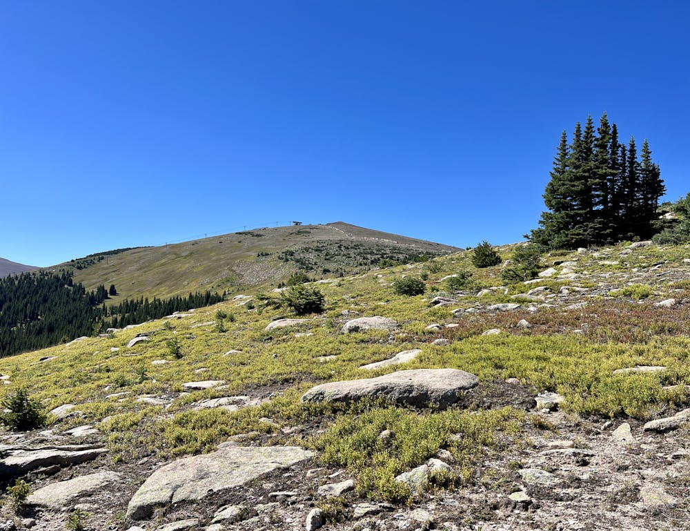
As you reach the end of the Upper Roof of the Rockies Trail, you'll take a right turn onto a rough doubletrack road that's mainly used by side-by-sides to do lift maintenance. As you begin up this rough track, you'll quickly leave the trees behind and begin enjoying stunning high-alpine views from the alpine tundra.
The road continues to climb, but near a snow fence, the path gets less defined. Be sure to download this route in FATMAP for offline navigation.
The final pitch to the summit of North Cone alternates between rough doubletrack and no trail at all, although the summit of North Cone is very obvious. Either follow the route shown here or simply make for the summit via a direct route.
Once on top, be sure to pause and savor the incredible vista! The staggering beauty of the Rocky Mountains surrounds you, and in mid-summer, you'll likely have this spot all to yourself.
Difficulty
Difficult
Hiking trails where obstacles such as rocks or roots are prevalent. Some obstacles can require care to step over or around. At times, the trail can be worn and eroded. The grade of the trail is generally quite steep, and can often lead to strenuous hiking.
Low Exposure

The path is on completely flat land and potential injury is limited to falling over.
Remoteness

Away from help but easily accessed.
Best time to visit
Features
- Alpine
- Picturesque
- Summit Hike