249 m away
Cherry Creek Trail: Confluence Park to Cherry Creek State Park
Creekside greenway through downtown Denver with shopping, dining, and cultural attractions along the way.
Easy Hiking
- Distance
- 23 km
- Ascent
- 200 m
- Descent
- 60 m
A beautiful walk in the heart of the city.
Hiking Easy

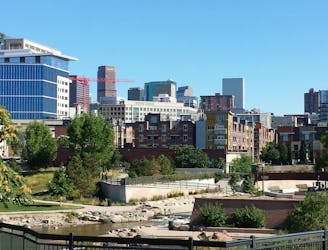
The Platte River Trail runs through the heart of downtown Denver, following the South Platte River. In this dense urban area, the paved path runs along both sides of the river, allowing you to create a beautiful loop connecting a series of idyllic parks right in the heart of the city.
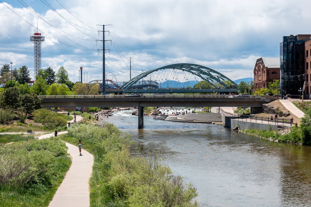
The route shown here begins from a large parking lot off Water Street, separated a bit from downtown. However, you can access this loop from a multitude of locations. You can also choose to extend it om either the north or south end, as the full greenway actually runs for 48 miles through the Denver Metro Area. You can also connect to the Cherry Creek greenway trail, which begins at a junction with the Platte River Trail and heads southeast through the city.
Thanks to the paved and well-maintained trail surface, this is an easy walk that's perfect for the entire family. It's also ADA accessible. The trail is also used by a bevy of other trail users, ranging from road cyclists (both recreational cyclists and commuters) to walkers/hikers, runners, skaters, and more.
Historically, the South Platte River corridor was an extremely polluted riverway running through the heart of the city. The current greenway corridor is notable for its tremendous transformation from a neglected and polluted area into a beautiful natural resource and a fantastic recreational trail. The rehabilitation efforts began in 1974, and the trail was named a National Recreation Trail just four years later in 1978. Today, it's even better than ever and is one of the most popular recreational and human-powered transportation corridors in the city.
Sources: https://www.uncovercolorado.com/hiking/platte-river-greenway-trail/ https://www.codot.gov/travel/colorado-byways/northeast/so-platte-trail https://trails.colorado.gov/trails/south-platte-river-5149 https://www.traillink.com/trail/platte-river-trail-(co)/ https://www.colorado.com/articles/south-platte-river-trail
Easy
Walking along a well-kept trail that’s mostly flat. No obstacles are present.

The path is on completely flat land and potential injury is limited to falling over.
Close to help in case of emergency.
249 m away
Creekside greenway through downtown Denver with shopping, dining, and cultural attractions along the way.
Easy Hiking
13 routes · Hiking