1 m away
Petroglyph Point Loop
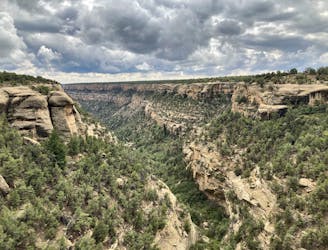
A respectable hike with stunning history—arguably the best hike in Mesa Verde National Park.
Difficult Hiking
- Distance
- 4.7 km
- Ascent
- 174 m
- Descent
- 174 m
Hike through the bottom of a gorgeous, spruce-filled canyon.
Hiking Moderate

The Spruce Canyon hike begins at the same parking lot as Petroglyph Point but runs through the bottom of a different canyon for most of its length. You could, in theory, combine both of these trails together for a longer hike through two different, beautiful canyon bottoms.
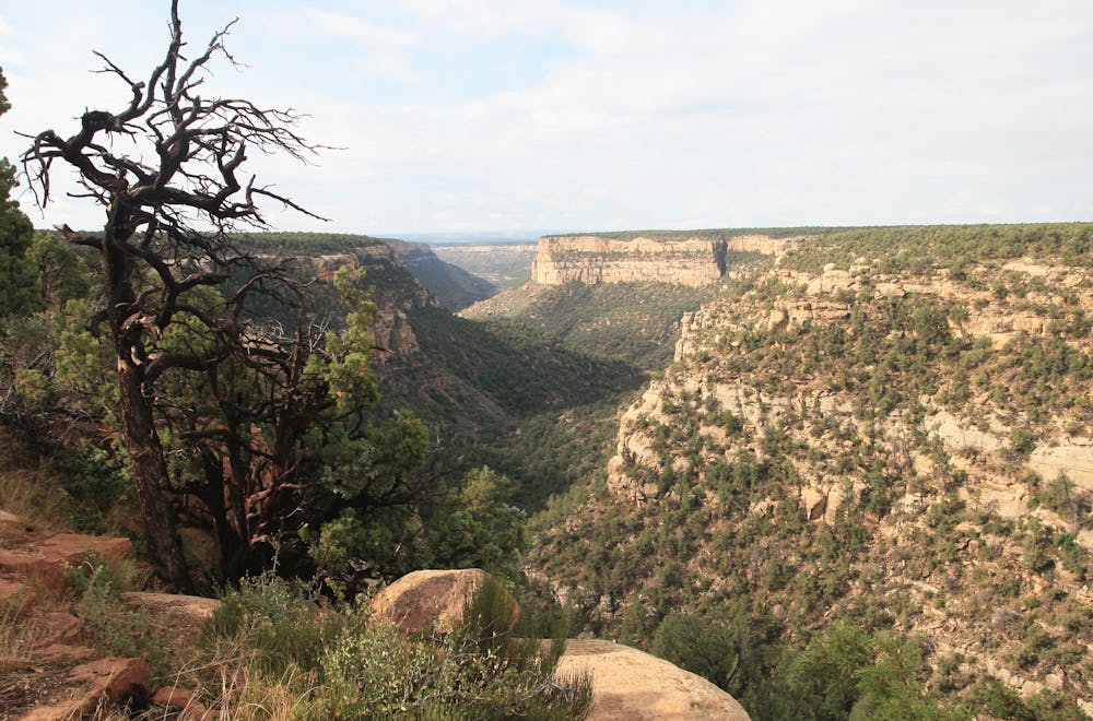
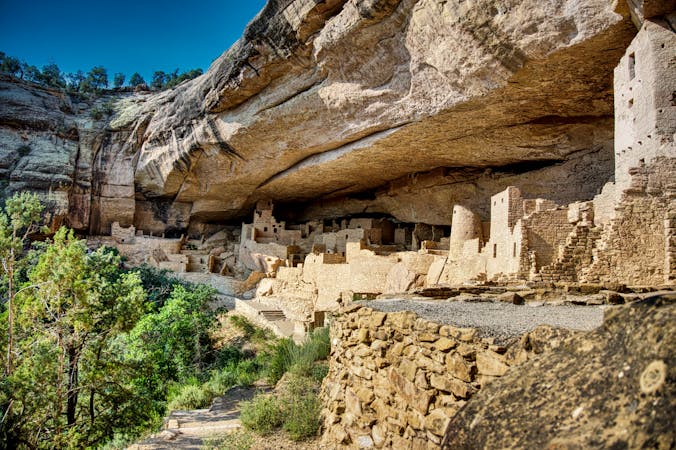
While this hike might only be 2.2 miles long, the sections dropping down into the canyon and climbing back out can be physically demanding. But that work is "all worth it," according to Samantha Ripley on UncoverColorado.com. On this hike, you'll "be enclosed in a canopy of big spruce, juniper, and oak leaves while the birds and insects twitter around you," she continues. While there aren't any cliff dwellings in the heart of Spruce Canyon, near the museum, you'll get to glimpse the Spruce House—the same cliff dwellings visible from the Petroglyph Point Loop.
In order to access the loop, you'll have to register at the trailhead or museum and pass through a gate to reach the trail. NPS.gov says that you should "contact a ranger for times the gate above the trailhead is open." During the winter, portions of this hike often close due to ice and snow.
Moderate
Hiking along trails with some uneven terrain and small hills. Small rocks and roots may be present.

The trail contains some obstacles such as outcroppings and rock which could cause injury.
Away from help but easily accessed.
1 m away
A respectable hike with stunning history—arguably the best hike in Mesa Verde National Park.
Difficult Hiking
2.3 km away
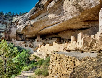
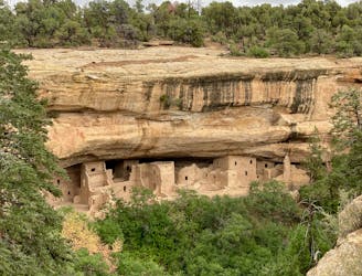
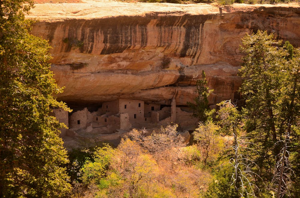
One of the most elaborate cliff dwellings.
Easy Hiking
2.5 km away
Gain stunning views of Soda Canyon on this short hike.
Easy Hiking
6 routes · Hiking

63 routes · Alpine Climbing · Hiking