7.3 km away
Tunnel Drive Trail
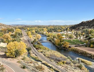
An easy but beautiful hike into the Royal Gorge.
Easy Hiking
- Distance
- 6.3 km
- Ascent
- 123 m
- Descent
- 123 m
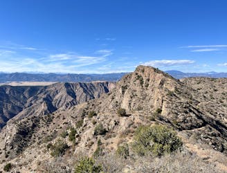
One of the closest peaks to Canon City.
Hiking Difficult

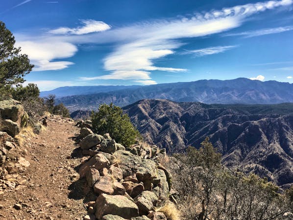
Tanner Peak rises outside the town of Canon City to a height of 9,340 feet above sea level. This is one of the most prominent close-to-town peaks and is easily accessible from multiple aspects. The route shown here is one of the most popular, beginning at a convenient trailhead on County Road 143.
From the craggy summit of the mountain, you'll enjoy spectacular views of Pikes Peak to the north and the Sange de Cristo range forming the western horizon.
While this arid peak makes for an attractive hiking or running objective, don't expect a pristine singletrack adventure. Rather, this entire trail is ATV legal and sees substantial traffic, especially on weekends during peak season.
Difficult
Hiking trails where obstacles such as rocks or roots are prevalent. Some obstacles can require care to step over or around. At times, the trail can be worn and eroded. The grade of the trail is generally quite steep, and can often lead to strenuous hiking.

The path is on completely flat land and potential injury is limited to falling over.

Away from help but easily accessed.
7.3 km away
An easy but beautiful hike into the Royal Gorge.
Easy Hiking
7.3 km away
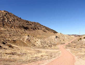
Fremont Peak: the hard way.
Difficult Hiking
8.4 km away
An easy but scenic hike through the lower Hogbacks area.
Easy Hiking
9 routes · Hiking