5.5 km away
Mary's -> Wrangler's Loop
A gorgeous loop above the Colorado River with relatively little climbing.
Moderate Hiking
- Distance
- 17 km
- Ascent
- 307 m
- Descent
- 307 m
A perfect desert loop with fantastic views from the ridge top.
Hiking Difficult

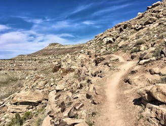
While most people choose to park at the primary trailhead off the Loma exit, parking off the Mack exit provides access to an incredible set of lesser-traveled trails in the Kokopelli Loops Trail System. Despite being lesser-traveled, one of the newest trails in the network—the Hawkeye Trail—forms the final descent of this loop and is now one of the highest-quality singletrack trails in the region.
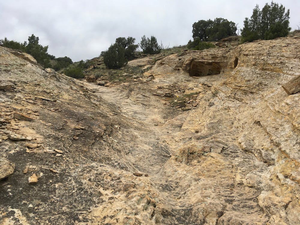
The route as it is mapped here begins by climbing up the Troy Built trail. Make no bones about it: Troy Built is a strenuous climb up the mountainside. For an easier ascent and a steeper descent, reverse this route by climbing Hawkeye and descending Troy Built. Pick your poison: this loop is great in either direction.
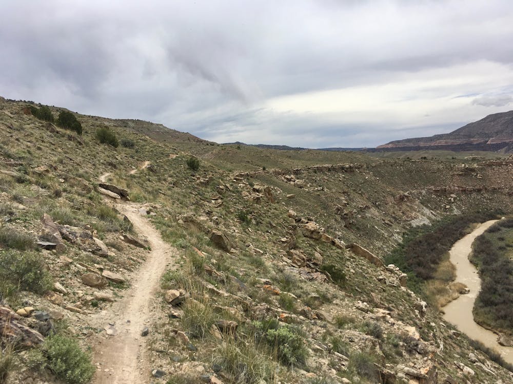
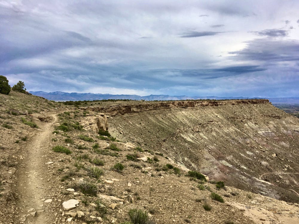
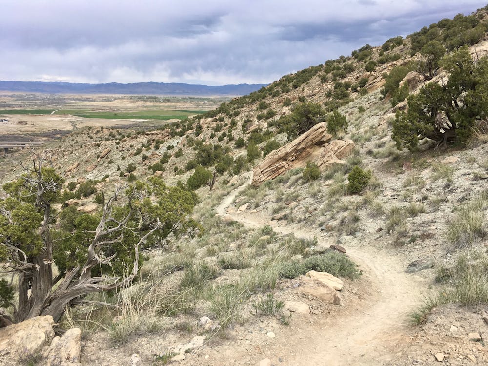
After reaching the Mack Ridge trail, the singletrack continues to climb before plateauing on top of the ridge. Here, you’ll enjoy fantastic views of Colorado National Monument, the Colorado River, and the Book Cliffs. The views from the top of the ridge are simply fantastic, and should be savored!
After hiking along Mack Ridge, enraptured by the phenomenal views, you’ll reach the descent down Hawkeye.
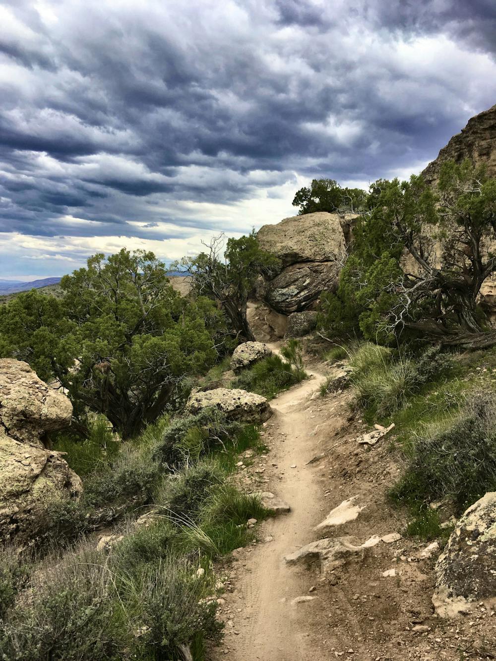
The singletrack descent features a trail tread that’s not too steep. The trail makes maximum use of the hillside, working back and forth and turning what would otherwise be a steep plummet into an extended, enjoyable descent. For hikers who don’t like descending extremely steep singletrack, Hawkeye will be a welcome relief.
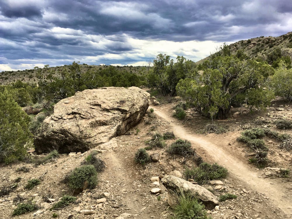
The Hawkeye Trail runs through a variety of intriguing rock features—through clefts in the rock, over boulders, and around photo-worthy formations. The trail is interesting and entertaining, but never overly technical or difficult.
The descent down Hawkeye is over all too quickly. This loop will leave you wanting more!
Difficult
Hiking trails where obstacles such as rocks or roots are prevalent. Some obstacles can require care to step over or around. At times, the trail can be worn and eroded. The grade of the trail is generally quite steep, and can often lead to strenuous hiking.

Some trail sections have exposed ledges or steep ascents/descents where falling could cause serious injury.

Away from help but easily accessed.
5.5 km away
A gorgeous loop above the Colorado River with relatively little climbing.
Moderate Hiking
10 routes · Hiking