Bear Creek Falls
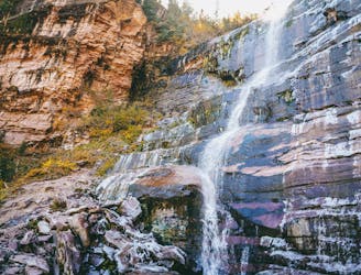
Hike to a stunning 80-foot cascade direction from downtown Telluride.
Difficult Hiking
- Distance
- 7.1 km
- Ascent
- 323 m
- Descent
- 323 m
Hike to the sky-scraping 13,061-foot pass on the Wasatch Trail.
Hiking Severe

The Wasatch Trail is one of the most iconic trails in Telluride. It is a bona fide bucket list objective for Colorado hikers, but this trail is no joke: it requires about 4,500 feet of elevation gain in 12 miles, reaching a summit elevation of 13,061 feet.
To access this trail, the hike shown here starts from downtown Telluride on the Bear Creek Falls trail. The towering 80-foot Bear Creek Falls is itself an iconic destination, and this route includes a side trip to the falls.
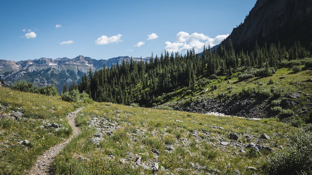
The trail winds up a narrow mountain valley, with beautiful views of aspen trees and the peaks high above. As you approach the falls, the trail becomes steeper, narrower, and more challenging. You will pass the junction with the Wasatch Trail, which you will follow later. You will soon reach a large boulder that marks the end of the trail and the beginning of the falls.
Bear Creek Falls is a stunning sight to behold. The water plunges down from a high cliff into a pool below, creating a misty spray and a rainbow on sunny days. You can climb up the boulder to get a closer view of the falls, or find a spot on the rocks or grass to relax and enjoy the scenery.
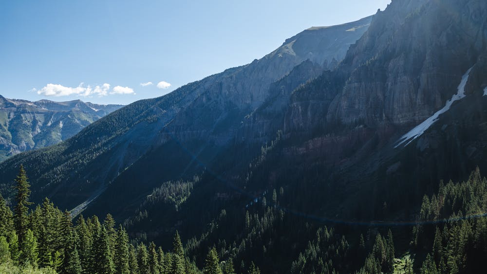
However, don’t relax too long, because this hike is just beginning! The ascent up the Wasatch Trail is long, technical in places, and physically demanding—but the views are spectacularly beautiful! The trail climbs high into the alpine, eventually reaching the Wasatch Trail’s high point at 13,061 feet.
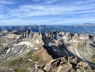
Here you’ll enjoy staggering high-alpine scenery, with the jaw-dropping San Juan mountains all around you. Keep your eyes peeled for alpine wildlife, like marmots. Once done enjoying the high alpine terrain, turn around and get ready for the descent!
The descent off the top of the pass consists of narrow singletrack traversing exposed high-alpine terrain. You will have to navigate tight switchbacks, loose rocks, and exposed ledges on your way down to the Bear Creek drainage. Some sections of trail are quite exposed, with consequential fall danger.
The descent shown here follows the East Fork Bear Creek trail, which is a bit more difficult than the classic Wasatch Trail. You can opt to head further west to bypass this section if you prefer.
The trail will eventually smooth out and follow the fast, flowy singletrack along the creek. This will take you all the way back to the trailhead where you started.
Severe
Hiking challenging trails where simple scrambling, with the occasional use of the hands, is a distinct possibility. The trails are often filled with all manner of obstacles both small and large, and the hills are very steep. Obstacles and challenges are often unexpected and can be unpredictable.

The trail contains some obstacles such as outcroppings and rock which could cause injury.

Little chance of being seen or helped in case of an accident.
Hike to a stunning 80-foot cascade direction from downtown Telluride.
Difficult Hiking
6.4 km away
Climb the Queen of the San Juans, "Colorado's most beautiful mountain."
Extreme Hiking
6.9 km away
Climb the Queen of the San Juans, "Colorado's most beautiful mountain."
Extreme Hiking