
26 routes · Mountain Biking
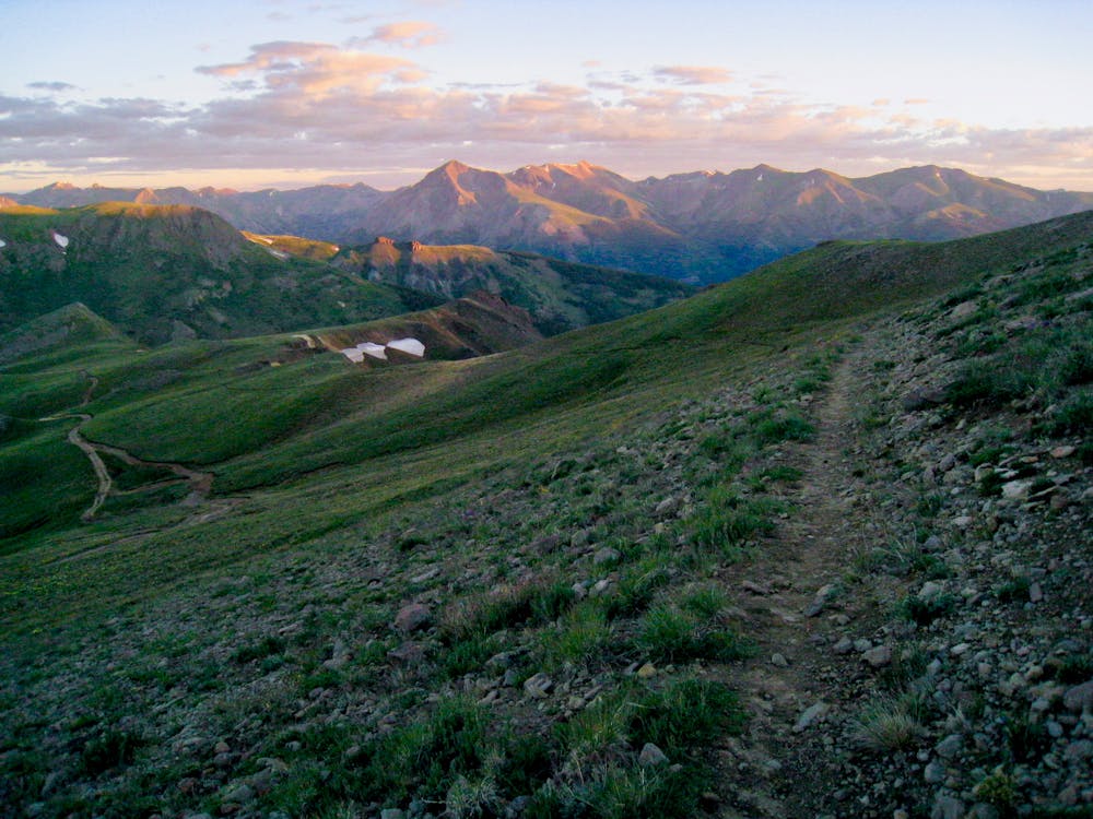
The highest segment of the Colorado Trail, topping out at 13,271 feet, is breathtakingly beautiful!
Mountain Biking Severe

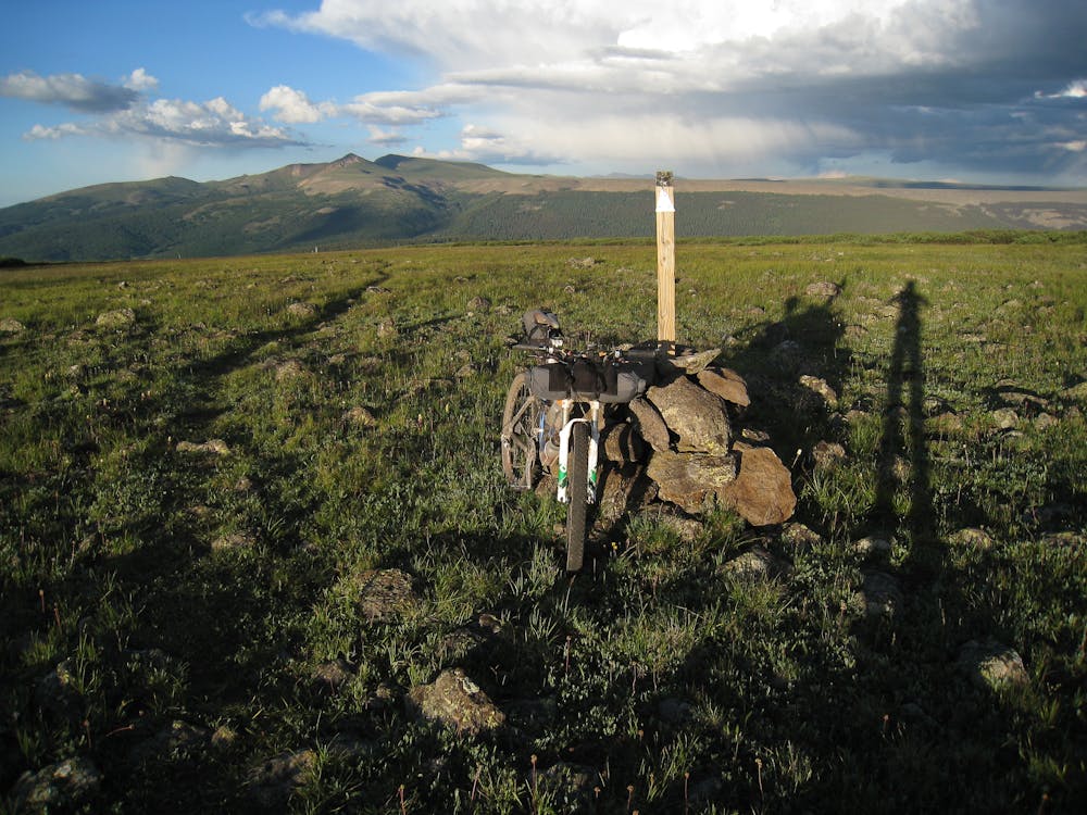
The Colorado Trail (COT) is widely regarded as one of the very best long distance mountain bike trails in the world. Running for 535 miles between Denver and Durango, the trail crosses high alpine mountain passes and drops into beautiful valleys as it traverses the most beautiful portions of the state of Colorado. The COT forms one third of the Triple Crown of Bikepacking, along with the Arizona Trail and the Great Divide Mountain Bike Route. Segment 22 runs from Spring Creek Pass on Hwy 149 between Lake City and Creede to Carson Saddle. Running 17.2 miles one-way and gaining 3,829 feet of elevation, according to ColoradoTrail.org, this section finally transitions back to sweet singletrack.
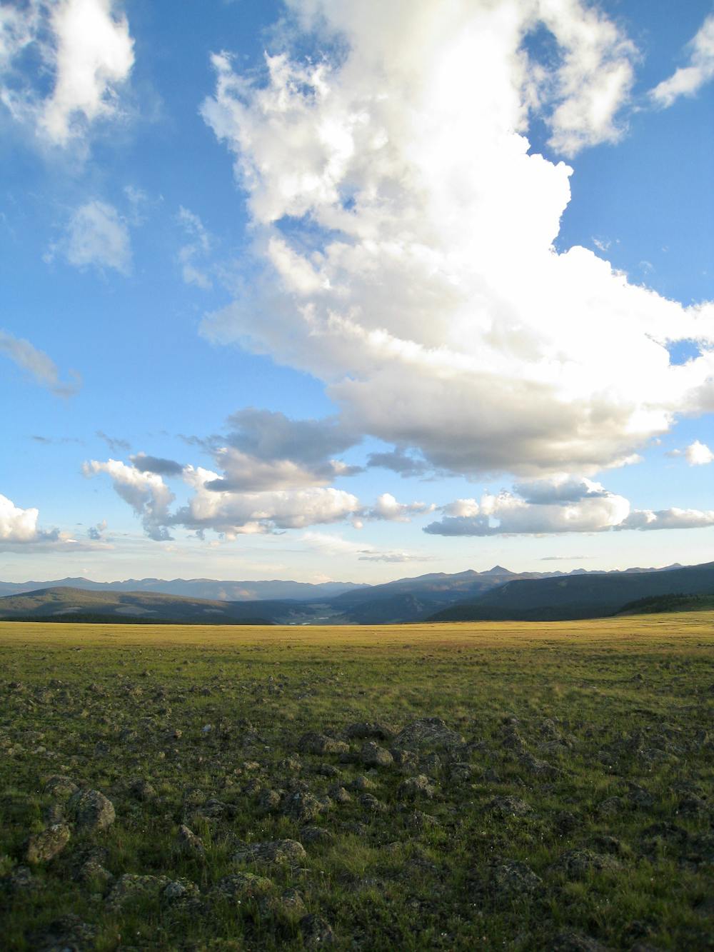
In fact, this section of the Colorado Trail climbs high into the mountains, topping out at the COT's highest point: Coney Summit at 13,271 feet above sea level. Not only does the trail max out its elevation here, but according to DownTheTrail.com this zone of the Colorado Trail doesn’t drop "below 12,000 feet for over 30 continuous miles, not even once."
As a result of traversing such incredible high alpine terrain, both the views and the singletrack itself are absolutely superb! "I first rode a portion of this segment of the CT two years ago. It instantly become my favorite piece of trail on the planet,” writes Hill Junkie.
The trail through the tundra is narrow and delectable, but rocky sections punctuate the smooth, flowy singletrack. Thanks to some serious elevation gain and loss, riders can expect to do quite a bit of hike-a-biking on the climbs.
Sources: http://www.coloradotrail.org/segments.html#22 https://www.downthetrail.com/hiking-the-colorado-trail/day-30-jarosa-mesa-to-lost-trail-creek-segment-22/ https://www.downthetrail.com/hiking-the-colorado-trail/day-30-jarosa-mesa-to-lost-trail-creek-segment-22/
Severe
Widely variable, narrow trail tread with steeper grades and unavoidable obstacles of 15in/38cm tall or less. Obstacles may include unavoidable bridges 24in/61cm wide or less, large rocks, gravel, difficult root sections, and more. Ideal for advanced-level riders.

The trail contains some obstacles such as outcroppings and rock which could cause injury.

In the high mountains or remote conditions, all individuals must be completely autonomous in every situation.
26 routes · Mountain Biking