1.4 km away
Riva Ridge Uphill Route

Uphill access at Vail, following Riva Ridge from the village toward the top.
Moderate Resort Ski Touring
- Distance
- 3.7 km
- Ascent
- 794 m
- Descent
- 0 m
Designated route for skinning up to Eagle's Nest at Vail.
Resort Ski Touring Moderate
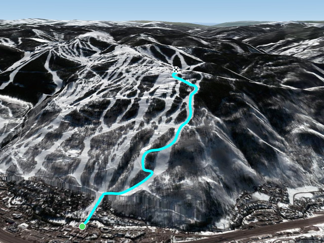
Vail allows uphill travel before and after open hours, so early risers can guarantee fresh tracks following a storm. There are two designated uphill routes, but you don’t have to descend the same way. Just be sure to steer clear of any mountain operations on the way up and down. Mapped here is the uphill route on Simba, which ends at the Eagle’s Nest if you take it to the top. From there, you’ll have plentiful choices for the downhill, mostly on blue runs back to Lionshead base.
On their website, Vail notes that uphill routes are subject to change, so be sure to look for signage indicating access on the day you are there. You should also call the trails hotline (970) 754-1023 ahead of time for info. Find out more about the uphill policy on the resort’s Mountain Safety webpage.
Moderate

Close to help in case of emergency.
1.4 km away
Uphill access at Vail, following Riva Ridge from the village toward the top.
Moderate Resort Ski Touring

17 routes · Resort Ski Touring
40 routes · Resort Ski Touring
3 routes · Freeride Skiing · Resort Ski Touring