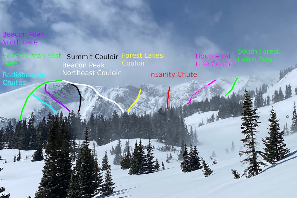
Beacon Peak Northeast Couloir
Nederland
A complex, steep descent in the Forest Lakes Cirque.
Ski Touring Extreme
- Distance
- 522 m
- Ascent
- 0 m
- Descent
- 281 m
- Duration
- 0-1 hrs
- Low Point
- 3.4 km
- High Point
- 3.7 km
- Gradient
- 44˚

This is a popular ski touring route which is generally considered to be extreme. It's remote, it features high exposure (e3) and is typically done between April and June. From a low point of 3.4 km to the maximum altitude of 3.7 km, the route covers 522 m, 0 vertical metres of ascent and 281 vertical metres of descent. It's graded 5.2 and Labande grade 6. You'll need skins, ice axe and crampons to complete it safely.
- •
- •
Description
The second entrance to the north of Beacon Peak, this couloir follows weaknesses in the upper cliffs, until it meets Forest Lakes Couloir. May be topped by cornices, but skis way into the summer.
Difficulty
Extreme
Extreme skiing terrain above 45 degrees. These routes are reserved for experienced experts.
High Exposure (E3)

In case of a fall, death is highly likely.
Remoteness

Away from help but easily accessed.
Best time to visit
Features
- Alpine
- Cliffs
- Couloir
- Single Descent
- Ski Mountaineering
Equipment required
- Skins
- Ice axe
- Crampons