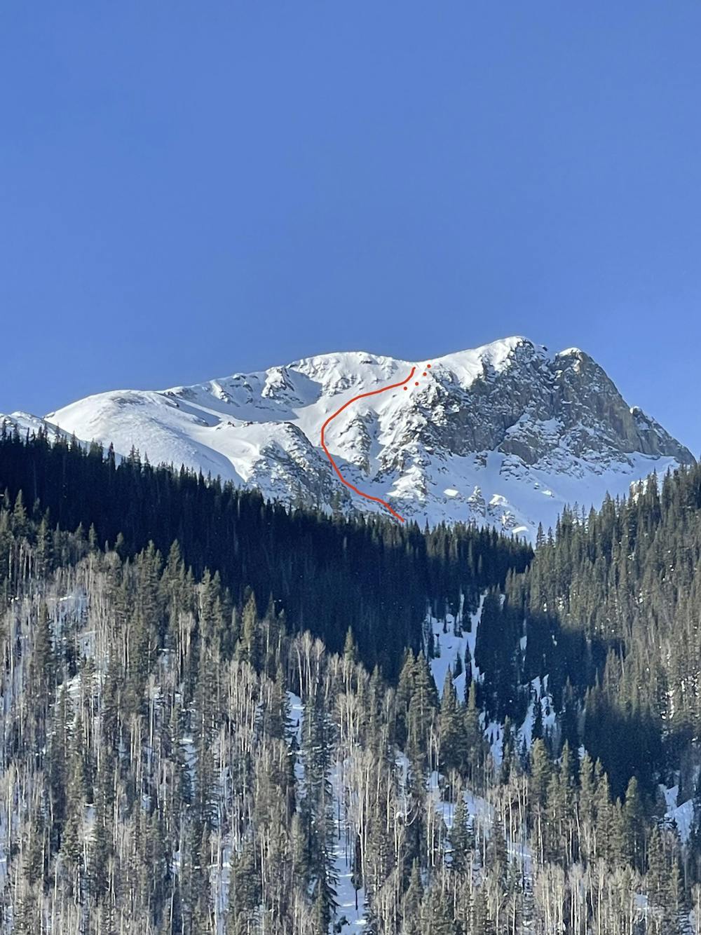
Northstar Couloir
Durango
A cornice-topped face that ends right at the edge of town.
Ski Touring Severe
- Distance
- 3.3 km
- Ascent
- 8 m
- Descent
- 1.2 km
- Duration
- 0-1 hrs
- Low Point
- 2.9 km
- High Point
- 4.1 km
- Gradient
- 37˚

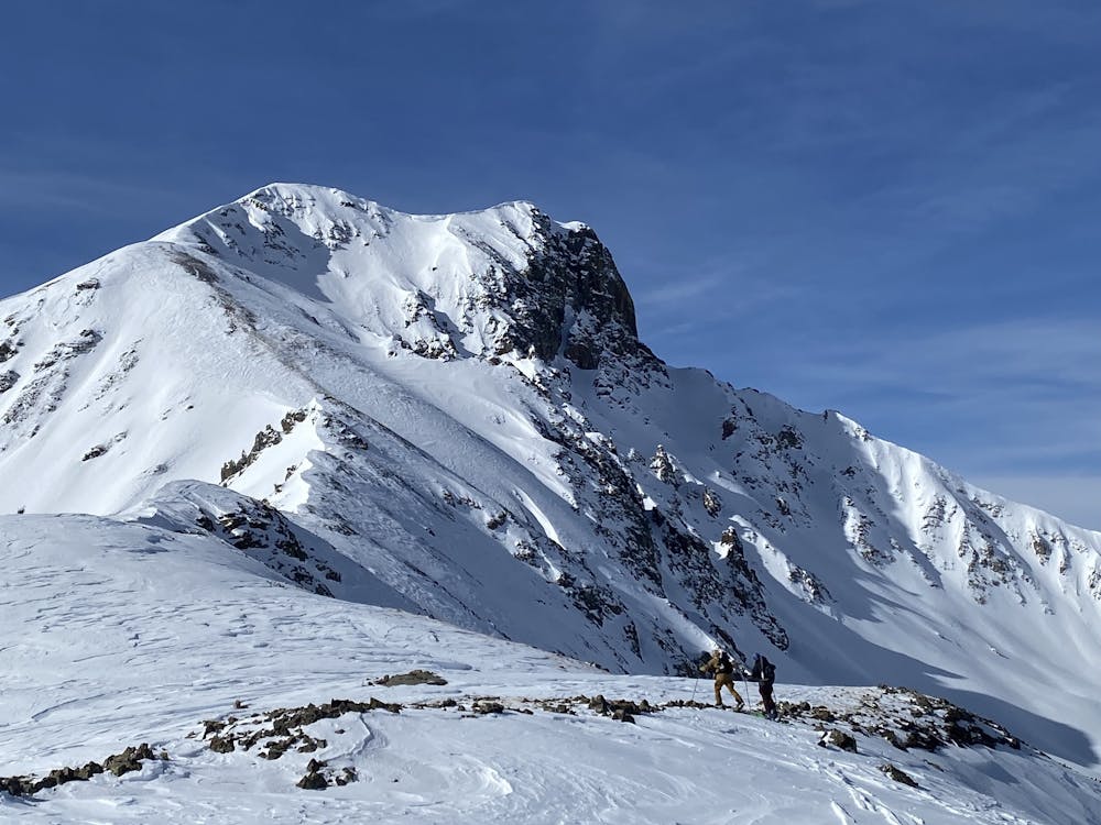
Sultan Mountain rises dramatically from the town of Silverton, and hosts plenty of steep descents within a stone's toss from civilization. If combined with either the east or north ridge routes, this feels more like a true mountaineering objective.
- •
- •
Description
Take your desired route to the summit. The easiest would probably be to traverse over from Grand Turk. Go to the large cornice north of the summit (but not too close to the edge!), and choose where to start your descent. We chose to ski down the lower-angle wind lip found looker's right of the cornice before cutting skier's right into the couloir proper. In the basin, you can either ski out the gully below treeline or cut skier's right back to the east ridge skintrack.
Difficulty
Severe
Steep skiing at 38-45 degrees. This requires very good technique and the risk of falling has serious consequences.
Low Exposure (E1)

Exposure is limited to that of the slope itself. Getting hurt is still likely if the slope is steep and/or the snow is hard.
Remoteness

Away from help but easily accessed.
Best time to visit
Features
- Alpine
- Couloir
- Tree Skiing
- Single Descent
- Ski Mountaineering
Equipment required
- Skins