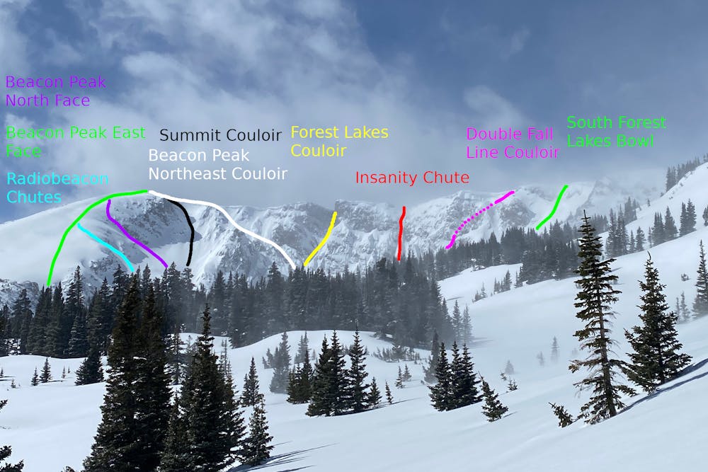
Summit Couloir
Nederland
The more-difficult entrance to the North Face.
Ski Touring Extreme
- Distance
- 252 m
- Ascent
- 0 m
- Descent
- 163 m
- Duration
- 0-1 hrs
- Low Point
- 3.5 km
- High Point
- 3.7 km
- Gradient
- 49˚

This is a popular ski touring route which is generally considered to be extreme. It's remote, it features high exposure (e3) and is typically done between April and June. From a low point of 3.5 km to the maximum altitude of 3.7 km, the route covers 252 m, 0 vertical metres of ascent and 163 vertical metres of descent. It's graded 5.1 and Labande grade 6. You'll need skins to complete it safely.

- •
- •
Description
This is the first entrance north of Beacon Peak. After figuring out the cornice situation, descend the 45° couloir until it leads into the North Face line, through the choke at the bottom and to the tarn.
Difficulty
Extreme
Extreme skiing terrain above 45 degrees. These routes are reserved for experienced experts.
High Exposure (E3)

In case of a fall, death is highly likely.
Remoteness

Away from help but easily accessed.
Best time to visit
Features
- Alpine
- Cliffs
- Couloir
- Single Descent
- Ski Mountaineering
Equipment required
- Skins