Oil Well Flats: Island in the Sky
Salida
Run to a stunning overlook from the Island in the Sky.
Trail Running Difficult
- Distance
- 13 km
- Ascent
- 293 m
- Descent
- 293 m
- Duration
- 1-2 hrs
- Low Point
- 1.8 km
- High Point
- 2 km
- Gradient
- 4˚

While Oil Well Flats was originally designed and built by—and primarily for—mountain bikers, this multi-use trail system has been gaining more and more acclaim from local hikers and trail runners. All of the trails here are designed to be two-way multi-use singletrack trails, and while bike traffic prevails, there are very few bike-specific features on these trails, making them perfect for hiking or trail running.
- •
- •
- •
Description
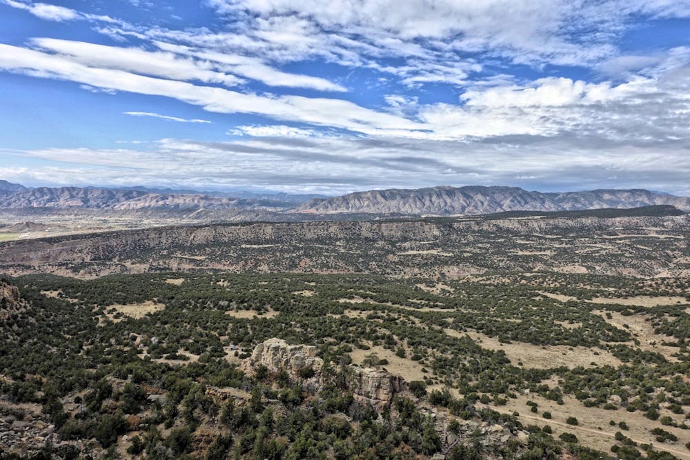
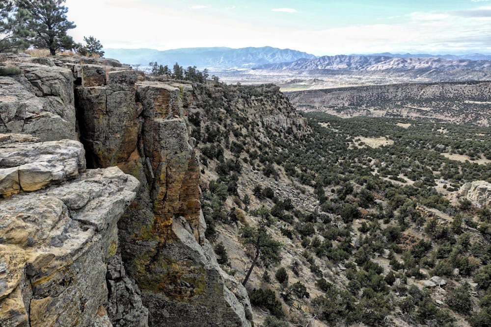
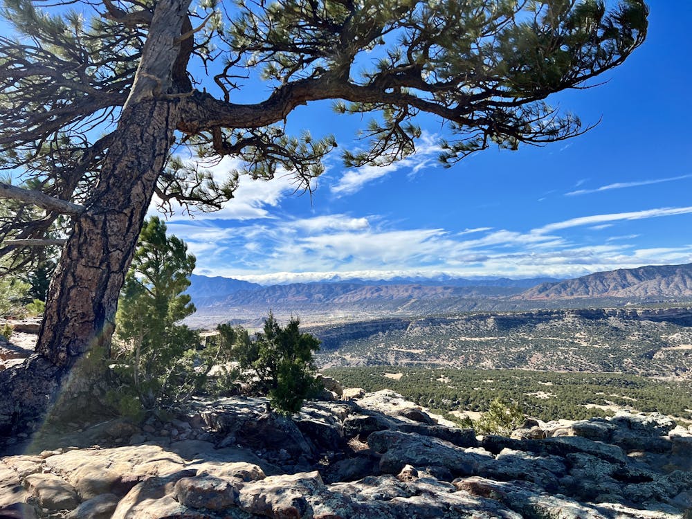
One of the most rewarding objectives in this trail system is reaching the overlook known as "Island in the Sky." From this highpoint, you'll get to look out from the top of a sheer cliff face and enjoy a spectacular vista of Oil Well Flats below you, Canon City in the mid-ground, and the impressive jagged skyline of the Sangre De Cristo range in the distance.
This out-and-back route is one of the most direct ways to access Island in the Sky from the main Oil Well Flats trailhead. It is possible to drive further up and into the trail system, but the roads do get a bit rougher and steeper, requiring a high-clearance vehicle in some places. The trailhead shown here is the most commonly-used parking lot
The majority of this run climbs gradually through the pinon pines, gaining elevation at a consistent pace, yet never too steeply. The pinons close in the views for most of the lower hike, yet the beautiful rocks and desert plant life are themselves a reward.
After climbing up Fire Canyon, you'll take a right turn onto the Island in the Sky trail. From here to the overlook, the trail grade kicks up significantly, and you'll have to ascend steep rocky sections to gain the top of the ridge. Watch out for fast downhill mountain bike traffic.
Once at the top, take some time to soak in this incredible view! Bring a lunch and enjoy a meal at one of the most beautiful spots in the region!
As mapped, the route returns down the same trail combination to keep the run to 8 miles. Trying to create a loop is an attractive option, but it does increase the mileage substantially.
Difficulty
Difficult
High Exposure

Some trail sections have exposed ledges or steep ascents/descents where falling could cause serious injury.
Remoteness

Away from help but easily accessed.