2.2 km away
Animas Mountain Loop
One of the most popular trail runs in Durango.
Moderate Trail Running
- Distance
- 9.3 km
- Ascent
- 466 m
- Descent
- 466 m
The most popular route to the top of Perins Peak, beginning in Rockridge.
Trail Running Difficult

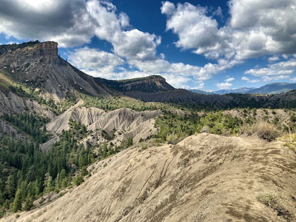
8,346-foot Perins Peak soars above downtown Durango, but some runners forget about it because it's only open four months per year: August 1 to November 30. However, if you manage to climb Perins Peak within that narrow window, you'll be richly rewarded!
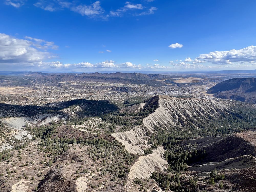
Since many runners forget about this peak, you're unlikely to encounter much foot traffic on your way to the summit, "which creates a wonderful sense of calm and immersion in nature," according to DurangoTrails.org. As an added bonus, this is one of the few trails close to downtown Durango that's closed to mountain bike traffic. That said, the route shown here is the most popular ascent to the top of Perins Pea, beginning in the Rockridge neighborhood.
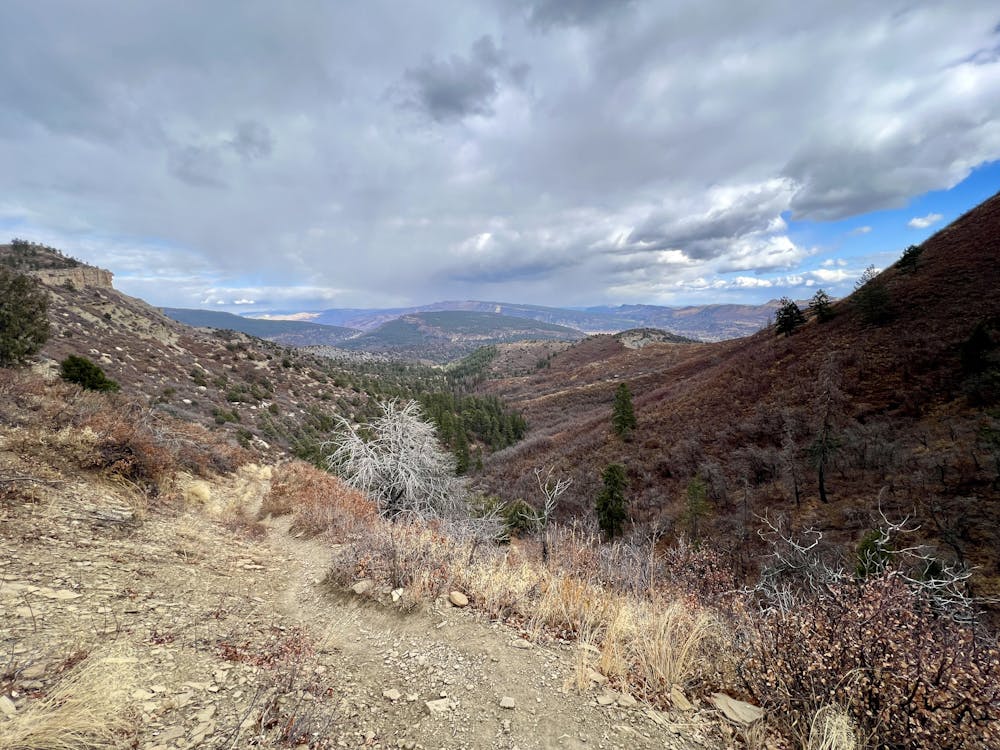
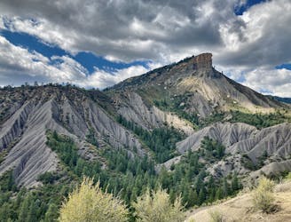
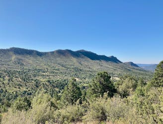
The route to the top follows pristine, rarely-traveled singletrack the entire way. Immediately after leaving the trailhead, you'll find yourself immersed in the beautiful waving grasses of the State Wildlife Area. Soon, the trail enters a section of gambel oaks as it begins climbing up a narrow valley. You'll find yourself running through a dense mix of pines and oaks before the trail grade kicks up in earnest as it begins ascending the steep side of the ridge.
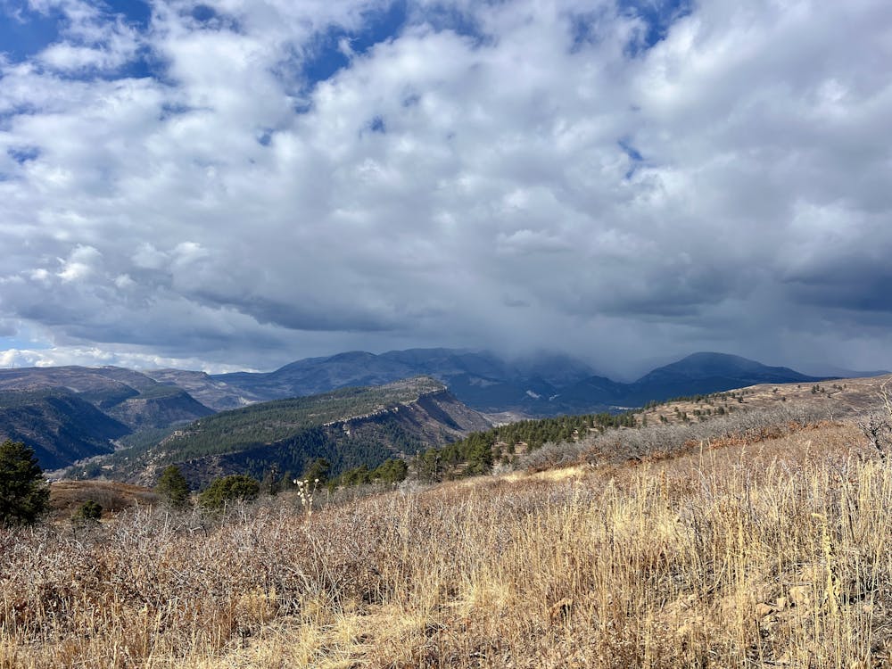
Here the trail really climbs, switchbacking up the mountainside via a steep and sometimes rocky grade. The views of the region begin to open up, with the glimpses of the San Juans to the north a mere taste of what you'll experience from the top!
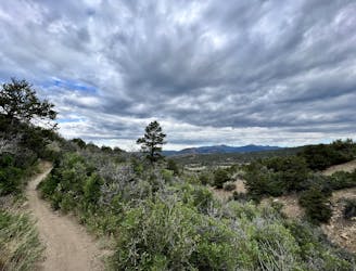
Soon you'll reach a trail junction on the top of the ridge where the route from the Twin Buttes side joins this one. Take a left turn and keep climbing to the top of the mountain.
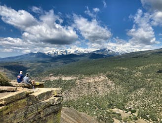
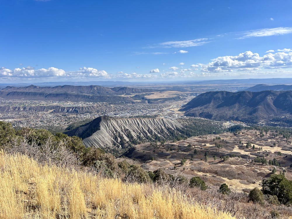
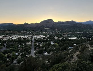
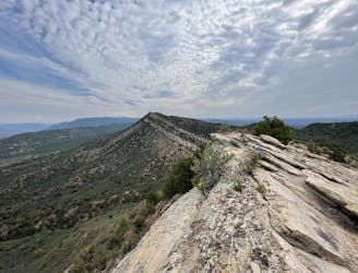
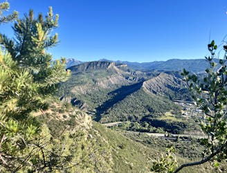
The views from the top of Perins Peak are absolutely stupendous! As you sit on top of a sheer precipice, you can soak in gorgeous views of the San Juans to the north, the town of Durango spread out below you, the Hogsback in Overend Mountain Park directly below you, Smelter Mountain to the right, Fort Lewis College and Raider's Ridge in the background behind town... the more you look, the more you'll notice!
Once you've had your fill of the views, return to your car the way you came. Take care to return via the same route—you don't want to accidentally end up on the other side of the mountain!
Difficult

Some trail sections have exposed ledges or steep ascents/descents where falling could cause serious injury.

Away from help but easily accessed.
2.2 km away
One of the most popular trail runs in Durango.
Moderate Trail Running
2.6 km away
Gain stunning views from the dramatic Hogsback Ridge.
Difficult Trail Running
4 km away
A popular Durango trail run to a gorgeous viewpoint.
Moderate Trail Running
4.2 km away
A quick run to a beautiful vista over Durango.
Moderate Trail Running
5.2 km away
A beautiful loop up and around Grandview Ridge.
Moderate Trail Running
5.2 km away
A great trail run heading high into the hills above Durango.
Moderate Trail Running
5.2 km away
Run to an incredible 360-degree view from Pautskey Point.
Difficult Trail Running
6.1 km away
While Smelter Mountain is known as one of Durango's classic in-town trails, the ascent is far from easy.
Difficult Trail Running
7 routes · Trail Running