Standley Lake South Shore Trails
Denver
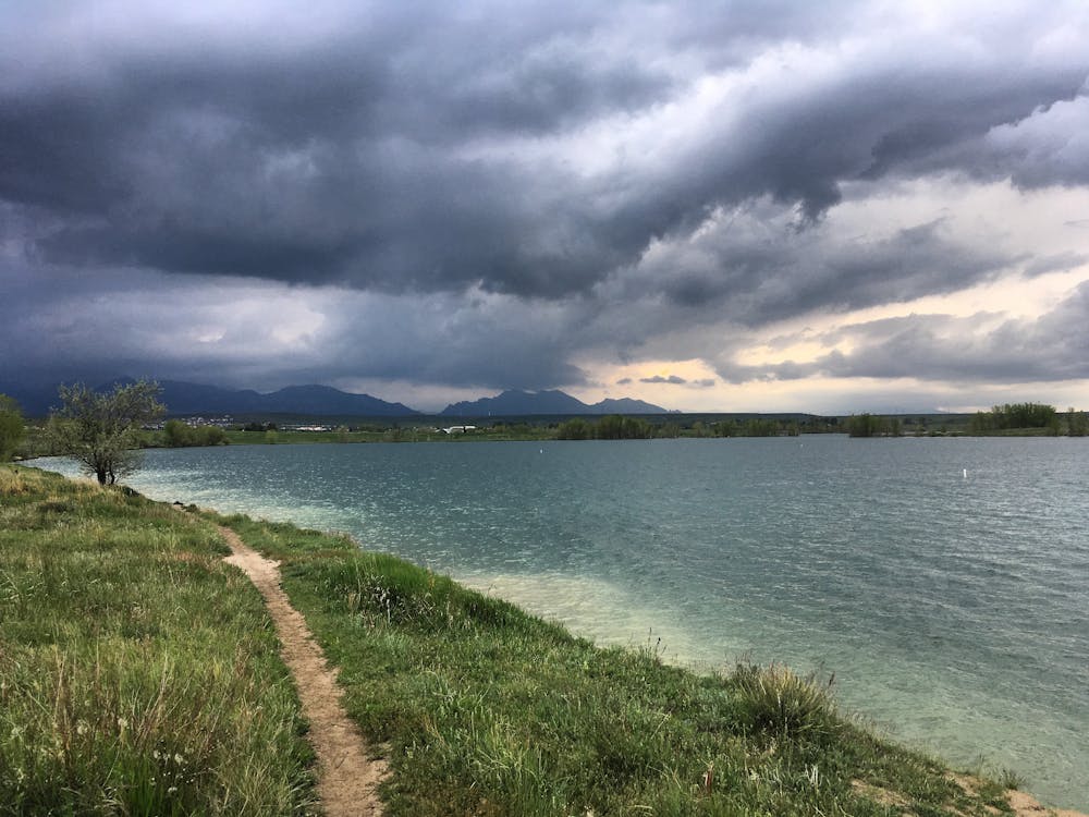
Easy singletrack on the south shore of Standley Lake makes for a mellow but beautiful run.
Trail Running Easy
- Distance
- 7.2 km
- Ascent
- 71 m
- Descent
- 71 m
- Duration
- 0-1 hrs
- Low Point
- 1.7 km
- High Point
- 1.7 km
- Gradient
- 2˚

While Standley Lake isn't a well-known hotspot for hiking or trail running in the Denver Metro area, the network of singletrack along the lake's south shore still provides a fantastic outing in nature. The trails here are mellow and fun, and the views across the lake to the Front Range beyond are gorgeous.
Description
A few different trailheads provide access to this trail system, but the route mapped here begins from the main parking lot. As you begin to ride, you'll notice that there are unmarked singletrack trails branching in all directions. Trying to stick to this route precisely and navigate around the loop may prove to be an exercise in futility, so I recommend just picking a few trails and going for it!
The trails shown on this exterior loop are quite flat and easy. A few of the trails that cross the loop and cut straight down to the lakeside drop down short but somewhat steep stretches of eroded singletrack. A few of these trails have eroded to reveal roots and rocks that increase the difficulty a bit.
Also, note that you can complete a much shorter hike or run if you so desire. With so many trails to choose form, you can go as long or as short as you wish!
Difficulty
Easy
Low Exposure

The path is on completely flat land and potential injury is limited to falling over.
Remoteness
Close to help in case of emergency.