5 m away
Sope Creek
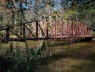
A beautiful hike filled with history.
Moderate Hiking
- Distance
- 14 km
- Ascent
- 228 m
- Descent
- 228 m
A beautiful hike near the Chattahoochee River.
Hiking Moderate

Cochran Shoals is one of the most popular hiking trails in the greater Atlanta metro area. Located in the Chattahoochee River National Recreation Area, this beautiful wooded natural area provides a delightful respite from the crush of traffic and mayhem found in the city.
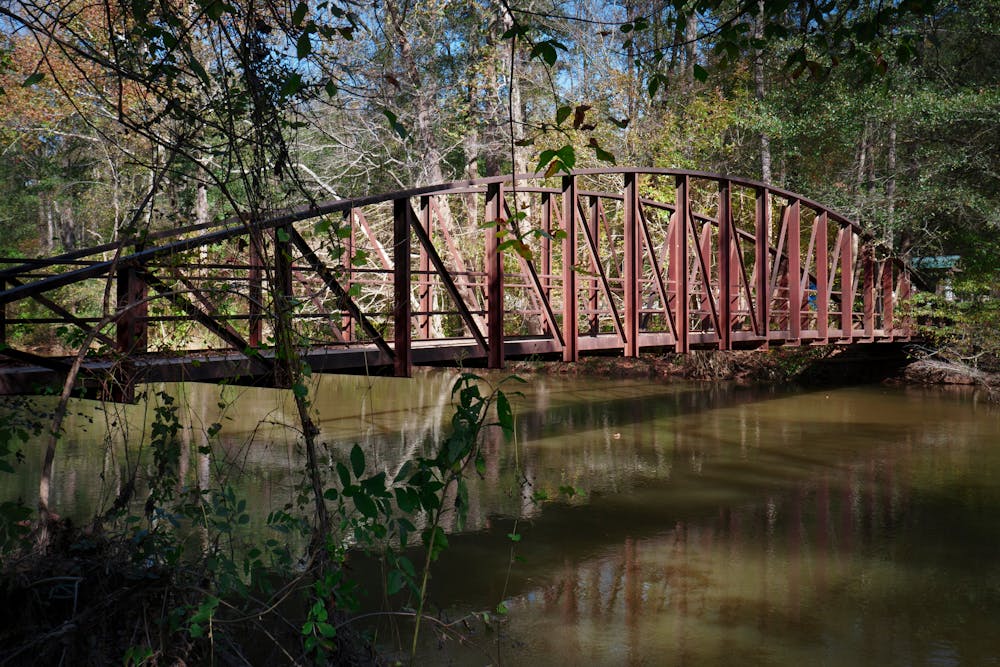
The route shown here begins from one of the largest and most popular trailheads and provides an almost 6-mile lollipop hike. The route, as mapped, combines a flat greenway trail, gravel paths, and some narrow singletrack trails for a true mixed-surface experience. While the first stretch along the wide path might seem like merely a prelude to the main experience, you'll get to cross a beautiful bridge and enjoy views of the Chattahoochee River before diving deeper into the forest on the singletrack trails.
If 6 miles seems too long, multiple options exist to shorten this route. And if you want to go farther, add on some bonus miles in the Sope Creek area.
Sources: https://cumberlandtrails.org/cochran-shoals-trail/ https://www.atlantatrails.com/hiking-trails/cochran-shoals-trails-along-the-chattahoochee/
Moderate
Hiking along trails with some uneven terrain and small hills. Small rocks and roots may be present.

The path is on completely flat land and potential injury is limited to falling over.

Away from help but easily accessed.
5 m away
A beautiful hike filled with history.
Moderate Hiking