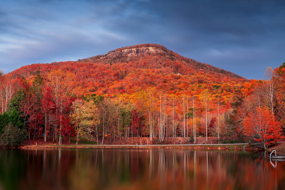
Mount Yonah
Dahlonega
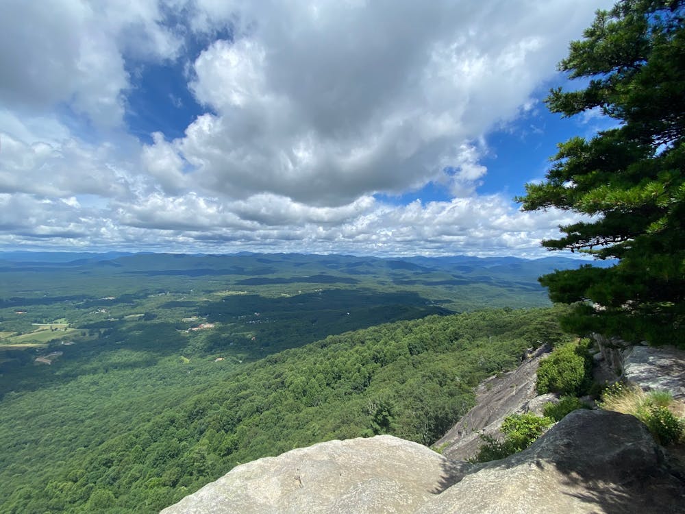
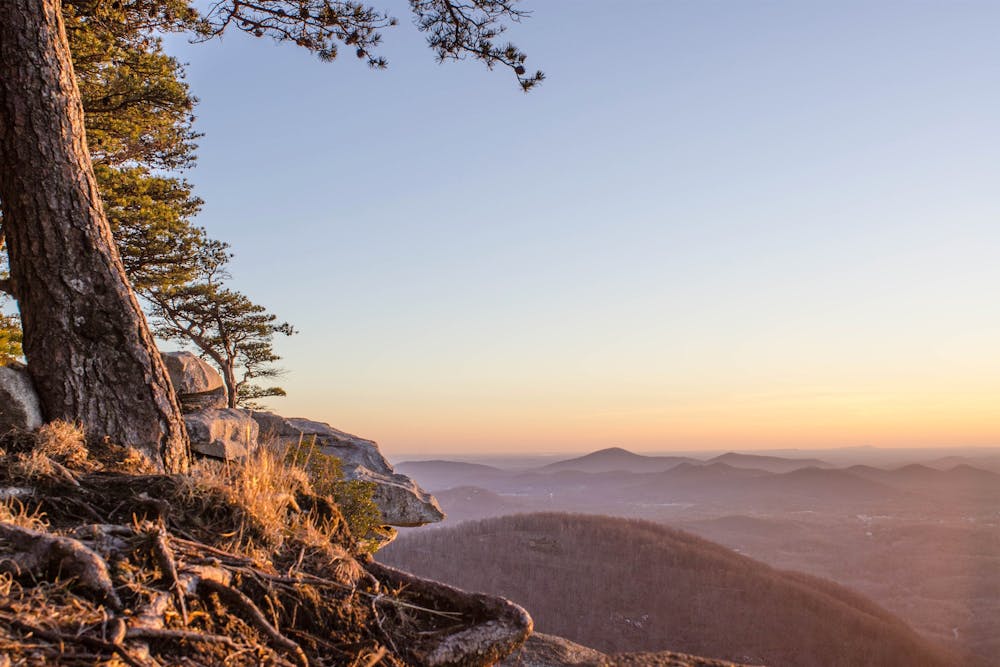
Hike to a stunning overlook of North Georgia from Mount Yonah's vaulted granite cliffs.
Hiking Difficult
- Distance
- 6.8 km
- Ascent
- 463 m
- Descent
- 463 m
- Duration
- 2-3 hrs
- Low Point
- 527 m
- High Point
- 963 m
- Gradient
- 10˚

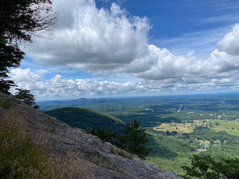
Mount Yonah is a towering mountain that dominates the landscape of the Chattahoochee-Oconee National Forest. This 4.2-mile out-and-back trail takes you to the summit of the mountain, which offers stunning views over North Georgia from Yonah's vaulted granite cliffs.
- •
- •
- •
- •
Description
The trail starts from a parking lot off Chambers Mountain Road and climbs steadily through a forest of hardwoods and pines, offering glimpses of the rocky peak above. Along the way, you will pass several side trails that lead to climbing routes, as Mount Yonah is a popular destination for rock climbers.
After about two miles, you will reach a large clearing known as the first LZ (landing zone), where Army Rangers in training sometimes practice helicopter landings. From here, you can enjoy views of the surrounding countryside and see the second LZ higher up the mountain. The trail continues to ascend through switchbacks and rocky sections, becoming steeper and more exposed as you approach the summit.
The trail ends at the second LZ, where you will find several campsites and fire rings. You can either stop here and admire the views, or scramble up the final stretch of rock to reach the true summit of Mount Yonah. The summit offers panoramic views of the Blue Ridge Mountains, Lake Chatuge, and Brasstown Bald, Georgia's highest peak.
The Mount Yonah trail is one of Georgia's best and most popular hikes, offering a challenging but ultra-scenic climb to an iconic mountain. It is suitable for experienced hikers, but be prepared for some elevation gain and uneven terrain.
Difficulty
Difficult
Hiking trails where obstacles such as rocks or roots are prevalent. Some obstacles can require care to step over or around. At times, the trail can be worn and eroded. The grade of the trail is generally quite steep, and can often lead to strenuous hiking.
Medium Exposure

The trail contains some obstacles such as outcroppings and rock which could cause injury.
Remoteness
Away from help but easily accessed.
Best time to visit
Features
- Picturesque
- Summit Hike
- Dog friendly
- Forestry or heavy vegetation