Haleakalā Crater: Sliding Sands to Halemau'u Trail
A point-to-point hike across the expansive crater, utilizing “hiker pick-up” along the highway.
Difficult Hiking
- Distance
- 18 km
- Ascent
- 524 m
- Descent
- 1.1 km
Out-and-back journey to the crater floor, from the summit area of Haleakalā.
Hiking Moderate

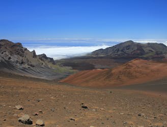
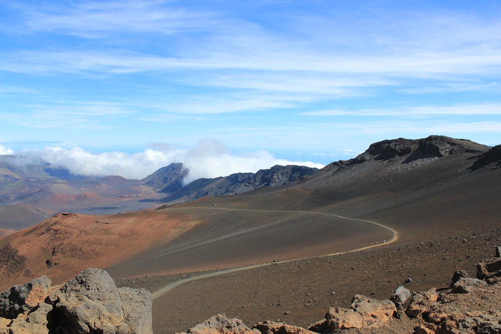
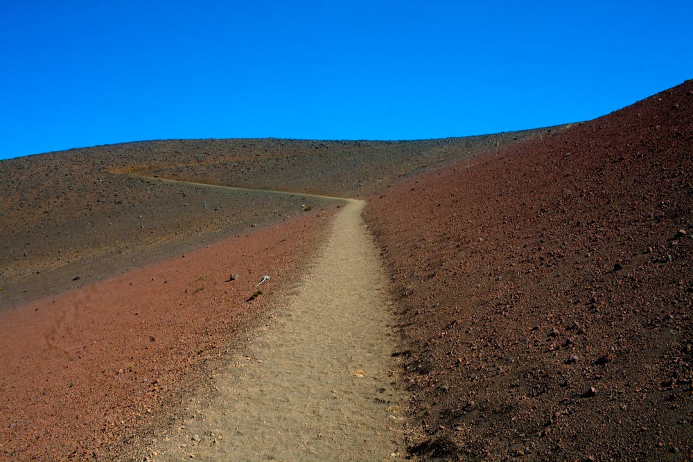
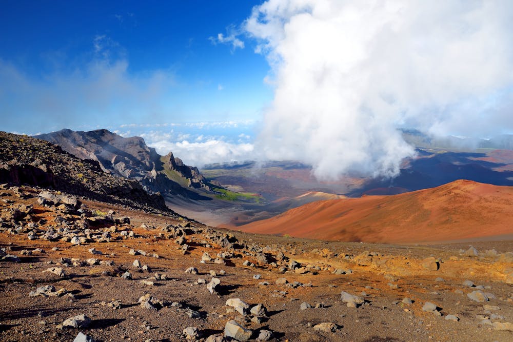
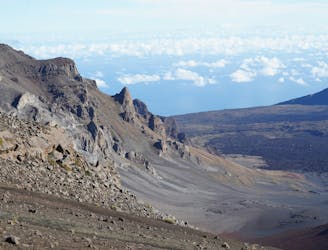
The trail called Keonehe‘ehe‘e (or Sliding Sands) descends from the Haleakalā summit visitor center into the crater of the volcano. This expansive depression in the mountainside is actually an eroded basin, not a crater from an eruption, but several true craters are contained within. It’s a seemingly lunar landscape of blackened slopes, scattered lava rocks, and heaps of cinders, with the trail twisting down into the midst of it. The surface is like a fine natural gravel, not as sandy as the trail’s name suggests, and the path is wide and mostly smooth. On the downhill journey, your eyes can be free from watching your feet, to look around at the otherworldly scenery.
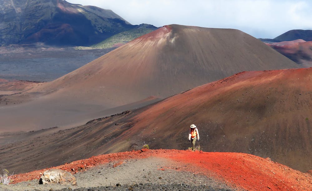
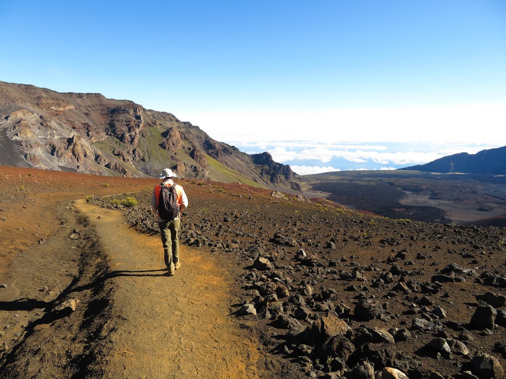
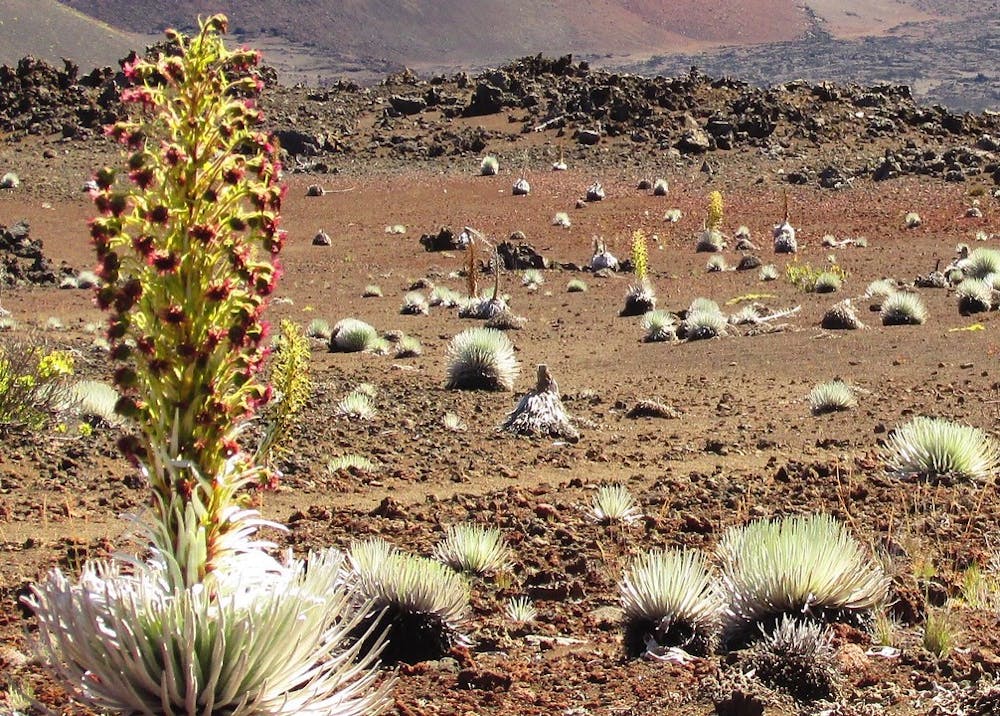
There are plants here, too. They include the Haleakalā silversword, a succulent resembling a spiky ball, that grows only on this mountain and nowhere else on Earth. Take care not to touch or step too close to these plants, as they are fragile and critically endangered. Grasses and some shrubs grow here and there, but the sweeping moonscape is largely void of vegetation. Staying on the trail is imperative in order to protect the thin soil and preserve this rare habitat.
After twisting downward among the lava rocks and cinder cones for about 4 miles, the trail reaches the crater floor and an intersection. Here you can choose to make a loop that goes through even more colorful and varied volcanic formations, or to stay on the main trail and turn around at any point. The route mapped here continues to the next intersection, located at a pass between cinder hills. These hills, and the many others around, are actually volcanoes within a volcano––products of eruptions that occurred since the basin was weathered out. This intersection makes a good turnaround point, but various trails continue for those determined to hike more. Note that an alternative to this out-and-back is to keep going on Halemau'u Trail, to make a point-to-point ending farther down the park road.
On these trails you must keep in mind that the downhill is deceptively easy, and going up will take a lot longer. Here at nearly 10,000 feet elevation, the uphill journey will feel exhausting if you’re accustomed to hiking closer to sea level. Pace yourself and take breaks when necessary. For any distance hiking in the crater, make sure to bring plenty of water and food, as well as wind and UV protection. The intensity of the elements at this elevation might take you by surprise, so you should come prepared for a variety of conditions.
Sources: https://www.nps.gov/hale/planyourvisit/hiking.htm https://www.maui-hikes.com/haleakala-national-park-sliding-sands-trail
Moderate
Hiking along trails with some uneven terrain and small hills. Small rocks and roots may be present.

The path is on completely flat land and potential injury is limited to falling over.

Away from help but easily accessed.
A point-to-point hike across the expansive crater, utilizing “hiker pick-up” along the highway.
Difficult Hiking
2 m away
A long traverse from Haleakalā Summit across the crater floor to Palikū Campground
Moderate Hiking
6.1 km away
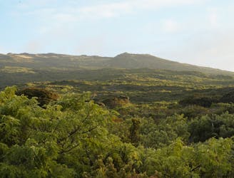
A short, casual loop trail through native Hawaiian forest and eucalyptus grove.
Easy Hiking

4 routes · Hiking

63 routes · Alpine Climbing · Hiking