9 m away
Waimano Falls
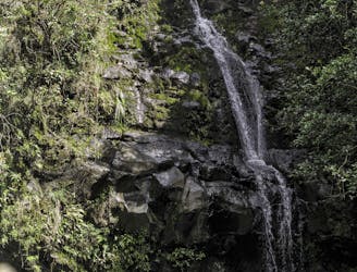
One of Oahu's most famous hikes, with a multi-tiered waterfall and beautiful pools at the end.
Severe Hiking
- Distance
- 4.6 km
- Ascent
- 264 m
- Descent
- 264 m
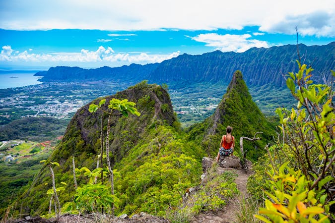
A long and spectacular ridge journey through the heart of Oahu
Hiking Difficult

The Mānana Ridge Trail offers stunning panoramic views of the Pacific Ocean, nearby islands, and the surrounding landscapes of Oahu, and the views just get better as you climb further along the ridge.
We've drawn the line going all the way to the end of the ridge, just to the north of Eleao peak, but you can just hike as much of it as you like. Going all the way does mean that you get the exceptional views to the east, rather than "just" the vistas to the west, but it does make for a long and hot day. If you go for the full thing, carry plenty of water and sunscreen! The hike is an out-and-back, so even if you plan to do it all, you can always change your mind and turn back if needs be,
The trail has a steady incline with some steep sections and rocky terrain, but there are plenty of spots at which to stop and take in the view while you catch your breath. As well as the views, the trail also has lush vegetation including native Hawaiian plants such as koa and ohia trees, so there is beauty to behold close at hand as well as in the distance.
Difficult
Hiking trails where obstacles such as rocks or roots are prevalent. Some obstacles can require care to step over or around. At times, the trail can be worn and eroded. The grade of the trail is generally quite steep, and can often lead to strenuous hiking.

The trail contains some obstacles such as outcroppings and rock which could cause injury.

Little chance of being seen or helped in case of an accident.
9 m away
One of Oahu's most famous hikes, with a multi-tiered waterfall and beautiful pools at the end.
Severe Hiking
16 routes · Hiking